Curated OER
Rivers Run Through It
Using a relief map of New York State, learners answer questions about the distance between different cities, identify bodies of water, and more. First, they discuss vocabulary related to the Hudson River area. Then, they complete a...
Curated OER
Folk Dances from Spanish Speaking Countries
Learners explore dance activities from three different Spanish speaking countries.
Curated OER
Using Timelines
Students explore how to create a simple timeline and make one of their life.
Curated OER
Taste of India
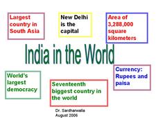
Bring a little taste of India into the classroom. This colorful presentation provides information regarding India's people, food, location, religion, and culture. An interesting trip to a fascinating place. Tip: Make it a real taste of...
Curated OER
India
Take a mental trip to India with your class. But before you go, review some basics about Indian culture. Several facts, a break down of the Indian flag, and a list of words adopted from India are all provided. Tip: Adding rich images...
Curated OER
Japan
Introduce your class to the beauty, population, architecture, and special places of Japan. They'll learn about the currency, the weather, and how Japan is different or similar to New Zealand. Note: While this presentation makes...
Curated OER
When Were Houses in our Locality Built?
Take a look at the types of houses to determine when they may have been built. This UK-based slide-show shows houses common to Great Britain such as, Tudor, Victorian, 1930's, and Modern styles. This could be used as a compare and...
Curated OER
Mapping Community Values
Pupils discuss the origin of various maps focusing on the values behind them. Students also explore how human needs and geography influence community settlement patterns. Pupils extend learning by creating and mapping their own ideal...
Curated OER
Memorable Maps
Students draw an assigned map from memory about the United States or any other region they are studying. In this maps lesson plan, students draw a map from their memory at the beginning of the year, and do the same assignment at the end...
Curated OER
Japan: Images of a People
Students learn the geography of Japan and its location in reference to the United States.
Curated OER
Mexico
Students complete a unit about the geography and culture of Mexico. They compare and contrast the weather of their own city and Mexico, read books about Mexico, count in Spanish, color in a flag of Mexico and the Mexican Coat of Arms,...
Curated OER
Native American Village Days
Students research the tribes of American Indians in Virginia and settled, agricultural tribes in other regions of America. They explain how geography and climate influenced the way various Indian tribes lived, and evaluate the impact of...
Curated OER
Pickles to Pittsburgh
Third graders explore the geography in the book "Pickles to Pittsburgh" by Judy Barrett. They read the story and identify the physical features of the town, discuss the elements included on a map, and create a map of the town of...
Curated OER
Where in the World Is…
Students identify countries, oceans, states, and more on a globe and on a flat map. In this geography lesson plan, students also locate places around their school.
Curated OER
Abenakis Before Contact: Different Worlds Meet
Learners study the lives of the Abenaki before contact with Europeans and how their lives changed after contact with the Europeans.
Curated OER
Natural Resources
Young scholars use magazines and newspapers to examine the Earth's natural resources. They identify ways that natural resources are protected, threatened, managed and mismanaged. They find the location of each story on a world map and...
Curated OER
Other Countries
Learners select a country and conduct research on the culture, population, geography, and government of their country. They conduct research using the Internet and a variety of resource books, and write and publish a report that...
Curated OER
Countries of Africa
Students study the coutries of Africa. In this African American history, small groups of students research a different country, color the country on the map of Africa, write a paragraph about the country, and draw pictures of its flag.
Curated OER
Communities
Students examine the similarities and differences between rural, suburban, and urban communities. They read about type of community in their social studies textbook, analyze the differences between Tokyo and Chicago, and complete a chart...
Curated OER
Using the Four Main Directions in the Classroom
Students use the four main directions to locate features in the classroom. In this direction instructional activity, students review the 4 main directions using a world map. Students use a magnetic compass to locate the north wall in...
Curated OER
Tracking Fall's Falling Temperatures
Young meteorologists track weather from day to day and record results on graphs, maps, or other places. They see firsthand how weather temperatures trend cooler as fall progresses and practice grade-appropriate skills in geography (map...
Curated OER
Learning About the Globe
Students examine the following terms to increase their geography skills: globe, equator, prime median, Western Hemisphere, Eastern Hemisphere, Northern Hemisphere, Southern Hemisphere, Pacific Ocean, Atlantic Ocean, and The United States.
Curated OER
Continents and Critters
Students investigate and identify the continents of the world. They identify and locate the seven continents on a map, and label a coloring page of a world map. Students then conduct research on an assigned continent, and write and...
Curated OER
Point Me to Puerto Rico
Students research the physical features and geography of Puerto Rico as well as locate it on a world map and identify its major characteristics. Pictures and postcards are shown to each class for a visual connection to Puerto Rico as...


