Curated OER
World Map and Globe
Students locate and identify continents and countries. In this world map lesson, students locate and identify one country on each continent.
Curated OER
Teaching Geography Through Geocaching
Bring geography to life with a real world treasure hunt.
Curated OER
Countries of the World
Learners identify countries on a world map. In this map skills lesson, students define the word "country" and use post-it notes to locate several countries on a world map.
Curated OER
State Maps
Students work together in small groups to create a state map. They include specific details about the state. They share the information with the class and the map is hung on the wall.
Curated OER
U.S. Geography for Children
In this U.S. map activity worksheet, students observe maps of the continental United States, Hawaii, and Alaska, locate and label landforms and bodies of water, and create symbols for natural resources and places of interest. Students...
Curated OER
Multiple Perspectives
Third graders explore immigration. In this social studies lesson, 3rd graders read about immigration in the United States. Students compare and contrast immigrant communities.
Curated OER
Fifty States Field Day
Young scholars explore the 50 states in preparation for a special field day. On the actual field day, the oldest students in the school manage each of 50 physical activity stations. They share information about each state and introduce...
Curated OER
Mapping Your State's Role in the Vietnam War
Students recognize reasons to celebrate Memorial Day. Students create a map of victims of the VIetnam War. Using the internet, students research information about soldiers from their state who were killd in action in Vietnam. Students...
Curated OER
A World of Special Celebrations
Brainstorm lists of celebrations with which your class are familiar. This lesson can be adapted to many different grade levels as they research ethnic and religious occasions/events celebrated by people around the world, and present...
Curated OER
Mr. Mascot's Magical Musical Tour
Students explore particular places in the world. Students decipher clues that a class mascot leaves behind as it travels the world. Through researching the clues, students discover geographical locations, elements of world culture,...
Curated OER
THE GULF STREAM
Students explore how to describe the Gulf Stream, how Benjamin Franklin charted it, and correctly plot it on a map.
Curated OER
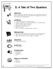
A Tale of Two Quarters
Have your class use the life of a quarter to understand and design plot and flow charts. They read the book, The Go-Around Dollar, think about how their teacher got her quarters that day, then create a flow chart. They have to show how...
Education World
Thinking About Thanksgiving: Lessons Across the Curriculum
Bring two integrated curriculum resources about Thanksgiving to an elementary social studies unit. The first activity focuses on Squanto's contributions to the early Pilgrims' survival with a gardening activity in which learners add...
Curated OER
Geographic Features and Human Settlements
Third graders examine geography and settlements. In this geography instructional activity, 3rd graders participate in classroom activities that center on the idea that people settle where there are geographical features that sustain life.
Curated OER
The City of New Haven
Students examine the geography, politics and history of their local town of New Haven, Connecticut. Using the internet, they explore the neighbors of New Haven and write directions from their house to school. In groups, they research...
Curated OER
Our 50 States
Students identify the location of the 50 states using an interactive map. They practice geography skills by playing a fun game. Pupils become familiar with the state abbreviations for the US states. Students become familiar with the...
Curated OER
What State Are You In?
Students identify the major U.S. cities. In this U.S. geography instructional activity, students work in pairs and use game cards to name various cities in the United States.
Curated OER
Physical Features
Students draw physical land features using ClarisWorks or Kid Pix, write their definitions, create slideshow, and create class geography book.
Curated OER
Mapping Landforms of South Carolina
Third graders analyze South Carolina maps. In this geography lesson, 3rd graders locate the five land regions in the state are and discuss how the regions are different. Students identify the major bodies of water and analyze how...
Curated OER
Where Do I Come From?
Students research immigration from Europe to the United States. For this immigration lesson, students read the book, The Long Way to a New Land. Students use a world map to locate Sweden and other countries in Europe. Students pretend...
Curated OER
Postmark U.S.A.
Students identify and collect postmarks from across the United States. They develop a list of ways to collect postmarks, display the postmarks on a large U.S. map, and find the exact location using MapQuest.
Curated OER
American Colonial Life in the Late 1700s: Distant Cousins
Students research how early colonists lived. They investigate late 17th century colonist's lives from Massachusetts and Delaware. Using their research, students write historical fiction in the form of friendly letters between the two...
Curated OER
Oprah Winfrey Opens New School in Africa
Students locate Africa and share their knowledge of the continent, then read a news article about Oprah Winfrey building a school in South Africa. In this current events lesson, the teacher introduces the article with a discussion and...
MENSA Education & Research Foundation
It’s Greek to Me: Greek Mythology
Designed as extension exercises in homeschool or classroom settings, as well as for individual work, the ideas in this packet are sure to engage learners in an investigation of Greek mythology.


