Curated OER
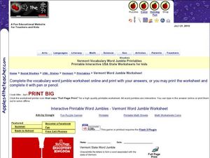
Vermont Vocabulary Word Jumble
In this word jumble worksheet, students unscramble the letters to spell words associated with the state of Vermont. Students spell 20 words.
Curated OER
Biomes of The World
Learners research different biomes, using links from global pen pal letters.
Curated OER
Walking on Maps
Students are introduced to the various types of maps and their functions. As a class, they play a game similar to twister to review map concepts. They answer questions about the map and use the internet to view larger maps of the world.
Curated OER
Four Main Directions
Students describe directions using a globe for north, east, south and west. In this mapping lesson students identify the north and south pole. Students understand the importance of the equator and the Prime Meridian. Students explain how...
Curated OER
Greek Vase Patterns
In this patterns activity, students complete 4 Ancient Greek patterns on the lines provided. They then decorate the blank vase on the page and write about what is happening in their picture.
Curated OER
Mehen - Egyptian Activity Sheet
In this Egyptian game worksheet, students cut out the game board and the game pieces and follow the directions to play "Mehen", the snake game.
Curated OER
Urban and Rural Communities
Students discuss similarities and differences of urban and rural communities. In this urban and rural communities lesson, students compare urban and rural communities using a Venn Diagram. Students examine maps of each type...
Curated OER
Watershed Model
Students view a presentation of water and land and how we need to protect our water resources. In this water lesson plan, students discuss how we rely on water, and complete activities in all subjects related to water.
Curated OER
Plate Tectonic - Volcanoes (1)
Students learn the different shapes of Volcanoes and discuss why volcanoes only have a few shapes.
Curated OER
The Postcard
Students listen to the book "Kate on the Coast" and plot her journey on a map. Then they decorate, address, and write a message on a postcard. They discuss where the postcards are being sent and plot the destinations on map.
Curated OER
A Day in a Life of an Arctic/Antarctic Animal
Students, through video segments, explore what types of animals live in the Arctic and Antarctica. They also clear up any misconceptions they have about penguins or polar bears.
Curated OER
Mythical Mayhem
Students explore Greek and Roman mythology in this five lessons unit. Common gods, their roles in the myth and stories of the era are surveyed as students take on the personality of a mythical character.
Curated OER
Life Giving Rivers
Students examine the world's rivers in this six lessons unit which mingles science with social studies. The dynamic forces that create erosion in nature are also seen as habitats and ecosystems that are affected by environmental and man...
Curated OER
Teaching With the Power of Objects
Students define value of an object. In this value lesson plan, students identify reasons for collecting objects, compile a personal inventory of items they find valuable, and then define why those items are valuable to them. In step two...
Curated OER
Get Ready for the Great Outdoors!
Students discuss what is a map and what they already know about maps. They brainstorm together to compile a list of responses for the board and observe a map of the United States, including states, capitals, and some of the National Parks.
Curated OER
Through A Pinhole
Students construct a pinhole camera using their knowledge of the physics of light. This interdisciplinary activity give students hands-on experience in understanding the production and processing of photographic images.
Curated OER
Florida the Best WebQuest
Students create a multimedia presentation demonstrating that Florida is the Best State in this creative project for the early elementary classroom. The instructional activity can be adapted for any state or country.
Digital Dialects
Digital Dialects: Geography Games: States of the Usa
Study a map showing the states in the USA, and then try to match their names to their locations on a blank map.
Ducksters
Ducksters: United States Geography for Kids: New Hampshire
Kids learn facts and geography about the state of New Hampshire including symbols, flag, capital, bodies of water, industry, borders, population, fun facts, GDP, famous people, and major cities.
Alabama Learning Exchange
Alex: Regions of the United States
This lesson plan provides a variety of activities for the student to become aware of the regions in our country. They will learn the geography and natural resources and how these influence the way of life of the people living in a region.
Annenberg Foundation
Annenberg Learner: Us History Map Assessment: Test Your Skills
Test how much you know about major U.S geographic features, Indian tribes, states and regions, European colonists and territorial expansion. View your correct and incorrect answers, and print out your assessment.
Alabama Learning Exchange
Alex: Edible Alabama and Her Agricultural Resources
This is a great culminating activity after a unit study on the natural resources of the state of Alabama. Learners will investigate some of Alabama's agricultural resources and create a multimedia presentation about one of them or recipe...
Alabama Learning Exchange
Alex: Dream Vacation
This unit teaches students to plan a trip with an itinerary, remain within a budget, and work cooperatively. It is a technology-based project that combines a study of mathematics, economics, geography, and social studies.
ClassFlow
Class Flow: Tornados in the Us
[Free Registration/Login Required] Overview: In this lesson, students will learn the basics about how tornadoes are formed, and when and where they are most likely to occur. They will learn that the United States is the country most...
