Curated OER
Mars Geologic Mapping
Students identify and interpret photographic details of a Martian surface image, design, and create a simple features map. They identify and interpret the geologic history of a part of Mars' surface and then, analyze and discuss the...
Curated OER
The Earth's Crust
Students use clay to form models of the different landforms and then complete a data table using a map, atlas, or the Internet to locate famous landforms in the United States. Students complete various activities, writing down their...
Curated OER
The Science of Weather: How Doppler Radar reads weather
Students read about how radar detects changes in the weather. In this lesson on weather reporting, students read a diagram that shows how radar reads weather. This lesson includes discussion questions and an individual activity that can...
Curated OER
Texas Weather Report
Students use provided links to observe selected weather sites and collect temperature and precipitation data for listed cities. They enter the information onto their spreadsheet. Students study maps of the Texas natural reagions,...
Curated OER
Weather Journal Log
Students discuss the weather each day and log it on a class chart for a month.
Curated OER
An Erosion Survey
In this erosion worksheet, students draw a map of their school ground or neighborhood, mark examples of weathering and erosion, and list the examples on spaces provided. A chart with examples of different types of weathering and erosion...
Curated OER
Tracking Fall's Falling Temperatures
Young meteorologists track weather from day to day and record results on graphs, maps, or other places. They see firsthand how weather temperatures trend cooler as fall progresses and practice grade-appropriate skills in geography (map...
Curated OER
Save Our City
Students identify ways to prepare for natural disasters. In this disaster preparation lesson plan, students read about disaster prevention devices and study cut-outs of six different disaster prevention devices. Students use a weather...
Peace Corps
Weather and Water in Ghana
Young scholars investigate the climate of their region. Students research statistics and conduct interviews. Young scholars take a virtual tour of Ghana and discuss its climate. Students consider water conservation and the role it plays...
Curated OER
Where Is That Place?
Students determine the difference between a country, state, and a city while recording the weather conditions for their school in Nebraska. They examine weather for another school in the state while practicing using weather equipment to...
Curated OER
Hurricanes
Young scholars use the internet to research the characteristics of hurricanes. Using this information, they read about past hurricanes and use a weather map to trace current disturbances in the oceans. They also discuss hurricane...
Curated OER
4-figure Grid Reference
Fourth graders study maps and grid lines. In this weather map lesson students complete an activity that allows them to understand grid lines on a map.
Curated OER
Tracking the Salt Front
Using the Hudson River as the focus, learners discuss the difference between salt water and fresh water environments, analyze maps and graphs, and complete addition and subtraction problems. This instructional activity comes with a...
Curated OER
Cold, Clouds, and Snowflakes
Students explore satellite data and graphing. For this weather data analysis math and science lesson, students analyze NASA satellite data to draw conclusions about geographical areas where precipitation might have happened. Students...
Montana State University
Who’s on Top?
What's it like to climb Mount Everest? An educational resource encourages an in-depth knowledge of Mount Everest's scientific missions through a variety of activities, including an analysis of maps, a KWL chart, videos, a simulation, and...
NASA
Cloudy vs. Clear - Graphs
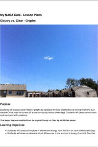
Explore the link between solar energy and cloud cover using real data from NASA from China! Future climatologists analyze and interpret graphs of solar energy on clear and cloudy days using a literacy cube. Investigators draw conclusions...
Curated OER
Explore: 4th Grade Beaufort Wind Speed
Fourth graders measure wind speed, air pressure, humidity, temperature, and wind direction. They compare their observations with those of actual weather forecasts.
Curated OER
Highs and Lows
Students use email to chart weather patterns and then graph their findings. In this weather patterns lesson, students chart their weather for a week at the school. Students then use email to find temperatures at a variety of locations....
Curated OER
And Tomorrow's Forecast Is...
Students create original short stories that feature distinctive weather phenomena, such as rainbows, snowstorms, tornadoes, thunder and/or lightning. They use a story map, imbedded in this plane, to help them organize their story.
Curated OER
Agriculture, Weather, Economy and Indiana
Fourth graders, in groups, investigate the role of weather in Indiana's farming economy. They make a prediction as to weather and its effect on the economy of Indiana. They present their data using a media presentation of data...
Curated OER
Tracking Weather Over Time
Learners gather, analyze and interpret data. They explain scientific inquiry. They plot points on a map and report information from a spatial perspective.
Curated OER
How Do Storms Influence Our Lives?
Students investigate the various ways storms influence our lives. They conduct Internet research, identify the characteristics of different storms, plot storm coordinates, and write a report on a particular storm.
Curated OER
In the Rain Shadow
Students, while utilizing a large wall map, experiment recording the annual precipitation for cities on the east and west sides of the Cascade Mountains. They discover that volcanic mountains do not have to erupt to affect the atmosphere.
Curated OER
Vanishing Coast: Erosion
Students explore the concept of erosion. In this erosion lesson, students discuss the effects of 2 classroom demonstrations that replicate coastal erosion.
Other popular searches
- Reading Weather Maps
- Interpreting Weather Maps
- Interpret Weather Maps
- Surface Weather Maps
- Creating Weather Maps
- Weather Maps With Fronts
- Pressure and Weather Maps
- Analyzing Weather Maps
- Construct Weather Maps
- Winds and Weather Maps
- Interactive Weather Maps
- Just Interpret Weather Maps


