Curated OER
Kazakhstan Outline Map
In this blank Kazakhstan outline map worksheet, students study the political boundaries of the country. This outline map may be used for a variety of geographic activities.
Curated OER
North America Outline Map
In this blank North America outline map worksheet, students study the political boundaries of the continent. This outline map may be used for a variety of geographic activities.
Curated OER
Czech Republic Outline Map
In this blank Czech Republic outline map activity, students study the physical boundaries of the country. This outline map may be used for a variety of geographic activities.
Curated OER
Washington Map
In this Washington state outline map worksheet, students examine political boundaries of the state and the placement its capital city as well as its major cities. This map is not labeled.
Curated OER
Africa Political Map
In this blank outline map worksheet, learners explore the political boundaries of the continent of Africa, the countries located there, and label other geographic features.
Curated OER
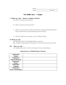
The Middle East: A Region
In this Middle East worksheet, students respond to 4 short answer questions about the region and its characteristics after they read assigned textbook pages. Students also complete a graphic organizer.
Curated OER
Africa Map Spatial Analysis
In this map skills worksheet, students complete a graphic organizer that requires them to examine what is represented on different types of maps of Africa.
Curated OER
Japanese Tsunami Worksheet
In this current events worksheet, students complete a graphic organizer about the 2011 Japanese tsunami. Students should add information about challenges and responses to challenges presented by the tsunami. Students also respond to 2...
Curated OER
Australia
In this map of Australia learning exercise, students research and study a map of Australia. Students label Australia's regions, major states and important landmarks.
Curated OER
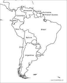
South America Map
In this South American political map worksheet, students examine both national boundaries and national capitals.
Curated OER
Americas: Political Map
In this North America and South America outline map learning exercise, students examine the political boundaries of the 2 continents.
Curated OER
Europe: Political Map
In this Europe political map worksheet, students examine each country's boundaries. The map also highlights each of the nation's capitals with a star.
Curated OER
South America Map
In this South America political map learning exercise, students examine the country boundaries. The map also labels each of the countries and their capitals.
Curated OER
Europe Labeled Map
In this Europe political map worksheet, students examine the national boundaries. The map also highlights each of the nation's capitals with a star. The countries and capital cities in this map are labeled.
Curated OER
Europe at Exploration 1500
In this world empires and trade in 1500 worksheet, learners examine a world empire map, world trade map, and Europe map. All maps display information from 1500.
Curated OER
Europe 1914
In this Europe 1914 map worksheet, learners note the 9 regions of the Europe labeled on the map and their relevance to World War II.
Curated OER
South America Outline Map
In this blank outline map learning exercise, students explore the political boundaries of South America and the nations there. This map may be used in a variety of classroom activities. The map is labeled with the country names.
Curated OER
South America Outline Map
In this blank outline map learning exercise, students explore the political boundaries of South America and the nations there. This map may be used in a variety of classroom activities. The location of the capital cities are...
Curated OER
European Country Map
For this Europe political map worksheet, students examine the national boundaries. The country names are labeled on the map.
Curated OER
Europe Outline Map (Labled)
In this blank outline map learning exercise, students study the political boundaries of the labeled European nations.
Curated OER
Australia Map
In this blank outline map instructional activity, students explore the political boundaries of Australia. This map is labeled and may be used in a variety of classroom activities.
Curated OER
Australia Map: Labeled
In this Australia outline map worksheet, students make note of the political divisions of the 5 provinces and territories of the nation. This map is labeled.
Curated OER
Australia Map: Labeled
For this blank outline map worksheet, students explore the political boundaries of Australia and its provinces and territories. This map is labeled and may be used in a variety of classroom activities.
Curated OER
Australia Map Resource Sheet
In this Australia map resource worksheet, students use the map of Australia to supplement their study of the country. They see a map labeled with Australian cities, and the surrounding countries and water bodies.
Other popular searches
- Five Themes of Geography
- U.s. Geography
- China Geography
- Africa Geography
- Mexico Geography
- Canada Geography
- Asia Geography
- France Geography
- Japan Geography
- World Map
- Ireland Geography
- Geography Studies


