Curated OER
Physical World Map
In this world map worksheet, students practice their geography skills as they label the 7 continents and 5 oceans. Teachers may use this physical map for various classroom activities
Devine Educational Consultancy Services
Geography Student Workbook, Australia
Your youngsters will be experts on the geography of Australia after working with these activities and worksheets, which review the continent's weather, major landforms, dimensions, history, and climate.
Curated OER
Fascinating Geography Facts
In this geography worksheet, students will read 4 interesting United States geography facts and 19 fascinating world geography facts.
Owl Teacher
Five Themes of Geography Research Activity
Here is an activity worksheet that will prompt your young geographers to choose a country anywhere in the world to research and study, and to then apply it to the five themes of geography.
Curated OER
World: Physical Map
In this world physical map worksheet, students make note of the major landforms located on this Robinson projection map.
Curated OER
World Climate Map
In this world climate map instructional activity, students examine the tropical, dry, warm temperate, cool temperate, polar and subartic, and highland climate regions of the world.
Curated OER
World: Continents Map
In this World outline map learning exercise, students note the political boundaries of the continents of the world on this Robinson projection map.
Curated OER
World: Political Map
In this world political outline map worksheet, students examine boundaries of each of the countries in the world. This map not is labeled.
Curated OER
World Pacific Map
In this world Pacific projection outline map worksheet, students examine boundaries of each of the countries in the world. This map not is labeled.
Curated OER
World Political Map
In this blank outline map worksheet, students note the political boundaries of the nations of the world on a Mercator projection map.
Curated OER
World: Continents
In this blank outline map worksheet, students note the political boundaries of the continents of the world on a Robinson projection map.
Curated OER
World: Continents Map
In this outline map worksheet, students note the political boundaries of the continents of the world. The map is labeled with the names of the 7 continents.
Curated OER
World Landforms
In this blank outline map activity, students note the major landforms of the 7 continents of the world on a Robinson projection map.
Curated OER
Rivers of the World
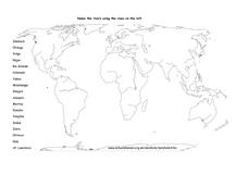
In this river worksheet, students focus on various rivers across the planet. Students label the names of 18 rivers on the world map provided.
Weebly
Ancient China
From China's physical geography and earliest beginnings of civilization to the Qin and Han dynasties, here is a nicely designed worksheet on ancient China, which includes a graphic organizer and timeline to summarize the reading material.
Curated OER
The United States and Canada: Climate and Vegetation
Display U.S. and Canadian climate and vegetation through this text-companion worksheet. Learners read about the geography of these regions, take notes, and answer 3 comprehension questions as they read the selection. A graphic organizer...
Curated OER
Where in the World? Your Relative Location
In this geography worksheet, students complete a graph showing their location on the planet earth. Students determine what percent of all people on Earth are on their continent, in their country and part of their town.
Brooklyn Children’s Museum
Inside India
What can a Ganesh statue, hand ornament, and print block tell you about India? Introduce your learners to the geography, history, and culture of India by analyzing primary sources and using the well-designed worksheets provided in this...
San Antonio Independent School District
Global PC and Google Earth
Learners take notes on the physical geography of an assigned country, as well as its type of economy, major cities, and the student's own first impressions of the country, with this graphic organizer.
Curated OER
Tears of Joy Theatre Presents Anansi the Spider
Accompany the African folktale, Anansi the Spider, with a collection of five lessons, each equipped with supplemental activities. Lessons offer multidisciplinary reinforcement in English language arts, social studies, science, and arts...
Curated OER
The World At Your Fingertips
In this the world at your fingertips learning exercise, students bring in 5 items from home that are not made in the U.S., then complete a chart, indicate on a map and answer 6 questions about imported items.
Curated OER
Europe after World War I
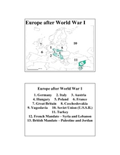
In this Europe after World War I map worksheet, learners note the 11 regions of the Europe labeled on the map.
Curated OER
Landforms and Resources of the United States and Canada
In this North American geography instructional activity, students read about the physical features and resources of the United States and Canada. Students take notes and answer 3 short answer comprehension questions as they read the...
Curated OER
Explorer Comprehension Worksheet
In this exploration worksheet, students draw the routes of the listed explorers on the blank world map. Students should also provide a color-coded map key.


