Curated OER
Lesson on GPS
Students investigate global positioning systems. For this technology and mapping lesson, students view a PowerPoint presentation in which they identify the features of a GPS, state its uses, and follow steps to find a waypoint.
Curated OER
People Change the Landscape
Students examine ways in which humans have brought change to the natural environment. In this ecology and literacy instructional activity, students listen to the book Island Boy by Barbara Cooney. Students observe and define map-reading...
Curated OER
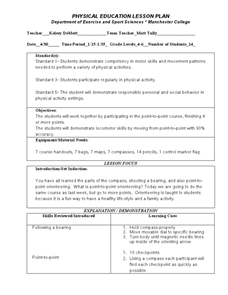
Following a Bearing
Students practice finding a bearing. In this orienteering lesson, students review how to use a compass and set a bearing. Students complete a worksheet where they practice finding a bearing and complete a group activity to...
Curated OER
United States: Physical Features Fun
In this map worksheet, students color and trace eleven listed features on a map of the United States. Students answer six additional questions about the map. A United States map is not provided. However, websites are provided to find...
Curated OER
Globe Lesson 4 - The Compass
Young scholars study compass' and their use in navigation. In this compass lesson plan, students use a compass and a globe to answer the questions about navigation.
Space Awareness
How To Travel On Earth Without Getting Lost
Have you ever wanted to travel the world? Take a virtual trip with a geography lesson that uses longitude and latitude, the position of the sun, an astronomy app, and a classroom globe.
Curated OER
Do the Tallywalker
Students study the basics of mapmaking, then make a tally walker, (geographic location device used in secret).
Curated OER
Mapping the Local Community
Young scholars review the symbols and legends of a map. In groups, they follow a set of directions to create a map showing the route to a specific place. They present their map to the class and review the basic components of a community.
Curated OER
Directions on a United States Map
Students generate directions for an imaginary trip. In this map lesson, students review the four main directions and how to use a map legend. Students locate destinations based on directions given by classmates.
Curated OER
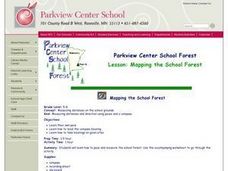
MAPPING THE SCHOOL FOREST
Students measure distances and directions using paces and a compass. They determine their own pace, explore how to read a compass bearing, and how to take bearings on given sites.
Curated OER
Outline Map of Japan
In this geography instructional activity, students examine a black line outline map of Japan. There is a compass rose on the page. There are no labeled cities.
Curated OER
Using Four Main Directions in the Classroom
Pupils identify the four cardinal directions. In this map skills geography lesson plan, students use a magnetic compass to label the four directions in the classroom. Pupils use the four directions to locate objects in the classroom.
Curated OER
Four Main Directions
Students describe directions using a globe for north, east, south and west. In this mapping lesson students identify the north and south pole. Students understand the importance of the equator and the Prime Meridian. Students explain how...
Curated OER
U.S. Geography- The Northeast
Students investigate the geography of the Northeast states. In this map skills lesson, students are shown a map of the Northeast states and identify the state names and borders. Students construct individual maps of the Northeast using...
Curated OER
Globe Lesson 4 - Intermediate Directions
Students explore the concept of intermediate directions. For this geography skills lesson, students use map skills in order to identify intermediate directions as they complete a map activity.
Curated OER
Naviagational Tools
Fifth graders create a compass, with the help of written instructions and then write six sentences discussing how compasses work and why they are helpful. They discuss the different types of navigational tools and how they are helpful.
Curated OER
Using the Four Main Directions in the Classroom
Students utilize a compass to determine where North is in the classroom. In this direction lesson, students label the four main directions. Students locate features in the classroom and describe the directions to get to them. Students...
Curated OER
Basic Orienteering
Students study orienteering. In this science lesson plan, students study the parts of a compass and use the compass to set a bearing and follow the bearing on the compass.
Curated OER
Are We There Yet?
Students discover how to use maps and why they are important when using a map. They calculate distance using a map scale and time using travel speed and a map scale.
Curated OER
Finding Your Way
Students work in small groups to practice basic map skills. They take turns giving directions and tracing a path from one location to different destinations on the map.
Curated OER
Treasure Hunt
Pupils find lost "treasure" using a treasure map after being shown a map that you have created where terms and symbols are discussed. The class is divided into small groups where they locate your treasure and then read a section from...
Curated OER
Follow the Light
Learners investigate the role of lighthouses in navigation and practice the use of cardinal directions through reading activities, discussion, locating geographical features, and mapping lighthouses along the east coast of the United...
Curated OER
Capitals, Oceans, And Border States
Students investigate geography by completing games with classmates. For this United States of America lesson, students examine a map of North America and identify the borders of Mexico and Canada as well as the Pacific and Atlantic....
Curated OER
Orienteering II
Students name the parts of a compass and comprehend the function of each part. They define paces and tallies and use them in a real world situation. Students are shown the proper use of radio terminology. They use a map and compass to...


