Curated OER
The Country of Venezuela
In this map skills of Venezuela worksheet, students use an outline map to find an label important cities landforms, and bodies of water. Students label and color code 10 answers.
Curated OER
Czech Republic Outline Map
In this blank Czech Republic outline map activity, students study the physical boundaries of the country. This outline map may be used for a variety of geographic activities.
Curated OER
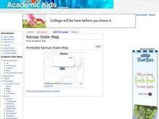
Kansas State Map
In this map of Kansas worksheet, students color and label major cities and physical features of this state. Students also study the location of Kansas in relation to the other states in the U.S. by studying the background map.
Curated OER
Latitude and Longitude- Online Interactive
In this maps worksheet, students learn about longitude and latitude by reading a two paragraph text and studying two maps. Students answer 9 fill in the blank questions. This is an online interactive worksheet.
Curated OER
The United States in 1790
In this geography skills worksheet, students study the provided map of the United States in 1790 and then complete the provided quiz over the 17 states and territories.
Curated OER
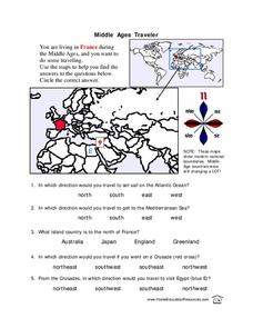
Middle Ages Traveler
In this map worksheet, young scholars are given three maps of France to use to answer multiple choice questions. Students complete an activity from the perspective of a Middle Ages traveler.
Curated OER
Illinois State Map
In this Illinois geography worksheet, learners color and label a map of Illinois. Students study the location of the capital and where Illinois is situated in the United States. There is a black line map of the state with a grey US map...
Curated OER
Indiana State Map
In this Indiana state map worksheet, students color and label the important cities and physical features on this outline map. Students also learn of Indiana's location in the U.S. by studying the background map.
Curated OER
Iowa State Map
In this Iowa state map worksheet, students color and label the important cities and physical features. Students also study the background map that shows the location of Iowa in the United States.
Curated OER
Idaho State Map
In this Idaho state map learning exercise, students color and label important physical features and cities. Students also study the background map to learn the location of Idaho as related to the rest of the U.S.
Curated OER
Pennsylvania State Map
In this geography of Pennsylvania worksheet, students color and label a map of the state. Students also study the location of Pennsylvania on a grey background map of the entire 50 states.
Curated OER
Utah State Map
In this geography of Utah worksheet, students color and label a map of the state of Utah. Students also study a second map that shows the location of this state in the U.S.
Curated OER
Tennessee State Map
In this Tennessee state geography worksheet, students color and label major cities and physical features on the map. Students also study a second map of the U.S. that shows the location of the state of Tennessee.
Curated OER
Virginia State Map
In this geography of Virginia worksheet, students color the map and label major cities and physical features. Students also study a second map showing the location of the state of Virginia in the United States.
Curated OER
Delaware State Map
In this geography of Delaware learning exercise, students color the map and label major cities and physical features. Students also study a second map showing the location of the state of Delaware in the United States.
Curated OER
California State Map
In this geography of California worksheet, students color the map and label major cities and physical features. Students also study a second map showing the location of the state of California in the United States.
Curated OER
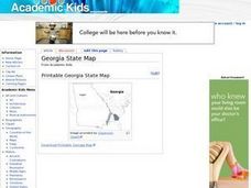
Georgia State Map
For this geography of Georgia worksheet, students color the map and label major cities and physical features. Students also study a second map showing the location of the state of Georgia in the United States.
Curated OER
Florida State Map
In this geography of Florida worksheet, students color the map and label major cities and physical features. Students also study a second map showing the location of the state of Florida in the United States.
Curated OER
Thinking Critically about Geography
In this map reading activity, students answer 2 critical thinking questions about a map shown. Page has links to additional resources.
Curated OER
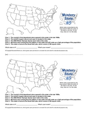
Mystery State # 5
Mystery state number five is none other than Utah! Quiz your kids on state knowledge while building deductive reasoning skills. They use each of the five clues to determine the name of the mystery state. A great warm up when studying...
Curated OER
Outline Map of Japan
In this geography worksheet, students examine a black line outline map of Japan. There is a compass rose on the page. There are no labeled cities.
Curated OER
Map Activity: Place Name
In this map worksheet, students locate given words on a map of the United States, then answer a set of 4 related short answer questions.
Curated OER
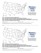
Mystery State #12
What's better than learning about US geography? Having fun while your doing it! After reviewing each of the five given clues, learners attempt to name the mystery state. A great way to reinforce geography skills and deductive reasoning...
Curated OER
Map Work: Using the Index and Grid References
In this maps worksheet, students use the Oxford First Atlas to answer 20 questions about cities in Great Britain. Students will need to use the index and grid references to locate cities or countries.


