Curated OER
Tennessee State Map
In this Tennessee state geography learning exercise, students color and label major cities and physical features on the map. Students also study a second map of the U.S. that shows the location of the state of Tennessee.
Curated OER
Virginia State Map
In this geography of Virginia worksheet, students color the map and label major cities and physical features. Students also study a second map showing the location of the state of Virginia in the United States.
Curated OER
Delaware State Map
In this geography of Delaware activity, students color the map and label major cities and physical features. Students also study a second map showing the location of the state of Delaware in the United States.
Curated OER
California State Map
In this geography of California instructional activity, students color the map and label major cities and physical features. Students also study a second map showing the location of the state of California in the United States.
Curated OER
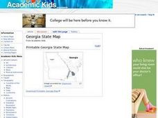
Georgia State Map
In this geography of Georgia learning exercise, students color the map and label major cities and physical features. Students also study a second map showing the location of the state of Georgia in the United States.
Curated OER
Florida State Map
In this geography of Florida worksheet, students color the map and label major cities and physical features. Students also study a second map showing the location of the state of Florida in the United States.
Curated OER
United States Map- Rivers
Students identify major rivers on a map of the United States. In this geography lesson, students discuss what a river is and use a map marker to identify the symbol of a river on a map.
Curated OER
social studies: Life in Colonial America
Students explore the trials and tribulations early colonial life and note its successes. Through literature, Internet research, and interactive software, they engage in various activities to evaluate early social and cultural development.
Curated OER
Tasty Mapping
Students create an edible map. In this civics and geography lesson, students research their town's features and local government. Students work in groups to design and create a physical map of their town based on research.
Curated OER
Lesson Plan: Five Themes of Geography
After learning the five themes of geography, learners take an Internet trip and categorize information found into one of the five themes. They answer five questions about the places explored. That is about all there is to this lesson; it...
Curated OER
Three Mapping Activities
Pupils label three maps of China after being introduced to background information about the country. In this geography lesson plan, students color two maps and label various points of interest in China. Finally, pupils draw...
Curated OER
Victims of Geography
Students examine the toll taken on New Orleans by Hurricane Katrina. In this current events lesson, students visit selected websites to discover details about the geography of the city and the hurricane itself.
Curated OER
Globe Game
Students are arranged into groups and are given a map or globe. Students select a location on the map. Students as yes and no questions to guess the specific place that was chosen.
Curated OER
Quilt? What Quilt? I Don't See a Quilt!
Students analyze maps and cultures of major cities in the state of Arizona and designate different regions within the state according to geography and economy.
Curated OER
What's Your Temperature?
Learners take a look at the local newspaper and focus on the weather section. They get into small groups, and each one looks at the same map, but of a different part of the country. They must prepare a presentation that shows how...
Curated OER
T-shirt Passport Lesson Plan
Young scholars locate their t-shirt place/name on maps, then share facts/artifacts (souvenirs) from their place/name location orally with whole class. They create a database using information gathered from the whole class.
Curated OER
Day to Day Life in a Small African Village
Students analyze life in a village of Tanzania including its language, geography, health, and hygiene issues. In this African village instructional activity, students locate Tanzania and its capital city on a map. Students...
Curated OER
Exploring the Hudson in 1609
While this lesson focuses on a study of the Hudson River, it could be used as a template for a discussion of map skills, converting measurements, and plotting a route. The lesson includes vocabulary and other resources to make it a...
Curated OER
"We Didn't Start the Fire"
Students extract geographical and historical information from the lyrics of a popular song, make associations between people, places, and events, and plot their information on a map.
Curated OER
This Is Tanzania
Students study the volcanic history and the wildlife of Tanzania. They examine how most Tanzanians live on a subsistence agricultural economy.
Curated OER
Around the World At 30o North Latitude
Reinforce the use of an atlas and reference materials with writers. They discover how geographic location can make living easier or harder. They draw an assigned journey on a map, categorize survival needs, and prioritize options during...
Curated OER
Trade in Precontact Alaska
Young scholars explore the geography of Alaska and its effect on trade. In this ancient Alaska lesson, students participate in a simulation that requires them to trade with those in the territory and outside of it.
University of Pennsylvania
Canaan and Ancient Israel
Planning for your next activity on ancient Israel, but not sure where to start? Check out this assortment of activities to help get the ball rolling. It includes a range of ideas on topics, such as Greek and Egyptian mythology,...
Curated OER
From There To Here...
Learners find out where some of the products in hour homes come from, then become aware of our local trash, landfills and incinerators. They chart and graph data and use maps for different purposes.


