Curated OER
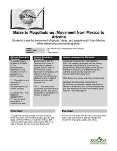
Maize to Maquiladoras: Movement from Mexico to Arizona
Students label maps of Arizona and Mexico of the products that moved from one place to another. In this Arizona and Mexico lesson plan, students also summarize the effects of the movement on life in Arizona.
Curated OER
Life in Sahara
Students explore the geography of the Sahara region of Africa and identify characteristics of a desert habitat. They explore the culture of the people living there and how it has adapted to desert life.
Curated OER
Where Should We Put a Store?
Students analyze population data. They convert population data into simple density maps to help make decisions about their world. They select the best location for a school store based on population density. They present their maps...
Curated OER
Four Main Directions
Students describe directions using a globe for north, east, south and west. In this mapping lesson students identify the north and south pole. Students understand the importance of the equator and the Prime Meridian. Students explain how...
Curated OER
Cotton Journey
Students use "Cotton Journey-A Field Trip In A Box" kit to relate the significance of cotton to the Civil War period and to study the cotton industry in general.
Curated OER
Families and Neighborhoods
Students distinguish where their homes are in relation to the city of Pittsburgh. In this geography lesson, students read the book All Families Are Specialand find their city on a map of Pennsylvania. Students locate Pittsburgh...
Curated OER
Design a Wildlife Habitat-Habitat Detective
Learners discuss ways people have changed landscapes and how this effects wildlife. They map the area around their school and keep a journal of wildlife they see. They predict how to preserve the wildlife they see for future generations.
Curated OER
Country: India
Learners use the Internet to study the history, geography, culture and art of India. Videos, photographs and maps are included.
Curated OER
Utah Becomes a State—1890
Students read about and discuss the geography and statehood of Utah. In this Homestead Act activity, students read the Homestead Act and discuss its effects. Students analyze a precipitation map and work in pairs to answer discussion...
Curated OER
The World At Your Fingertips
In this the world at your fingertips worksheet, learners bring in 5 items from home that are not made in the U.S., then complete a chart, indicate on a map and answer 6 questions about imported items.
Curated OER
Countries of Africa
Students study the coutries of Africa. In this African American history, small groups of students research a different country, color the country on the map of Africa, write a paragraph about the country, and draw pictures of its flag.
Curated OER
This Is Tanzania
Young scholars begin the lesson by locating Tanzania on a world map. While reading an article, they note what the author's opinion is of the people who live there and discover the connection the people have with the land. They examine...
Curated OER
Let's Spice It With Pepper
Learners identify and locate the areas in which pepper and spices orginated. On a map, they locate the areas and write the name of the spice that is found there. They use historical events to trace its route to the Americas. They...
Curated OER
Mexican and American Views of Texas
Learners study the territorial status of Texas in 1830, 1840, and 1846 and interpret an historical timeline. They develop a general statement of Mexican and American views of Texas.
Curated OER
"Eggs-treme" Egg Hunt
Students practice reading a map of the classroom or playground. They hide plastic eggs and draw a map identifying the location of two eggs hidden in the classroom or on the playground.
Curated OER
Learning About the Basin
Learners use watershed maps to explore the Lake Pontchartrain Basin in Louisiana. In this geography lesson, students identify important features such as elevation, vegetation, cultural, historical and land use on a map of Lake...
Curated OER
You Too Can Haiku
Students explore the country of Japan. In this international studies activity, students utilize their geography skills to locate Japan on a map. Students explore some Japanese customs and communities. Students use descriptive...
Curated OER
Where is the Water?
Students explore freshwater ecosystems. In this geography lesson, students brainstorm all the lakes and rivers they know then mark them on a map. Students will then mark all the major freshwater resources on each of the seven continents,...
Curated OER
Yours, Mine, and Ours
Young scholars explore the five themes of geography while they conduct Internet research to compare and contrast their city, region, or country with the city and region of Nagano, Japan.
Curated OER
Thematic Unit on Cats
Students discover in which climates the cats of the world live in. They review the different climates of the world and use maps and globes to help them locate continents.
Curated OER
Follow the Light
Students investigate the role of lighthouses in navigation and practice the use of cardinal directions through reading activities, discussion, locating geographical features, and mapping lighthouses along the east coast of the United...
Curated OER
Surprise at Pearl Harbor
Young scholars review the concept of courage and relate it to their daily life. As a class, they are introduced to the events of December 7, 1941 at Pearl Harbor. Using a map, they locate Hawai'i and label the islands. They use the...
Curated OER
Let's Travel!
Students review the rules and expectations, they earn points each day by making the correct behavioral choices. They read maps and do Internet reserach, students become aware of United States and or world geography. Students check...
Curated OER
Nebraska Counties
Students explore the counties of Nebraska. In this Nebraska history lesson plan, students examine maps of the state and determine the location of specific counties and conduct research on them. Students also use the county names to fill...
