Curated OER
Taking a Trip Through the Regions
Students identify the location and characteristics of different regions throughout the world. Using this information, they compare and contrast the regions and discover how they change over time. They use the internet to research a place...
Curated OER
People and Places
Fifth graders investigate how the geography of the land effected the human experience of the Lewis and Clark Expedition. They research using primary and secondary sources, design a map.
Curated OER
"Trails, Rails, and Roads" Lesson 2: Road Tripping
Students practice map skills and take a virtual road trip through Maine examining the history of transportation. They create questions from the information they learned and play a game against other groups.
Curated OER
The Rivers and Lakes of Alberta
Learners are introduced to the online Atlas of Canada and they identify the lakes and major rivers of Alberta.
Curated OER
You Can Find It!
Pupils locate different places including U.S. cities using longitude and latitude coordinates. In this longitude and latitude lesson plan, students locate 10 different locations.
Curated OER
Controlling the Flow of the Colorado River: A Study of Dams
Students research and map the Colorado River and its dams and predict the effects of a dam on an area. They suggest reasons a dam would be built and compare the Colorado River system with other major river systems within the US and...
Curated OER
Where in the World is Egypt?
In this geography worksheet, students investigate the location of the continent of Africa and the country of Egypt by studying a map of the region. Students color the map and locate Egypt.
Curated OER
The Birmingham River System
After a lesson on geography and the features of a river, students view a map of the Birmingham river system, which is in England. They are then asked to label 4 features on the map.
Curated OER
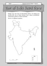
Tour of India Board Game
In this India board game activity worksheet, students use the outline map of India to create their own board games that feature the culture and locations of the country.
Curated OER
Medieval Times: Castles, Knights, and Heraldry
Students demonstrate the ability to use the computers for research and exploration of castles and any other sources needed and locate web sites for various needs. They explain what a coat of arms was and make their own .
Curated OER
Reasons to Settle in America
Students complete a research project. In this American History lesson plan, students work in groups to research reasons that people wanted to settle in America. Students record the information, share what they found and write...
Curated OER
Identifying Continents and Oceans
Students locate and identify the four major oceans and the seven continents on a world map. They use an unlabeled world map and compass rose to describe relative locations of the continents and oceans.
Curated OER
Invaders and Settlers
Students watch a video that illustrates the way in which an English community evolved based on geography and the settlers and invaders who lived there over different time periods. They create a map that shows how different villages are...
Curated OER
Animals from Afar
Pupils visualize the scope of the Roman empire by illustrating the geographic origins of various imported animals. They study how exotic animals were imported into Rome from the farthest regions of the empire.
Curated OER
Zones of Conflict
Students read maps and identify specific countries involved in conflict. They classify countries in cultural realms. They relate maps to what they know about world conflict.
Curated OER
Rivers Run Through It
In this mapping practice worksheet, 5th graders read an informational paragraph and answer 7 questions about the parts of a map along with places shown on a given map.
Curated OER
Then and Now
Students list the similarities and differences seen as they compare and contrast historical and current street maps of their local communities.
Curated OER
On the Way Home#122
Students observe the various physical and man-made features that they pass on the route they take on their way home from school. They sketch the features before drawing and labeling a map of the route. They share the maps with other...
Curated OER
Planning a Railroad
Students use a topographical map to plan a route from Doknner Summit to Truckee, then compare it to the route selected by Theodore Judah.
Curated OER
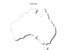
Australia
In this Australia map, students research and locate the main regions, states and important landmarks found on the map and discuss them with their classmates.
Curated OER
Water Sources in Cape Verde and West Africa
Young explorers study the scarcity and importance of a continuous supply of fresh water in Cape Verde. They research the five main ways that fresh water is obtained in these countries. Each research group prepares a presentation, and...
Curated OER
"Where in the World is my School?"
Students learn new vocabulary and discuss what GPS is and does. They locate their school using the equipment.
Curated OER
States in the USA Quiz
In this online interactive geography quiz worksheet, students respond to 50 identification questions about the states in the United States of America. Students have 4 minutes to complete the quiz.
Curated OER
Discovering Dinosaurs: Planning your Summer Vacation
Students use the online Atlas of Canada to gather information about places in Canada.

