Curated OER
Northwest Hawaiian Islands
Students compare and contrast places around the world. Students analyze the effects of human activity on the physical environment and devise plans to address the consequences. Students also focus on geographical topics such as formation...
Curated OER
Microsoft Publisher Country Brochure
Students explore geographic information. In this geography and technology lesson, students choose a county and answer related questions on a Webquest. Students create a word web and design a country brochure.
Curated OER
Living During the Little Ice Age
Students brainstorm what living conditions during the period known as the Little Ice Age (1350-1850) might have been like. They research lifestyles, the economy, crop yields, and human and livestock mortality.
Curated OER
A World of Favorites
Investigate students' favorites worldwide by having them create and publish a questionnaire to gather information about students' favorites. They will conduct research about a continent, create three web pages and a chart representing...
Curated OER
Off to the Future
Students read a handout and predict the position of the San Andreas Fault far in the future. In this future world lesson, students use a map worksheet to demonstrate the path of the Pacific Plate millions of years from now.
Curated OER
Building Bridges for Young Learners- School
Students examine the purpose of education. For this schooling lesson, students read a letter from a child in Uzbekistan. Students compare and contrast their schooling to children around the world.
Curated OER
New Food Saves Lives, Could End Hunger
Students locate the country of Niger, then read a news article about a new type of food that is being used to fight childhood hunger in Africa. In this current events instructional activity, the teacher introduces the article with map...
Curated OER
Travel Plan Project
You can use a travel plan project in the classroom to learn about budgets, maps, time management, and more.
Curated OER
Early Explorers
Fifth graders study early explorers. In this World history lesson plan, 5th graders draw an outline of a map labeling each part, build geographical features out of dough, and paint each of the land and water features.
Weather Bug
WeatherBug
Exploring the weather has never been more intriguing! Whether you are looking for a quick glance at the 10-day forecast, trying to figure out if lightning is heading your way, or wondering what the pollen count is, you will find out...
Curated OER
Art And Ecology: Check Out This Place!
In this art and ecology worksheet, students look at paintings and answer questions, using the painting, a world map and climate. There are 2 pictures, each with its own set of questions.
Curated OER
Marvelouw Mongolia
Students are able to: tell basic information about Mangolia: locate it on a world map, locate its capital, name the countries surrounding Mongolia, read a Mongolian folk tale, and explore about the balalaika.
Curated OER
Opening Doors to Social Studies with Children's Literature: The Desert Alphabet Book
Students explore the geography of the United States. In this social studies instructional activity, students identify the major deserts on a map of the United States.
Curated OER
The Secret Garden
Learners research the culture and geography of India and England while reading "The Secret Garden". Using this information, they write at least three predictions about what they believe might happen in the story. Using the Internet,...
Curated OER
Point Me to Puerto Rico
Students research the physical features and geography of Puerto Rico as well as locate it on a world map and identify its major characteristics. Pictures and postcards are shown to each class for a visual connection to Puerto Rico as...
Curated OER
Westward Ho: The Difficulties of Emigrants Moving West
Students research the journey west of 19th century emigrants. In this pioneer lesson, students read the letters and diaries of a fictitious family traveling on the Oregon Trail. They mark their route on a US map, create a chart showing...
Curated OER
Traveling with Flat Stanley
pupils use the internet to gather geographical data about a state of their choice. Using new vocabulary, they describe the features present in the state, its climate and attractions. They develop a PowerPoint presentation to share...
Curated OER
To Walk the Sky Path
Fifth graders use maps of Florida. They locate places from a list on their map. Students use the places mentioned in the book, "To Walk the Sky Path," and locate them on the map. Students should have labeled a minimum of 10 places, and...
Curated OER
The Mountain Community: Why Flagstaff?
Students identify geographical features that hindered or promoted settlement in the city of Flagstaff, Arizona. In this settlement lesson plan, students write a summary of what they learned and identify geographical features on a map.
Curated OER
Touring the Regions of the United States
Fifth graders explore the regions of the United States. In this geography skills instructional activity, 5th graders examine the landforms, climates, and economies of the regions of the United States. Students conduct Internet research...
Curated OER
Regions of the US: Gulf Stream, States and Their Capitals
Fifth graders identify one way of dividing the US into geographical regions and then consider alternate ways of doing the same. They locate each of the fifty states and their capitals on a map. They research the Gulf Stream region.
Curated OER
Ticket to Ride
Students research a place they would like to visit. They write a report about that location that includes a map, the climate and other features that explain their desire to visit.
Curated OER
"Across Oregon On The 45th N Parallel" A Transect of Oregon
Students explore the physical geography of Oregon. In groups, students collect weather and elevation information on Oregon. They organize the data and create maps and graphs of the information. Afterward, students compare the...
Curated OER
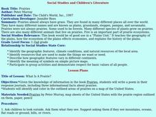
Social Studies and Children's Literature
Students write a journal in response to literature. The story that is read is about prairies. The subject of prairies becomes an object for research. The culminating activity is the making of a map where prairies exist in the United States.


