Curated OER
Missouri Outline Map
In this Missouri outline map learning exercise, students examine political boundaries of the state and the placement its capital city as well as its major cities. This map is not labeled.
Curated OER
Pennsylvania Outline Map
In this Pennsylvania outline map learning exercise, students examine political boundaries of the state and the placement its capital city as well as its major cities. This map is not labeled.
Curated OER
Ohio Outline Map
In this Ohio outline map worksheet, students examine political boundaries of the state and the placement its capital city as well as its major cities. This map is not labeled.
Curated OER
New Jersey Outline Map
In this New Jersey outline map worksheet, students examine political boundaries of the state and the placement its capital city as well as its major cities. This map is not labeled.
Curated OER
New Hampshire Outline Map
In this New Hampshire outline map worksheet, students examine political boundaries of the state and the placement its capital city as well as its major cities. This map is not labeled.
Curated OER
Nevada Outline Map
In this Nevada outline map worksheet, students examine political boundaries of the state and the placement its capital city as well as its major cities. This map is not labeled.
Curated OER
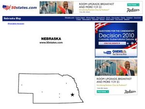
Nebraska Outline Map
In this Nebraska outline map worksheet, students examine political boundaries of the state and the placement its capital city as well as its major cities. This map is not labeled.
Curated OER
Wyoming Outline Map
For this Wyoming outline map worksheet, learners examine political boundaries of the state and the placement its capital city as well as its major cities. This map is not labeled.
Curated OER
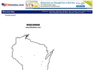
Wisconsin Outline Map
In this Wisconsin outline map worksheet, students examine political boundaries of the state and the placement its capital city as well as its major cities. This map is not labeled.
Curated OER
West Virginia Outline Map
In this West Virginia outline map worksheet, students examine political boundaries of the state and the placement its capital city as well as its major cities. This map is not labeled.
Curated OER
Utah Outline Map
In this Utah outline map worksheet, students examine political boundaries of the state and the placement its capital city as well as its major cities. This map is not labeled.
Curated OER
Tennessee Outline Map
In this Tennessee outline map worksheet, students examine political boundaries of the state and the placement its capital city as well as its major cities. This map is not labeled.
Curated OER
South Dakota Outline Map
For this South Dakota outline map worksheet, learners examine political boundaries of the state and the placement its capital city as well as its major cities. This map is not labeled.
Curated OER
Rhode Island Outline Map
In this Rhode Island outline map activity, students examine political boundaries of the state and the placement its capital city as well as its major cities. This map is not labeled.
Curated OER
Delaware Outline Map
In this Delaware outline map worksheet, students examine political boundaries of the state and the placement its capital city as well as its major cities. This map is not labeled.
Curated OER
Indiana Map
In this Indiana outline map worksheet, students examine political boundaries of the state and the placement its capital city as well as its major cities. This map is not labeled.
Curated OER
Iowa Outline Map
In this Iowa outline map worksheet, students examine political boundaries of the state and the placement its capital city as well as its major cities. This map is not labeled.
Curated OER
Kentucky Outline Map
In this Kentucky outline map worksheet, students examine political boundaries of the state and the placement its capital city as well as its major cities. This map is not labeled.
Curated OER
Maryland Outline Map
In this Maryland outline map worksheet, students examine political boundaries of the state and the placement its capital city as well as its major cities. This map is not labeled.
Curated OER
Oregon Outline Map
In this Oregon outline map worksheet, students examine political boundaries of the state and the placement its capital city as well as its major cities. This map is not labeled.
Curated OER
North Dakota Map
In this North Dakota outline map worksheet, students examine political boundaries of the state and the placement its capital city as well as its major cities. This map is not labeled.
Curated OER
Washington Map
In this Washington state outline map learning exercise, students examine political boundaries of the state and the placement its capital city as well as its major cities. This map is not labeled.
Curated OER
Canada Recycles! Do You?: Grades 4-6
In this recycling education worksheet, students read a table regarding Canadian recycling statistics and respond to 9 questions regarding the data.
Curated OER
The Earth and Beyond
In this solar system worksheet, students complete 2 activities that involve ordering the nine planets and correctly placing them onto a diagram.


