Curated OER
Physical and Human Geography Review Worksheet and Study Guide
In this geography skills worksheet, students respond to 30 short answer questions pertaining to physical and human geography.
Curated OER
World Map Labels
In this geography skills worksheet, students identify the countries and bodies of water labelled on the maps of the world, Africa, Asia, Canada, Europe, the Caribbean, the Middle East, North America, Australia, and South America.
Curated OER
Geography: Intro to Canada
Learners investigate the geography of Canada by analyzing a map of the country. In this North American geography lesson, students identify the 13 provinces of Canada and their locations by examining a Canadian map. Learners may use...
Curated OER
Investigating the Countries of the World
Explore world geography by creating presentations for different countries around the world. Researchers identify many different countries on a globe and select one for which they will create a presentation. They share their research and...
Curated OER
Simulated Air Trip to Seoul, Korea
Students become acquainted with the geography and culture of Korea. In this Korean trip lesson, students view a video about Korea and read about the country. Students sample snacks and possibly learn a Korean phrase as they participate...
Virginia Department of Education
World History and Geography to 1500 A.D.
Here's a great resource for your curriculum library. The 240-page packet, organized into units by topics, includes sample lesson plans, links to primary and secondary source documents, worksheets, activities, and sample assessments.
Curated OER
Physical World Map
In this world map worksheet, students practice their geography skills as they label the 7 continents and 5 oceans. Teachers may use this physical map for various classroom activities
Curated OER
World Map
For this world map worksheet, learners practice their geography skills as they label the 7 continents and 5 oceans. A word bank in included.
Curated OER
US Geography Crossword
In this 50 states activity, students complete a crossword puzzle with facts about US geography. There are 22 words to fit in the puzzle, which has no word bank.
Curated OER
Florida: U.S. Geography for Kids
In this Florida geography worksheet, students locate and label the important features of Florida and create icons for the economy and culture of Florida.
Curated OER
Africa: Introduction, Geography and Mapping
Students study the geography of Africa through the use of maps. They locate, distinguish, and describe the relationships among varying regional and global patterns of geographic phenomena such as landforms, climate, and natural resources.
Curated OER
Geomnemonics: Facilitating the Teaching of Social Studies Content with Geography Skills
Students explore how to draw a world map by hand and how to locate countries.
Curated OER
Geography of China (Tibet)
Sixth graders study the geography of Tibet. They create maps of Tibet. Students predict population, land area, water area and coastline length of the United States and Tibet. Students compare and contrast the day-to-day lives of people...
Curated OER
Geography and Culture
Students explore African geography, study the overall continent of Africa and its individual countries, discuss demographics, and participate in research and class activities.
Curated OER
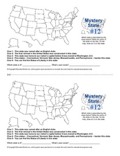
Mystery State #12
What's better than learning about US geography? Having fun while your doing it! After reviewing each of the five given clues, learners attempt to name the mystery state. A great way to reinforce geography skills and deductive reasoning...
Curated OER
Vermont Map
In this state maps worksheet, learners identify the map of Vermont. Students fill in the state capital, the major cities, and other state attractions.
Curated OER
Maps
If your students are just starting a unit on Geography this could be the introduction you're looking for. This PowerPoint presents a clear and organized overview of the different types of maps people use and why each is important. Tip:...
Curated OER
Mystery State # 28
Using clues is a great way to increase deductive and logical reasoning skills. Boost thinking skills while quizzing kids about us geography. They use five clues to determine which state is in question.
Curated OER
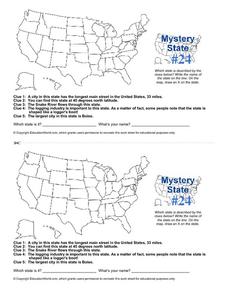
Mystery State # 24
Prepare those brains for a rousing day of learning with a fun geography activity. Your pupils use five different clues to determine the name of mystery state number 24. Where do all those potatoes come from? Idaho!
National Geographic
Mapping the Americas
Celebrate the geography of the Americas and develop map skills through a series of activities focused on the Western Hemisphere. Learners study everything from earthquakes and volcanoes of the Americas and the relationship between...
Angel Island Immigration Station Foundation
Where Is Angel Island? An Introductory Geography Lesson
Prepare young historians for a study of Angel Island Immigration Station with a lesson plan examining primary and secondary source materials, maps, and websites. Using what they have learned, individuals create a map of Angel Island,...
Curated OER
Great Lakes Homepage for Kids
Here are some outstanding lessons on the geology and history of the Great Lakes. These lessons are divided into Grade 4 -6, and Grade 7 - 8 activities. The activities all use the background information, maps, graphs, data, and Great...
Curated OER
Geography Game - Educated Guess
Students participate in a geography game that involves teams creating clues about a secret location. They select a location, develop the clues, and take turns solving the clues written by the other teams.
Ms. Catsos
Ancient Rome Map Worksheet
It wasn't just the great leaders of ancient Rome that shaped their civilization—the geography of the region played a major role as well. After first identifying major land masses, bodies of water, and city states on a map of Europe,...
Other popular searches
- Five Themes of Geography
- U.s. Geography
- China Geography
- Africa Geography
- Mexico Geography
- Canada Geography
- Asia Geography
- France Geography
- Japan Geography
- World Map
- Ireland Geography
- Geography Studies


