Curated OER
Human Impacts on Major Rivers of the World
Learners explore motivations behind human intervention in the stream flow of selected rivers, infer kinds of interventions and their results, and evaluate level of success of such interventions of stream flow as well as environmental...
Curated OER
Itaipu Dam and Power Plant (Brazil and Paraguay)
Learners study South America's Itaipu Dam and Power Plant in order to gain an understanding that hydroelectric power is a major means of generating electricity throughout the world. They also look into the environmental impacts that...
Curated OER
The Republic of Sakha (Yukutia)
Young geographers learn about the extreme temperatures found in the Rebublic of Sakha, and study the hardships caused by these temperatures. They look at why people choose to live in such a remote and rugged area. This incredible,...
Curated OER
Maps that Teach
Young scholars study maps to locate the states and capital on the US map. Students locate continents, major world physical features and historical monuments. Young scholars locate the provinces and territories of Canada.
Curated OER
Location of Cities 201
Students work in pairs to locate the ancient cities on a world atlas using the longitude and latitude measurements. They examine the physical and human futures that explain their locations.
Curated OER
A Sense of West Virginia
Students consider their perceptions of the world through their 5 senses while visiting the West Virginia State Museum. In this West Virginia history lesson, students discover how knowing about the past helps with their understanding of...
Curated OER
GeoPictionary
Students play the game of Pictionary in pairs or teams using geographic locations and terms instead of name.
Curated OER
United Kingdom
Middle schoolers investigate the geographical features of the United Kingdom. They create a clay, playdoh, or salt and flour map of the region. The maps should be labeled with landmarks and bodies of water. They can also draw maps on...
Curated OER
The Day the Water Ran Out
Students explore ecosystems by researching desert characteristics. In this drought lesson plan, students identify the potential impacts of a drought on their home state and interview people who are familiar with water studies. Students...
Curated OER
Designing a Poster to Communicate Information: Yellowstone National Park
It's not hard to convince someone to visit the beauty of Yellowstone National Park. But there's more than meets the eye in this region! Learners watch a short historical video and conduct research before creating an advertisement for...
Curated OER
MAKING CONNECTIONS WITH MAPS
Students define choropleth map. They construct a choropleth map. They interpret a choropleth map. They present geographic information.
Curated OER
Deserts and Winds
Although the wind blows frequently in deserts and may even contribute to their existence, you may teach these two topics separately. Regardless, there are demonstrative photos and diagrams that support the explanations. Explore the...
Curated OER
On the Way Home#122
Young scholars observe the various physical and man-made features that they pass on the route they take on their way home from school. They sketch the features before drawing and labeling a map of the route. They share the maps with...
Curated OER
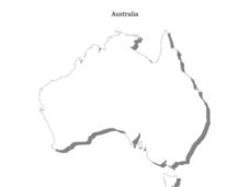
Australia
In this Australia map, students research and locate the main regions, states and important landmarks found on the map and discuss them with their classmates.
Curated OER
2 Cities: Europe's Capital Cities
In this European cities worksheet, students label the countries and then provide an alphabetical key for each country. Students then label each capital city and provide a numerical key for each city.
Curated OER
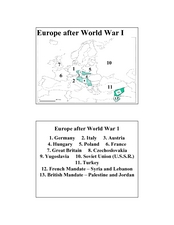
Europe after World War I
In this Europe after World War I map worksheet, students note the 11 regions of the Europe labeled on the map.
Curated OER
Mapping Australia
In this mapping Australia worksheet, students locate and label various features and places on a blank map, 10 total. A reference web site is given for additional activities.
Curated OER
Rivers Quiz 3
In this rivers worksheet, students answer short answer questions about famous rivers around the world. Students complete 10 short answer questions.
Curated OER
Capitals Quiz 1
In this capital city worksheet, students answer short answer questions based on different capital cities. Students complete 10 short answer questions.
Curated OER
Geographic Landforms
Each slide is a simple notebook page with one landform in blue and its definition in red. There are 26 vocabulary terms in all, some you may want to use, and others easily hidden. It is recommended that you add photos or other graphic...
Curated OER
Absolute And Relative Location
Students create a map that takes someone from school to their home using both relative and absolute locations. They assume the person using the map is unfamiliar with the area.
Curated OER
South Asia Today: India
Students use information from the Ministry of External Affairs of the Government of India Web site to explore the Indian economy and environment for business investment, then write a business proposal.
Curated OER
Discover the Rain Forest
Students research tropical rain forests through the use of trade books, encyclopedias, rain forest videos, and computer searches to determine the effects that human use has on the rain forest.
Curated OER
Community Map of The Giver
Students read "The Giver" after finishing the unit on inventions and inventors. Using the information in the novel, they develop a geographic map illustrating the community in the story. They identify human and physical features and...
Other popular searches
- Five Themes of Geography
- U.s. Geography
- China Geography
- Africa Geography
- Mexico Geography
- Canada Geography
- Asia Geography
- France Geography
- Japan Geography
- World Map
- Ireland Geography
- Geography Studies


