Curated OER
Deserts of the World
The major deserts of the world are labeled on this geography worksheet. An excellent map of the world showing where the deserts are located, is used along with a list of the 12 major deserts of the world. Very good!
Curated OER
Internet Fact Hunt at the "Fact Monster" Web Site- Hunt #33
In this Internet fact hunt learning exercise, students access the "Fact Monster" web site to locate the answers to 5 multiple choice questions. They answer questions about US history, geography, literature, and science.
Denver Public Schools
Kung-hsi Fa-ts' ai! – A Chinese New Year Celebration
Looking for ideas for your Lunar New Year celebration? Check out an interdisciplinary unit of study that includes lessons in counting, calligraphy, culture, geography, literature, art, and music. Kung-hsi Fa-ts' ai! (May you...
Science Matters
Ring of Fire
Over a period of 35 years, earthquakes and volcanoes combined only accounted for 1.5 percent of the deaths from natural disasters in the United States. The 15th lesson in a 20-part series connects the locations of earthquakes and...
Curated OER
Understanding Latitude and Longitude
Teaching learners about latitude and longitude can get a little complicated. Present the concept by first representing it as a graph. Just like finding a location on a graph using the x and y-axis, learners will be able to locate items...
Curated OER
Crowley's Ridge: An Upland in the Lowlands
Young geographers examine how Crowley's Ridge was formed. This is one Arkansa's six natural geologic divisions. The history of Crowley's Ridge is important in that the first settlers of the state were attracted to this region, and it...
Midnight Martian
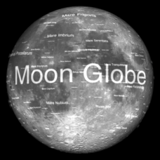
Moon Globe
Not just a simple globe of the moon, this interactive version allows you to choose lighting according to the location of the sun, views from different positions on Earth, and more! Satellite images and topographic data have been combined...
Curated OER
Geo-portrait of the Caribbean: 1492 -1992
Students compare and contrast the Caribbean region in 1492 with the same region today , and use five themes of geography as avenues of comparison.
Curated OER
Where in the World is Hawaii?
Learners compare a globe and a two-dimensional world map and explore how they both represent the planet Earth. They locate the Hawaiian Islands on the globe or the world map and describe how the geographical position is unique.
Curated OER
Where Do I Fit In?: Mental Mapping Student Neighborhoods
Students examine geography through the themes of place, human/environment interaction, and region. They create a mental map of their own neighborhood, analyze their role in the world, and design a neighborhood that reflects their needs.
Curated OER
Mapping the Lewis and Clark Trail
Students explore how physical and human geography features effected Lewis and Clark's expedition by using the Lewis and Clark Digital Discovery Web site.
Curated OER
Explore Surface Types on a Journey Around Earth
Students explore satellite data. In this technology cross-curriculum math and world geography lesson, students locate specific map areas using a microset of satellite data. Students use technology and math skills to determine percentages...
Curated OER
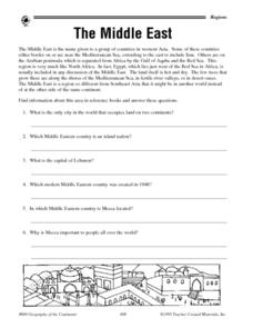
The Middle East - Regional Research
In this geography learning exercise, student read a short blurb about The Middle East as a region of the world before conducting further research. They complete 10 short answer questions, and complete a 15 question activity in which they...
Curated OER
Mapping Mistakes
Students examine early European maps and explore geographic errors. They also view maps of the geography of North America. Students discuss the obstacles faced by early explorers in mapping unexplored territory. They consider what the...
Curated OER
Earth at Night
Students examine the Earth at night. In this geography lesson, students identify the continents at night using various Internet Web sites. This lesson may be adapted for use with middle school and high school students.
Curated OER
Spain and Portugal Quiz 1
In this Spain and Portugal quiz 1 worksheet, students answer 10 trivia-style questions, not interactively, about Spain and Portugal, then scroll down to check their answers.
Curated OER
Day to Day Life in a Small African Village
Students analyze life in a village of Tanzania including its language, geography, health, and hygiene issues. In this African village instructional activity, students locate Tanzania and its capital city on a map. Students...
Curated OER
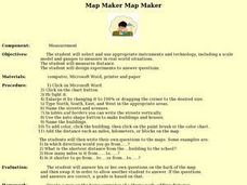
Map Maker, Map Maker
Map maker, map maker, make me a map! Your class can sing this tune as they work to create their own regional maps by taping paper to the wall, projecting an overhead transparency image, and tracing. Where this lesson plan intends for the...
Curated OER
Ring of Fire
Students locate some of the 1,500 active volcanoes on a world map. Then by comparing their maps with a map of the world's tectonic plates, they discover that volcanoes occur because of the dynamic nature of the Earth's lithosphere.
Curated OER
Where Am I?
Students identify volcano locations by latitude and longitude. They analyze a world map, and complete a "Volcano Event Locations Chart."
Curated OER
What I Did On My Summer Vacation
Students use the internet to research the location of their summer vacation trip. Given the demographics, they plot the location on a world map. They create a brochure using the information they collected. Using PowerPoint, they develop...
Curated OER
Compass Rose for the New Millennium
Sixth graders are introduced to the concepts of a compass rose and how it used in relationship to reading maps in geography. The lesson is meant to build upon prior knowledge and skills.
Curated OER
Create-A-Country
Sixth graders work with a partner to fill out the attached form describing their own country. They will use the information about their country to create a PowerPoint presentation to show the class. They must present a slide for each...
Curated OER
An Audio Travel Album
Students interview a person who recently visited a country they are interested in knowing more about. Using the Internet, they research the country noting the geography and economic situations of the country. In groups, they import the...
Other popular searches
- Five Themes of Geography
- U.s. Geography
- China Geography
- Africa Geography
- Mexico Geography
- Canada Geography
- Asia Geography
- France Geography
- Japan Geography
- World Map
- Ireland Geography
- Geography Studies


