Curated OER
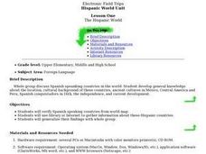
The Hispanic World
Go on an electronic field trip. Discover Spanish-speaking countries through Internet exploration. Students participate in a whole group discussion to general knowledge about the location, cultural background, independence and current...
Curated OER
Living in the Desert
Conduct an investigation on the plants used by the Hohokam tribe. To survive in the harsh desert environment the Hohokam used many natural resources. Learners read, research, map, and graph multiple aspects of Hohokam plant use as a...
National Gardening Association
Migration Mishaps
Elementary ecologists pretend to be migratory hummingbirds. They fly between wintering and nesting grounds, trying to reach a habitat haven. In a musical-chair fashion, some birds will miss out, and are removed from the game. To further...
Curated OER
Call to Arms: A Service Project
Sick of selling candy and washing cars? How about hosting a Digital Day or a Learning Lunch? The suggestions here make fund raising fun and rewarding. Raise money to preserve important maps and other primary source documents.
Curated OER
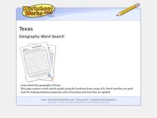
Texas Location Word Search
In this Texas location activity, students identify, locate and label twenty six significant Texas locations on a Texas map. Students also complete a word search containing the twenty six key locations.
Curated OER
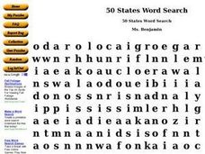
50 States Word Search
In this fifty states worksheet, students identify and locate all fifty states of the United States of America. There are 50 states located in the word search.
Curated OER
Where in the World Do Those Cookies Come From?
Young scholars discuss exports and imports by discovering where the ingredients come from for making chocolate chip cookies. They take a survey of their favorite cookies and create a bar graph to represent the information.
Curated OER
Endangered Animals
Students listen to a teacher led lecture on jaguars, their habitats, and how they became endangered. Using a specified web site, they choose an endangered animal to research. After gathering information, students participate in...
Curated OER
Food and Countries Match
Beijing duck? Italian pizza? Japanese sushi? Language learners match food words with their country of origin. An answer key is included with the colorfully illustrated worksheet.
Curated OER
We've got the whole world in our hands
Students explore spatial sense in regards to maps about the globe. In this maps lesson plan, students label oceans, locate the continents and poles, follow directions, and explain the symbols on a map.
Curated OER
Amate Bark Paintings/Folk Arts of Latin America
Students explore the history of bark paintings in South America and produce their own version of these paintings.
Curated OER
Establishing Borders: The Expansion of the United States 1846-48
Students investigate how the United States acquired land after the Revolutionary War ended. In this establishing borders lesson, students use maps to identify territories acquired by the US and the states that later developed. Students...
Curated OER
Drought Threatens Huge Man-Made Lake
Students locate Lake Mead, then read a news article about Lake Mead drying up and how that would effect water and power supplies to the region. In this current events lesson, the teacher introduces the article with a map and vocabulary...
Curated OER
The Motivation for Movement
Students explore the geographic theme of movement. In this migration lesson, students discuss push-pull factors that motivate immigrants and interpret illegal immigration data. Students also discuss the difficulties that illegals face.
Curated OER
Gray Whales on the Move
Students study whale migration and their natural history. In this migration lesson plan students plot whale migration on a map and describe their ecosystems.
Curated OER
Langston Hughes
Young scholars identify similarities between Hughes' poetry and music (jazz and the blues).
Curated OER
Push/Pull factors in Immigration
Students explore the push/pull factors experienced by immigrant families. They interview a parent and an American about their family's immigration history. Students write a summary of the interview and compare the push/pull factors of...
Curated OER
Mixing Up the Melting Pot
Students examine the cultures of indigenous peoples and how they have or have not assimilated into modern society. They create reports with recommendations on how the Nukak of Columbia could be assimilated into society.
Curated OER
USA Immigration by Country Quiz
In this online interactive geography quiz worksheet, students respond to 30 identification questions about countries U.S. citizens have immigrated from. Students have 5 minutes to complete the quiz.
Curated OER
A Brief History of Los Angeles
Students study the diverse cultures that make up the population of Los Angeles.
Curated OER
States of Fitness
Learners participate in physical activities coordinating to divisions on a map.
Curated OER
3-D Posters
Students work in small groups to create 3-D posters to discourage throwing trash away and encourage recycling.
National Geographic Kids
National Geographic Kids: Mexico
Click-through facts-and-photo file about Mexico's geography, nature, history, people and culture, and government. Includes a map of the country that pinpoints its North American location and a video about the spectacular Copper Canyon in...
Other popular searches
- Mexico Geography
- New Mexico Geography
- Mexico Geography Map
- Cultural Geography of Mexico
- Mexico Culture Geography
- The Geography of Mexico
- Physical Geography of Mexico
- Teaching Geography of Mexico
- Making Physical Maps Mexico
