Curated OER
Globe Skills Lesson 4 The Colonial Period
Learners practice their map skills. In this Colonial geography instructional activity, students complete an activity that requires them to locate English colonial locations using latitude and longitude coordinates.
Curated OER
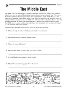
The Middle East - Regional Research
In this geography learning exercise, student read a short blurb about The Middle East as a region of the world before conducting further research. They complete 10 short answer questions, and complete a 15 question activity in which they...
Curated OER
New Food Saves Lives, Could End Hunger
Students locate the country of Niger, then read a news article about a new type of food that is being used to fight childhood hunger in Africa. In this current events instructional activity, the teacher introduces the article with map...
Curated OER
Geography of Early China
Students research and identify the primary geographic features of China. They investigate which features isolated China, and identify the significance of the Hwang River to Early Chinese civilizations. Finally, they research the Silk...
Curated OER
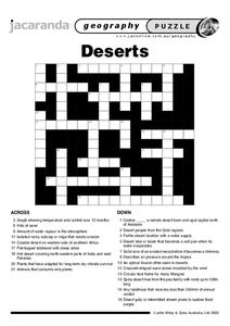
Deserts Puzzle
In this geography learning exercise, students complete a crossword puzzle referring all to deserts. They identify the various types of desert land and what plants and animals can survive in these lands. Also, students identify the people...
Curated OER
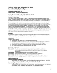
The Gift of the Nile: Egypt and its River
Students begin with a piece of a puzzle that shows an artifact from ancient Egypt. They find others who have pieces that go with their puzzle piece. Students work in these groups to construct a relief map of the Nile River Valley.
Curated OER
Maps that Teach
Students study maps to locate the states and capital on the US map. Students locate continents, major world physical features and historical monuments. Students locate the provinces and territories of Canada.
Curated OER
Dead Sea Investigation: Middle East and African Connections
Pupils demonstrate comprehension of the physical characteristics of the Dead Sea region and its connection to the Red Sea and the African Great Rift Valley. They are given students the opportunity to understand the role of plate...
Curated OER
Globe Game
Students are arranged into groups and are given a map or globe. Students select a location on the map. Students as yes and no questions to guess the specific place that was chosen.
Curated OER
We've got the whole world in our hands
Students explore spatial sense in regards to maps about the globe. In this maps lesson plan, students label oceans, locate the continents and poles, follow directions, and explain the symbols on a map.
Curated OER
Drake’s West Indian Voyage 1588-1589
Students examine the exploration routes of Sir Francis Drake. In this American exploration lesson, students investigate primary sources to trace the routes and contact with the natives that Sir Francis Drake experienced on his voyages in...
Curated OER
Passport to Stories Around the World
Students read stories from various cultures and create a passport indicating the completion and comprehension of the story. The template for the passport is included. The lesson plan can be used for a broad range of ages depending on...
Curated OER
Mapping Population Changes In The United States
Students create a choropleth map to illustrate the population growth rate of the United States. They explore how to construct a choropleth map, and discuss the impact of population changes for the future.
Curated OER
The Roman Empire-Map Activity
In this Roman Empire learning exercise, students complete a map activity in which they label and color civilizations, countries and physical features as instructed. There are no maps included.
Curated OER
Trekking to Timbuktu
Students view a television show to provide a context for conducting research into the location and culture of Timbuktu. The students complete a report on the subject in the form of a research paper.
Ducksters
Ducksters: Geography for Kids: Libya
Learn about Libya's history and geography on this site.
Ducksters
Ducksters: Geography for Kids: Egypt
On this site, the history, capital, flag, climate, terrain, people, economy, and population of Egypt.
National Geographic Kids
National Geographic Kids: Morocco
Click-through facts-and-photo file about Morocco's geography, nature, history, people and culture, and government. Includes a map of the country that pinpoints its North African location and a video about a daily festival of sights and...
ClassFlow
Class Flow: National Geographic Survey
[Free Registration/Login Required] How much do you know about the world around us? Questions provided by National Geographic Survey. http://www.nationalgeographic.com/roper2006/findings.html
Other
Kids World Travel Guide: Continent Facts
Provides interesting and fun facts on the continents of the world.
Quia
Quia: World Capitals Matching
Use this website to practice matching world capitals and the corresponding country.
Quia
Quia: World Capitals Concentration
Use this website to practice matching world capitals and the corresponding country in a concentration game type format.
Quia
Quia: World Capitals Word Search
Practice matching world capitals and the corresponding country in a word-search format.

