Curated OER
Continents
For this geography worksheet, students identify the 7 continents by creating a color key. Students also research a country from each continent.
Curated OER
Puzzles and Brain Teasers
In this geography worksheet, students match the state with its capital city. Students match the capitals for all 50 states. The states are divided up by 10 on each page.
Curated OER
Beauty of Maps: Constantinople
In this geography instructional activity, students learn the capital cities of European countries. Students match 9 countries to their correct capital city.
Curated OER
Living By Water
Young scholars research a coastal community, locate it on a map and profile its physical, geography, climate, architecture and cultural characteristics. They envision this coastal community and make a detailed drawing of it by blending...
Curated OER
Jeopardy: Germany
Introducing your middle schoolers to general knowledge about a region or topic can spark their interest or get the inquiry ball rolling. This Jeopardy game tests students on what they know about German related topics such as, religion,...
Curated OER
Writing Exercise: Ancient Sumer
When summer is over, it's time to get started on Sumer! Get your scholars writing about Ancient Sumer civilizations in this exercise, which features five short-answer prompts. Writers will describe Fertile Crescent Geography, compare and...
Curated OER
Can You Name the Region?
While just a picture of the Rocky Mountains, this presentation could be used as an introductory activity to a geography lesson. The series of slides begins with a piece of a complete picture which is revealed little by little, until the...
Curated OER
Oil: The Problem or Solution to the World's Economic Future
Students map the major oil producing and consuming countries and regions. They identify current and future topographic and political problems that could affect the production and transportation of oil.
Geography 360°
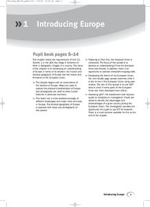
Introducing Europe
Provide your learners with a comprehensive introduction to Europe with this great set of worksheets. Map activities include matching European countries to their capitals and places on a political map, as well as...
Curated OER
Crude Conversation
Students analyze text and maps in determining the effect the world's energy resources have on human society, and make charts illustrating at least three ways each resource makes life easier for human society.
Curated OER
Introducing Topographic Maps: Guiding Students from Concrete Models to Graphic Representations
Students interpret topographic maps and infer human activity as it is influenced by the landscape.
Curated OER
My Life As A Social Scientist
Middle schoolers examine different areas of social studies and tell classmates about what social scientists do. They work in small groups: each group member researches a different social science focus, then presents to the class.
Curated OER
Geography of the Roman Empire
Students explore the Roman Empire. In this ancient Rome lesson, students research regions of the Roman Empire and present their finding to their classmates. Students also use an interactive map to practice placement of the regions within...
Reed Novel Studies
The Secret Garden: Novel Study
Mary from The Secret Garden finds a key that could possibly unlock the door to a secret garden. Scholars read Frances Hodgson Burnett's class novel and match vocabulary words with definitions, answer comprehension...
Curated OER
Geography of China
Students research Chinese dynasties and write papers on them. They conclude by making comparisons between eastern and western cultures.
Curated OER
Geography Lesson Plan
Students examine the history of the Aborigines. In this Australia lesson, students research selected websites and print materials regarding the lives of the Aborigines and create posters that showcase their findings.
Curated OER
Thinking Critically about Geography
In this map reading instructional activity, students answer 2 critical thinking questions about a map shown. Page has links to additional resources.
National Wildlife Federation
Sensory Discovery Walk
Let your senses be your lead. Pairs of pupils blindfold their partners and then lead them around nature areas. They use their senses to find landmarks and create maps with their findings. Once they create their maps, they go back to the...
US Mint
Absolutely and Relatively: The Puerto Rico Quarter Reverse
How much does your class know about Puerto RIco? How much can they learn from the back of a 2009 quarter? Use the coin, part of a series of quarters that depict US territories, to teach learners about the geography, culture, and history...
Curated OER
50 States: New England States
Students discover where certain states are located and what the look like. They look for their information on a web site. Each student is assigned a state which they must research then present to the entire class.
Curated OER
Tracking Fall's Falling Temperatures
Young meteorologists track weather from day to day and record results on graphs, maps, or other places. They see firsthand how weather temperatures trend cooler as fall progresses and practice grade-appropriate skills in geography (map...
Owl Teacher
Latitude & Longitude
Here is a worksheet activity where learners mark the latitude and longitude coordinates of cities all over the world. There are 15 cities to identify, from Baghdad, Iraq to Warsaw, Poland and Anchorage, Alaska.
Curated OER
Midwestern States Word Search
In this geography word search activity, students identify 16 Midwestern states by locating them in a word puzzle. A word bank is included.
Curated OER
Eastern States Word Search
In this geography word search learning exercise, students locate and circle the 13 states located in the Eastern region of the United States. A word bank is provided.
Other popular searches
- World Geography Studies
- Geography Studies the Sea
- Geography Studies Rocks
- Elementary Geography Studies
- Geography Studies Cd Rom
- Social Studies Geography
- Social Studies Us Geography
- Social Studies and Geography
- Social Studies Maps Geography


