Seterra
Northern Europe: Countries - Map Quiz Game
Remembering geography is a tiring and tedious task to many scholars. Change it up by assigning the map quiz game. Elementary and middle schoolers alike test their knowledge and compete with the clock to match as many countries as...
Curated OER
Geography Terms
Introduce the terms and concepts related to basic map and geography skills. Terms include full definitions and cover latitude, longitude, the Equator, Tropic of Cancer, Tropic of Capricorn, Prime Meridian, and the International Date Line.
Sharp School
Geography Project
This very simple geography project can lead to a lot of useful referential information that can be displayed in your classroom! Learners construct a poster-size map of a country, identifying major demographic points and including pie/bar...
National Museum of the American Indian
The A:Shiwi (Zuni) People: A Study in Environment, Adaptation, and Agricultural Practices
Discover the connection of native peoples to their natural world, including cultural and agricultural practices, by studying the Zuni people of the American Southwest. This lesson includes examining a poster's photographs, reading...
Curated OER
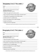
Geography A to Z: The Letter J
How many states, capitals, countries, and locations do your kids know that begin with the letter J? Hopefully they know seven of them, because that's the number of questions on the fun and fast worksheet.
Curated OER
Create Your Own Country Project
Young scholars demonstrate their knowledge of geography with this fun, collaborative social studies project. Working in small groups, students develop their very own countries, writing descriptions of their physical location, social...
Virginia Department of Education
World History and Geography to 1500 A.D.
Here's a great resource for your curriculum library. The 240-page packet, organized into units by topics, includes sample lesson plans, links to primary and secondary source documents, worksheets, activities, and sample assessments.
Ed Helper Clip Art
USA States
Looking for a map of the Unites States of America? Look no further than this printable map designed to accompany your geography instruction and to give map skills a boost.
Channel Islands Film
Arlington Springs Man: Lesson Plan 4
West of the West's documentary Arlington Springs Man introduces viewers to the remarkable finds on Santa Rosa Island. Archaeologist have discovered on this small island that is part of the Channel island chain, human and pygmy mammoth...
Angel Island Immigration Station Foundation
Where Is Angel Island? An Introductory Geography Lesson
Prepare young historians for a study of Angel Island Immigration Station with a lesson examining primary and secondary source materials, maps, and websites. Using what they have learned, individuals create a map of Angel Island, labeling...
Curated OER
A World of Information
Students analyze data and statistics about countries around the world. They read graphs and charts, color a world map to illustrate the top ten statistics about the world, and write a paragraph to summarize their information.
Curated OER
Race to the Capital Geography Game
Student experience playing this geography game of racing to match states, provinces and countries to their capitals. After they think all the matches are made, line up in a large circle to evaluate whether the group has correctly...
National Geographic
Mapping the Americas
Celebrate the geography of the Americas and develop map skills through a series of activities focused on the Western Hemisphere. Learners study everything from earthquakes and volcanoes of the Americas and the relationship between...
Curated OER
Mexico: Culture, Language, and History
Study the culture, language, and history of Mexico in this collection of lessons. Create maps of Mexico's geography, study Spanish language phrases, and create a fiesta, along with a Mexican Marketplace scene.
Curated OER
Hershey and the World: The 5 Themes of Geography and Google Earth
Students invsestigate cocoa producing regions in the world. In this geography skills activity, students examine how the 5 themes of geography affect the Hershey Chocolate Company as they compare and contrast cocoa production in America,...
Curated OER
Africa: Introduction, Geography and Mapping
Students study the geography of Africa through the use of maps. They locate, distinguish, and describe the relationships among varying regional and global patterns of geographic phenomena such as landforms, climate, and natural resources.
Curated OER
Geomnemonics: Facilitating the Teaching of Social Studies Content with Geography Skills
Students explore how to draw a world map by hand and how to locate countries.
Curated OER
Geography of China (Tibet)
Sixth graders study the geography of Tibet. They create maps of Tibet. Students predict population, land area, water area and coastline length of the United States and Tibet. Students compare and contrast the day-to-day lives of people...
Curated OER
Fascinating Geography Facts
In this geography worksheet, students will read 4 interesting United States geography facts and 19 fascinating world geography facts.
Curated OER
Geography A to Z: The Letters W,X,Y and Z
Warm up the class with a fun geography quiz. They'll use the letters W, X, Y, and Z to answer seven geography-based questions. Y for Yangtze, Z for Zimbabwe, or Y for Yugoslavia.
Curated OER
Social Studies - Guessing Game
Focus on a particular geographic location with this resource. Learners use their social studies textbook to look up information about a specific place. They write down a list of facts and read them to the class. Classmates guess which...
Curated OER
Geography Vocabulary
In this geography worksheet, learners match vocabulary words to their definitions having to do with bodies of land and water. Students complete 10 problems.
Curated OER
Geography, Climate, and Community in the Dominican Republic
Learners examine primary source materials on the Dominican Republic in an exploration of how environment influences lifestyles. They compare and contrast life in the Dominican Republic with life in the United States.
Curated OER
Geo-Magazine
Divide your geography class into groups and have each research an assigned region. The result of this project is a regional magazine that addresses the five themes of geography. Many valuable resource links are embedded into the page...
Other popular searches
- World Geography Studies
- Geography Studies the Sea
- Geography Studies Rocks
- Elementary Geography Studies
- Geography Studies Cd Rom
- Social Studies Geography
- Social Studies Us Geography
- Social Studies and Geography
- Social Studies Maps Geography


