Curated OER
T-shirt Passport Lesson Plan
Young scholars locate their t-shirt place/name on maps, then share facts/artifacts (souvenirs) from their place/name location orally with whole class. They create a database using information gathered from the whole class.
Curated OER
Papier-mache Greek Vessels
Sixth graders create three-dimensional black and red figured Greek Vessels out of papier-mache, while researching and discussing Greek history, and myths of powerful gods and goddesses.
Curated OER
Maps and the Pictures in Our Heads
Geographers of all ages examine different types of maps. They draw maps of their environment, utilizing both three-dimensional and picture maps. They interpret map information, noting how it can sometimes be misleading. Some good...
Curated OER
National Expansion
Students investigate the Manifest Denstiny. They explore how the idea was evident in 19th century American maps. Students brainstorm the relationships between maps and national expansion. They review a map from 1816 that called for...
Curated OER
Global Economy: A Simple Activity
Students explore the global economy. In this economics lesson, students examine clothing labels in search of the countries the clothing was made in. Students consider the implications of a global economy.
Curated OER
Making an Illustrated Dictionary with Geographic Terms
Students, in groups, explore geographic terms using left and right brain activities.
Curated OER
Condon National Bank
Use maps, readings, and photographs to analyze the historic, cultural, and social conditions surrounding the activities of the Dalton brothers and their gang. Learners identify how the residents of Coffeyville defended themselves against...
Curated OER
Cartographer on Assignment: Creating a Physical Map of Africa
Students use geographic information to make an outline map of Africa, then demonstrate their understanding of the physical landscape of Africa by using a variety of materials to create a physical map of Africa
Curated OER
Where Do People Move To Or From?
Students identify countries of origin of their ancestors, graph patterns of migration to the U.S. and Hawaii, then utilize oral history as a primary document by interviewing their ancestors or parents to explain why they moved to their...
Curated OER
Finding Your Spot in the World
Young scholars learn the concept of movement by locating their house and the houses of their ancestors.
Curated OER
Sandscapes to Landscapes
Students explore landscapes and create their own in a creative project.
Curated OER
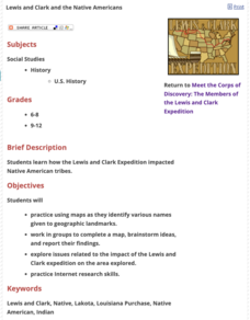
Lewis and Clark and the Native Americans
Students practice using maps and identifying landmarks on the Lewis and Clark expedition. They research Lewis and Clark's relationship with the Native Americans and report their findings to the class. They identify the impact of the...
Curated OER
Personal Travel Guide to a Chinese City
Scholars become travel guides in this group research project to investigate a Chinese city or region for a presentation. Heavily based on Internet research, the activity requires participants to jigsaw the final project, so each team...
Curated OER
Soneka's Village
Students explore the Maasai culture. In this cultural traditions lesson, students read primary documents and story books about the Maasai in order to compare their culture to the culture of those living in a Maasai village.
Curated OER
Where is Everybody?
Students collect data from different grade levels at their school and develop thematic maps which show population density, and determine how this might affect the school and themselves in the future.
Curated OER
A Picture's Worth 1000 Words: Decoding Intercultural Symbols
Learners interpret a set of pictographs, defining what each image means and create their own set of symbols as an alphabet. They then write using their own symbolic alphabet using pictures.
Curated OER
Exploring the Hudson in 1609
Learners follow the journey of Henry Hudson down the river with his name. Using journal entries and maps, they learn about its exploration. They use maps to identify stages of the journey, and practice converting distances into miles.
Curated OER
Charting Neptune's Realm: Profiles
Students identify and describe the importance of nautical profiles in early navigation. They draw a profile of a street or mall and explore the effectiveness of different types of directions.
Curated OER
Searching the States (or Provinces) Scavenger Hunt
Learners examine information on a particular state or province. Groups of students use the internet to locate facts about an assigned state. They research information such as capital, state song, and major crops. learners report their...
Curated OER
Radio Program #2: Ethnic Mix
Learners examine patterns of migration into the area. They complete various map activities and interviews. Students partake in family histories as well. On a map of Europe, identify the countries of immigrant origin mentioned in the...
Curated OER
Working for the Common Good
Students explore the concept of nation building. In this Peace Corps lesson, students examine primary source documents from corps volunteers in the Dominican Republic to determine what it means to work for the common good.
Curated OER
Using Word Processing to Create Graphic Organizers
Students create a graphic organizer and instructional rubric using word processing software. They conduct Internet research at the History Alive website, and publish an essay.
Curated OER
Around the World At 30o North Latitude
Reinforce the use of an atlas and reference materials with writers. They discover how geographic location can make living easier or harder. They draw an assigned journey on a map, categorize survival needs, and prioritize options during...
Curated OER
How Mountains Shape Climate
Students use raw data to make a climatograph; they explain the process of orographic precipitation and the concept of a rain shadow.
Other popular searches
- World Geography Studies
- Geography Studies the Sea
- Geography Studies Rocks
- Elementary Geography Studies
- Geography Studies Cd Rom
- Social Studies Geography
- Social Studies Us Geography
- Social Studies and Geography
- Social Studies Maps Geography
