Curated OER
Introduction to World Religions
Sixth graders compare and contrast the world religions. In this cultural practices lesson, 6th graders locate places in the world where Buddhism, Christianity, Judaism, Hinduism, and Islam are practiced.
Curated OER
World: Political Map
In this world political outline map worksheet, students examine boundaries of each of the countries in the world. This map not is labeled.
Curated OER
World Pacific Map
In this world Pacific projection outline map activity, students examine boundaries of each of the countries in the world. This map not is labeled.
Curated OER
World: Continents Map
In this World outline map worksheet, students note the political boundaries of the continents of the world on this Robinson projection map.
Curated OER
World Political Map
In this blank outline map worksheet, students note the political boundaries of the nations of the world on a Mercator projection map.
Curated OER
World: Continents Map
In this outline map worksheet, learners note the political boundaries of the continents of the world. The map is labeled with the names of the 7 continents.
Curated OER
World Landforms
In this blank outline map worksheet, students note the major landforms of the 7 continents of the world on a Robinson projection map.
Curated OER
World: Continents
In this blank outline map worksheet, students note the political boundaries of the continents of the world on a Robinson projection map.
Curated OER
Where Do I Fit In?: Mental Mapping Student Neighborhoods
Students examine geography through the themes of place, human/environment interaction, and region. They create a mental map of their own neighborhood, analyze their role in the world, and design a neighborhood that reflects their needs.
Curated OER
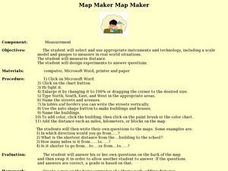
Map Maker, Map Maker
Map maker, map maker, make me a map! Your class can sing this tune as they work to create their own regional maps by taping paper to the wall, projecting an overhead transparency image, and tracing. Where this lesson plan intends for the...
Curated OER
Read a Fall Foliage Map
Pupils examine the purpose of a color key and use a color key to help them read a map.
Curated OER
Africa: Introduction, Geography and Mapping
Students study the geography of Africa through the use of maps. They locate, distinguish, and describe the relationships among varying regional and global patterns of geographic phenomena such as landforms, climate, and natural resources.
Curated OER
Australia/Oceania Outline Map
In this Australia and Oceania outline map worksheet, students explore the region of the world as they label the 14 countries. The countries are numbered and lines for the answers are provided on the sheet.
American Battle Monuments Commission
The Great War: A Visual History
Immerse yourself in the military operatives of the Great War with an interactive timeline and map. As high schoolers click on each year of World War I, they can select individual battles, campaigns, troop movements, and notable victories...
Teaching Tolerance
Inventing a Better World
From play pumps that provide clean water to shoes made from trash, innovators change the world one invention at a time. After researching various inventions, young entrepreneurs develop their own. Extension opportunities include prompts...
Curated OER
The Columbia Exchange
The Columbia Exchange was one of the first major instances of mass international trade. Learners cut out 24 images of trade commodities and glue them on a map of the world. It'll be fun for kids to see where so many products they use...
Curated OER
World: Physical Map
In this world physical map activity, students make note of the major landforms located on this Robinson projection map.
Echoes & Reflections
Survivors and Liberators
The end was just the beginning. The period immediately after the end of World War II and the Holocaust is often called "The Return to Life" as survivors looked to reunite and recreate broken families and shattered lives. A two-lesson...
Curated OER
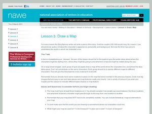
Draw a Map
Students draw a map. In this map drawing lesson students draw a map to show where a character is from and where they are going in the story. Students are writing an odyssey.
Curated OER
Understanding "The Stans"
Students explore and locate "The Stans" in Central Asia to create, write and illustrate maps, graphs and charts to organize geographic information. They analyze the historical and physical characteristics of Central Asia via graphic...
Curated OER
A Visit to Hogwarts
Students collaborate in groups to read excerpts or entire selections from two Harry Potter books, use educational software to create concept maps detailing similarities and differences between first two Harry Potter books, and analyze...
Curated OER
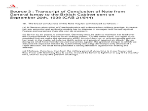
Chamberlain and Hitler, 1938--What Was Chamberlain Trying To Do?
Explore events prior to World War II. Learners view replicas of authentic photographs and hand written documents representing the viewpoints of Adolf Hitler and Neville Chamberlain. They discuss alternate viewpoints, consider historical...
Ms. Catsos
Ancient Rome Map Worksheet
It wasn't just the great leaders of ancient Rome that shaped their civilization—the geography of the region played a major role as well. After first identifying major land masses, bodies of water, and city states on a map of Europe,...
Curated OER
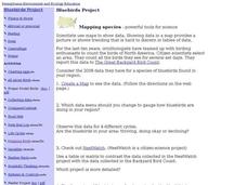
Bluebirds Project: Mapping Species
In this bluebirds project: mapping species worksheet, students create a map based on data for bluebirds in their area, then answer 5 questions about the mapping of the species. This page has numerous links to helpful web...
Other popular searches
- World War Ii Map
- World War I Map
- World War 2 Map
- World War I Outline Map
- World Climate Map
- World Biomes Map
- World Outline Map
- Blank Map of the World
- World Political Map
- Ancient World Greece Map
- World Time Zone Map
- Deciduous Forests Map World


