Curated OER
El Mundo Hispano
Colorful maps are clearly labeled in this PowerPoint to show viewers where different Hispanic countries are located within Central and South America. Each country is listed on its own slide with a title, the capital, close-up map, flag,...
Curated OER
What Makes a Map?
Students, in groups, brainstorm to find what makes up a map, what kind of information can be "read" from a map, who might use a map, how their world is defined or helped by maps, etc. They make a map of their "world."
Curated OER
Math with Maps and Globes
Students round out their math skills with these ‘round the world' ideas. In this math and geography lesson, students try out time zone sticks, a polar race, and tic-tac-globe to engage them in learning more about globes and the...
Curated OER
World Continents Map Quiz
In this online interactive geography quiz worksheet, students respond to 7 identification questions regarding the continents of the world.
Curated OER
Map Maker Map Maker
Students create their own maps. In this map making lesson, students go to Microsoft Word and create a chart. They label directions, buildings, streets, and distance.
Curated OER
The Continents and Oceans of the World
Students explore world mapping skills. In this world geography lesson, students identify and label the continents and oceans on a world map using the Visual Thesaurus. Students generate mnemonic devices to help memorize these terms.
Curated OER
Top World Languages Quiz
In this online interactive geography quiz activity, learners respond to 50 identification questions about world languages. Students have 5 minutes to complete the quiz.
Curated OER
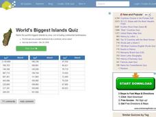
World's Biggest Islands Quiz
In this online interactive geography quiz worksheet, students respond to 20 identification questions about the largest islands in the world. Students have 4 minutes to complete the quiz.
Curated OER
World Capitals Quiz
In this online interactive geography quiz worksheet, learners respond to 195 identification questions about the capital cities of countries in the world. Students have 12 minutes to complete the quiz.
Curated OER
Finding Your Spot in the World
Young scholars learn the concept of movement by locating their house and the houses of their ancestors.
Curated OER
Say Hello! Around the World
Hello! Bonjour! Paivaa! Ni hao! Teach learners of all ages how to say hello in several different languages. There are project ideas for younger learners and older learners. Kids love learning a different language, even if it's just this...
Curated OER
Welina's World
Students living in Hawaii draw a picture of themselves in their neighborhood. They draw their neighborhood in relation to their district and then in relation to the island they are from. They compare their pictures to their classmates'...
Curated OER
Louisiana History-Unit 4: Early People of Louisiana and a Meeting of Different Worlds
The Poverty Point Culture of Louisiana is described in detail within four slides of this six-slide PowerPoint. Four detailed paragraphs help describe the economic legacy that existed in Louisiana. A table, map, and photo are included to...
Curated OER
Map Stratego
Young scholars determine strategic locations for defense against attack. They use a core map to analyze coast lines and distances to develop a strategic defense plan for the U.S. during World War II.
Curated OER
The Dip Felt Around the World
Students share their opinions about a story about a sudden decline in China's stock markets. After reading an article, they identify the global impact of China's falling stock markets. They create a cause and effect map about the fall...
Curated OER
Exploring the World's Geography
Students discuss the seven continents of Earth and the diverse geography. After discussion, they create their own paper-mache globes which properly display all seven continents, the equator, and the prime meridian. They conduct research...
Curated OER
The Shapes of Our World
Students utilize shapes and spatial relationships in a practical context by creating maps and writing a critical essay.
Curated OER
Rock Around the Map
Students research the geographical histories of various musical genres and make maps that note important places in music history. They Write geographical biographies about one of their favorite musical artists.
Curated OER
10 Biggest Islands Map Quiz
In this online interactive geography quiz activity, students respond to 10 identification questions regarding the biggest islands in the world.
Curated OER
Project Map: Latitude And Longitude Worksheet
In this latitude and longitude worksheet, students find the coordinates of 14 cities around the world and use this information to complete 14 short answer questions. This worksheet includes online atlas web links.
Curated OER
The World's Water Woes
Students discuss their community's water sources and assess the factors affecting the water availability and quality. They research water disputes around the world and explain common factors among them.
Curated OER
Countries of the World
Students in a ESL classroom examine a world map and study the various countries' names. The study the cultures of selected countries and create a vocabulary list. Finally they label an empty map with the countries' names and a short...
Curated OER
What Are Maps For?
Students create a story about a problem someone could have which could be solved by the use of a map. They complete a worksheet that guides them through the features of a map of Chicago. Then they calculate story problems using the...
Curated OER
Southern Hemisphere Map
In this Southern Hemisphere polar projection map worksheet, students examine this region of the world. The continents shown are labeled.
Other popular searches
- World War Ii Map
- World War I Map
- World War 2 Map
- World War I Outline Map
- World Climate Map
- World Biomes Map
- World Outline Map
- Blank Map of the World
- World Political Map
- Ancient World Greece Map
- World Time Zone Map
- Deciduous Forests Map World


