Curated OER
What Do You Know About Oceans?
Students brainstorm and discuss what they know about oceans and seas, read poem My Ocean Speaks by Olga Cossi, discuss narrator's feelings about ocean, write reflective journal entries about their experience or inexperience with the...
Curated OER
Cartography
Students follow directions to draw a map of an island. They complete the island map adding their own details using symbols and a legend.
Curated OER
Orienteering 2
Students are shown the basics of map and compass work. They name the parts of a compass and comprehend the function of each part. Students define paces and tallies and use them in a real world situation. They use a map and compass to...
Curated OER
Exploring Canadian Heritage
Students use the online Atlas as a research tool to find information on national parks and world heritage sites.
Curated OER
Where Should We Put a Store?
Students analyze population data. They convert population data into simple density maps to help make decisions about their world. They select the best location for a school store based on population density. They present their maps...
Curated OER
Europe at Exploration 1500
In this world empires and trade in 1500 worksheet, students examine a world empire map, world trade map, and Europe map. All maps display information from 1500.
Curated OER
Geotagging in school
Middle schoolers create a digital photo map of the world. In this digital photo map lesson plan, students pick topics such as the Olympics, natural disasters, or trip planning and create a photo map on the computer.
Curated OER
Here We Go
Students take a closer look at the World Cup of 2006. For this current events lesson, students research the listed Web sites that include information about football and the worldwide competition. Students discuss the positive and...
Curated OER
Geography: Intro to Canada
Young scholars investigate the geography of Canada by analyzing a map of the country. In this North American geography lesson, students identify the 13 provinces of Canada and their locations by examining a Canadian map. ...
Curated OER
Alberta And Saskatchwan: the View in 1905
Students analyze the differences between maps 1905 and current maps of Alberta and Saskatchewan. They use maps from the Canadian Council for Geographic Education to complete a guided inquiry. This lesson also has many extension activities.
Curated OER
The Mausoleum at Halicarnassus
Students explore an ancient wonder of the world. In this Mausoleum at Halicarnassus lesson, students read about the history of the Mausoleum, create Mausoleum timelines, and research the sculptors whose work is featured in the Mausoleum.
Curated OER
The UK and the Republic of Ireland
In this maps activity, students label the cities and countries of the United Kingdom and the Republic of Ireland and answer a short answer questions. Students complete 4 activities.
Curated OER
Modern Marvels
Students examine the man-made wonders of the world. In this current events lesson, students research selected websites to learn more about the most recent wonders of the world competition. Students also research Stonehenge.
Curated OER
Community Map of The Giver
Students read "The Giver" after finishing the unit on inventions and inventors. Using the information in the novel, they develop a geographic map illustrating the community in the story. They identify human and physical features and...
Curated OER
Friends, Romans, Countrymen...
Students research an important person or place from Ancient Roame and communicate their findings in a report that includes a map and illustration. Students may publish their reports online.
Curated OER
Is it Olympic Time?
Students investigate the Winter Olympics by studying the geography of the 2010 Vancouver games. In this competitive sports lesson, students identify the planning and preparation needed to produce an event like the Winter Olympics....
Curated OER
Age of Exploration
In this world history worksheet, students utilize a word bank of 10 terms or phrases to answer 10 fill in the blank questions about the Age of Exploration. A short answer question is included as well.
Curated OER
Hurricane Tracking
Students access the Internet to find information on current hurricanes. They get locations, speeds, and air pressures and then plot the location of the hurricane on a hurricane-tracking map. They also access the FEMA website to solve...
Curated OER
The Road to Success
Students chronicle the main events in their lives so far. They draft, revise, and publish an anecdote. Students get to know their fellow classmates and they build a nurturing learning community. Students take an interest inventory and...
Curated OER
Auschwitz
In the Auschwitz worksheet, students respond to 36 short answer questions as they visit and research websites pertaining to the infamous concentration camp of World War II.
Curated OER
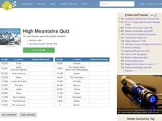
High Mountains Quiz
For this online interactive geography quiz worksheet, students respond to 18 identification questions about the highest mountain ranges in the world. Students have 4 minutes to complete the quiz.
Curated OER
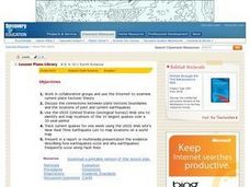
Earthquakes And Fault Lines
Students discuss major causes of earthquakes and identify famous fault lines, access and map information about ten largest earthquakes in world from 1989 to 1998, and theorize about location of these earthquakes as they relate to Earth's...
Curated OER
It’s a Big, Big World
Students examine the role of the explorers. In this explorers and conquistadors, students create word puzzles (Wordles) regarding the time period in history. Students conduct research regarding a particular explorer and create foldables...
Curated OER
Building an Empire Mapping China
Learners create travel brochures of China's nine regions and make a bulletin board display with them.
Other popular searches
- World War Ii Map
- World War I Map
- World War 2 Map
- World War I Outline Map
- World Climate Map
- World Biomes Map
- World Outline Map
- Blank Map of the World
- World Political Map
- Ancient World Greece Map
- World Time Zone Map
- Deciduous Forests Map World


