Curated OER
"Where in the World is my School?"
Students learn new vocabulary and discuss what GPS is and does. They locate their school using the equipment.
Curated OER
Dalai Lama
Sixth graders use skills and knowledge that they gained from their Tibet unit to formulate a final product of their Tibet journey. This study covers topics such as Tibet's geographical location, religious beliefs, customs, dress, and way...
Curated OER
Globe Lesson 7 - Parallels and Meridians - Grade 6+
In this parallels and meridians worksheet, students read a 2-paragraph review of parallels and meridians and respond to 7 short answer questions.
Curated OER
Plotting Earthquakes
In this earthquakes worksheet, students access a website to gather information about the magnitude and location of earthquakes for 5 days. Then students complete 7 short answer questions.
Curated OER
Globe Lesson 17 - Alaska and Hawaii - Grade 4-5
Students develop their globe skills. In this geography skills lesson, students explore the area added to the United States when the Alaskan territory was purchased from Russia.
Curated OER
Globe Skills Lesson 10 Apollo 11
Students develop their globe skills. In this geography skills instructional activity, students use a globe and a softball to replicate distance between the earth and its moon.
Curated OER
Globe Lesson 9 - Around the World - Grade 6+
In this geography skills worksheet, students read 5-travel scenarios and use their problem solving skills to respond to 9 short answer questions.
Curated OER
What Causes Irregular Temperature Patterns?
Students examine common trends in climate across the U.S. They identify the anomalies in hot-cold temperature differences in the U.S and locate them on the map using latitude and longitude coordinates.
Curated OER
Mapping a Refuge
Pupils record observations gathered while at a national wildlife refuge. In this lesson plan on wildlife refuges, students choose an observation spot and record seasonal changes throughout the year.
Curated OER
Globe Lesson 13 - When the Day Changes
Students explore the patterns of day and night. In this geography skills lesson plan, students read brief selections and examine diagrams that note the transition of day and night around the world. Students respond to the questions...
Curated OER
Two Reasons for the Four Seasons
Students explore the reasons for the seasons. In this season lesson,students use flashlights to demonstrate the movement of the Earth and how it influences the seasons. Students label pictures and discuss what would happen if the...
Polar Trec
Where in the World Is Our Teacher?
Kirk Beckendorf, a middle school teacher, joined researchers at the McMurdo Station in Antarctica to help maintain automatic weather stations. The lesson encourages pupils to track his travels around the region. They connect with the...
Montana State University
Meet Mount Everest
Learning about one landform might seem boring to some, but using the resource provided practically guarantees scholar interest. The second in a sequential series of eight covering the topic of Mount Everest includes activities such as a...
Curated OER
Welina's World
Students living in Hawaii draw a picture of themselves in their neighborhood. They draw their neighborhood in relation to their district and then in relation to the island they are from. They compare their pictures to their classmates'...
Midnight Martian
Moon Globe
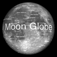
Not just a simple globe of the moon, this interactive version allows you to choose lighting according to the location of the sun, views from different positions on Earth, and more! Satellite images and topographic data have been combined...
Curated OER
Location of Cities 201
Pupils work in pairs to locate the ancient cities on a world atlas using the longitude and latitude measurements. They examine the physical and human futures that explain their locations.
Curated OER
TE Activity: Nidy-Gridy
Young scholars make a grid and coordinate system map of their classroom as they investigate why it is important to have a common map making system. They look at how landmarks are used for navigating an area.
Curated OER
Where in the World...?
Students use longitude and latitude to locate various cities, regions, landforms, and bodies of water around the globe. They use The New York Times Learning Network's crossword puzzle 'Longitude and Latitude' to sharpen their atlas skills.
Curated OER
Plate Patterns
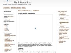
Students read about a volcano and use the latitude and longitude information to plot and describe the volcano on the map. They discuss patterns seen on the map. In addition, they color code a map according to zones, plates, etc.
Curated OER
Where is Here?
Students are shown the very basics of navigation. The concepts of relative and absolute location, latitude, longitude and cardinal directions are discussed, as well as the use and principles of a map and compass.
Curated OER
Using Vegetation, Precipitation, and Surface Temperature to Study Climate Zones
Students begin their examination of the climate zones found around the world. Using a software program, they identify the relationship between the vegetation, climate and temperatures of the different zones. They also plot coordinates...
Curated OER
Canada Eh? Pre/Post Tests on Canada Using GPS
Students participate in a GPS activity and answer questions about Canada. In this Canada lesson, students identify location by using a GPS Unit and latitude and longitude. Students find an Inuksuk (station) and a complete worksheet.
Curated OER
LAND USE ISSUES
Students relate math with real life situations. They identify and plot points on a grid map. They identify and locate the Drop Box Sites.
Curated OER
Small European Countries
Students examine the advantages and disadvantages of being a very small European country in today's world. They locate each country on a map using the coordinates, discuss the governments of each country, and develop a list of...
Other popular searches
- Latitude and Longitude Maps
- Longitude & Latitude Maps
- Longitude Latitude Maps
- Maps, Latitude/longitude

