Curated OER
Understanding "The Stans"
Students explore and locate "The Stans" in Central Asia to create, write and illustrate maps, graphs and charts to organize geographic information. They analyze the historical and physical characteristics of Central Asia via graphic...
Curated OER
Government Lesson Plan: Lesson Plan 12
Students investigate various political systems around the world. They complete a chart that compares the U.S. political system with other nations' governments, conduct research on a selected nation, and present an oral report.
MENSA Education & Research Foundation
Connecting Africa: A Project-Based Learning Adventure
Mission Possible: Your task is to design a new highway route from Tunis, Tunisia to Cape Town, South Africa. If you accept the challenge, you must create a small map of the route that has already been rejected, a...
Curated OER
Oil: The Problem or Solution to the World's Economic Future
Students map the major oil producing and consuming countries and regions. They identify current and future topographic and political problems that could affect the production and transportation of oil.
Curated OER
Map Reading in the 21st Century
Pupils interact with MapPoint tools to view maps of the past and the present in multiple ways. They participate in mini-lessons aimed at locating certain points of interest or famous routes taken in history.
Curated OER
Waldseemüller’s Map: World 1507
Students take a closer look at historical maps. In this primary source analysis lesson plan, students examine the first world map produced by Martin Waldseemuller. Students complete the included map analysis worksheet and then write...
Curated OER
The Sands of Arabia
Sixth graders apply geographic information to the study of World History. In this Geography instructional activity, 6th graders create a political/physical map of the Middle East, develop questions and answers about the culture of...
Curated OER
Introduction to the World Globe
Learners examine a globe and the world map to see what constitutes the differences. In this world map introductory lesson plan, students discuss what they see when they view the globe. Learners then, look at a world map and compare the...
Curated OER
South east Asia and the South Pacific: Political: Labeled Map
In this Asia and the South Pacific map worksheet, students examine the boundaries of the nations in this region of the world. Students also note the location of capital cities as they are denoted by stars. This map is labeled.
Curated OER
Eastern Hemisphere Map
In this Eastern Hemisphere polar map worksheet, students examine the Eastern Hemisphere including the political boundaries formed by the countries in this region of the world.
Curated OER
NATO Geography & Language
The class receives background information on NATO, an atlas, and a blank world map. They color the original 1949 countries in red, the 1952 additions in green, and the 1990 additions in blue. This exercise would be a good starting point...
Curated OER
Where Am I? Map Activity
In this map activity worksheet, learners determine which countries are shown on a set of 16 maps, then read facts about each country designed to help with a report on that country.
Curated OER
Rivers, Maps, and Math
Middle schoolers use maps to locate and label the major rivers of North and South America. Using the internet, they identify forests, grasslands, mountain ranges and other landforms on the continents as well. They compare and contrast...
National Geographic
Australia, Antarctica, and Oceana
Go on a traveling adventure throughout Australia, Oceana, and Antarctica! This textbook excerpt offers a full unit of study that can easily be supplemented by extra projects or research materials. Learners study maps, read about...
Geography 360°
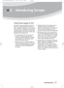
Introducing Europe
Provide your learners with a comprehensive introduction to Europe with this great set of worksheets. Map activities include matching European countries to their capitals and places on a political map, as well as...
Curated OER
A Shuttle's Eye View
Students explore the goals of the Shuttle Radar Topography Mission as a springboard to exploring the topographical features of their own state or region. They synthesize their understanding of landforms and topography by mapping their...
Curated OER
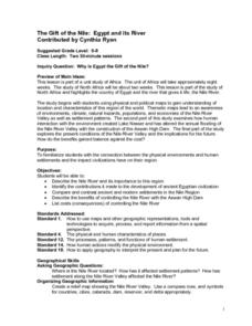
The Gift of the Nile: Egypt and its River
Students begin with a piece of a puzzle that shows an artifact from ancient Egypt. They find others who have pieces that go with their puzzle piece. Students work in these groups to construct a relief map of the Nile River Valley.
Curated OER
Mapping Your Community
Students define the boundaries of their community by comparing the community's official boundaries with other historical, political, physical, and perceived boundaries of the area and create a community map.
Curated OER
Mending the Rift
Learners determine what factors identify a country's political borders. After reading an article, they investigate questions surrounding the Great Rift Valley. On a map, they trace the valley from Asia through Africa and research the...
Curated OER
George Washington's Revolutionary Journeys
Students take a closer look at historical maps. In this American Revolution activity, students examine the provided historical maps and documents to determine the assignments that George Washington assigned to subordinates during the...
Curated OER
Life in Old Babylonia: The Importance of Trade
Students read maps and artifacts for information indicating the existence of a trade network in Old Babylonia and beyond. They list goods imported to and exported from Babylonia. They indicate trading centers on a map of ancient...
Curated OER
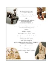
The Ancient Civilization of Mali
Students explore the ancient civilization of Mali and examine various historical and cultural aspects of the civilization. In this ancient civilization of Mali lesson, students examine trade with respect to geographic locations, discover...
Curated OER
Through the Looking Glass: Recognizing Developing and Industrialized Countries
Students examine the regions of the world, and identify the basic characteristics of industrialized and developing countries. They conduct Internet research on the economic and population characteristics of industrialized and developing...
Curated OER
Desertification
Learners investigate the process of desertification in the Sahel region of Africa. They discuss photos from a National Geographic magazine, analyze the physical/political map of the Sahara, identify the causes and effects of...
Other popular searches
- World Political Map
- World Outline Political Map
- Blank World Political Map
- World Political Map Labeled


