Curated OER
Revolutionary Money
Examine paper money from the American revolution! Historians study the paper bills and discuss the history of money. How has money changed over the times? Activities are included.
Curated OER
Where Am I?
Students identify volcano locations by latitude and longitude. They analyze a world map, and complete a "Volcano Event Locations Chart."
Curated OER
Create-A-Country
Sixth graders work with a partner to fill out the attached form describing their own country. They will use the information about their country to create a PowerPoint presentation to show the class. They must present a slide for each...
Curated OER
Food and Culture, Past and Present in Choctaw Culture
Students explore the Choctow culture. In this Choctow lesson, students use their research skills to create presentations that feature Choctow geography, resources, tradition, foods, and health issues.
Curated OER
It's Happening Where: Graphic Organizer #1 for Newspaper Articles
Planning a newspaper or journalism unit? Use these graphic organizer to help your young reporters organizer their articles. The first page instructs users to plan out the structure of their article, while the second page prompts them to...
San Antonio Independent School District
Global PC and Google Earth
Learners take notes on the physical geography of an assigned country, as well as its type of economy, major cities, and the student's own first impressions of the country, with this graphic organizer.
Curated OER
Life in a Hurricane Zone
Students investigate the social effects of hurricanes. In this social studies lesson, students assume the persona of residents of the Dominican Republic and write diary entries and letters regarding the devastation caused by Hurricane...
Curated OER
Let's Go to Korea
Students prepare for travel to Korea. For this Korean travel lesson, students discover to steps of obtaining passports, airline flight options to Korea, and study places to see and visit in Korea.
American Institute of Architects
Architecture: It's Elementary!—Fifth Grade
Young citizens construct an understanding of urban planning in this cross-curricular unit. Covering every aspect of city development from the political, economic, and social influences to sustainable building practices, this...
Montana State University
Meet Mount Everest
Learning about one landform might seem boring to some, but using the resource provided practically guarantees scholar interest. The second in a sequential series of eight covering the topic of Mount Everest includes activities such as a...
iCivics
Step Three: Who You Gonna Call?
Problem solving is an essential skill everyone must master. The resource instructs pupils how to analyze different scenarios and decide the best way to solve many different problems that take place in communities. Scholars read, discuss,...
Curated OER
Where in the World in Mrs. Waffenschmidt? #19
When you hunt for Mrs. Waffenschmidt, you need to use the clues she's given you to determine where she can be found. The class reads a paragraph, considers the clues, and then determines where in the world Mrs. Waffenschmidt is located....
Curated OER
Where is the World is Mrs. Waffenschmidt? #18
Mrs. Waffenschmidt is off again, but where to this time? Use the informational text to uncover her mystery location. Your class will read facts and conclude that she is in the Sahara Desert. This is a good way to make informational text...
Huntington Library
The Corps of Discovery: The Lewis and Clark Expedition
Don't miss this fantastic comprehensive lesson plan on the Lewis and Clark Expedition, packed with instructional guidance, worksheets, map work, informational texts, and secondary source materials.
Sharp School
Travel Brochure Project
Designing a travel brochure is a classic project that will help your class members develop a variety of skills, such as researching informational texts, designing creative visual products, and communicating what you have learned.
Curated OER
Designing a Hiking Trail
Put your students' map skills to the test with this engaging cross-curricular project. Given the task of developing new hiking trails for their local community, young cartographers must map out beginner and intermediate...
Curated OER
Mystery State #32
There is no better way to start a lesson, than with a good problem-solving activity. Give your class the chance to see if they can use each of the five clues to determine the name of mystery state number 32. Hint: It's the eastern most...
Curated OER
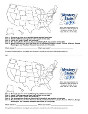
Mystery State # 39
Which state will be the answer to the five clues today? After considering each clue, learners will name the mystery state. If your class can determine which state was home to Chief Sitting Bull, they'll be able to answer South Dakota.
PBS
What's In a Name?
What is in a name? Eager historians trace the geographical history of places in the United States with Spanish names. Using a worksheet activity, clues, and web research developed in conjunction with the PBS "Latinos in America" series,...
Kids Discover
Ancient Egypt by KIDS DISCOVER
Discover Ancient Egypt! Learn about mummification and gods, visit pyramids and temples, examine cliff carvings and paintings, take quizzes and engage in activities. Colorful, interactive, and easy to use, this app is not just for kids!
Council for the Curriculum, Examinations and Assessment
Victorian Historians
Take the class back in time to the Victorian Era! The resource provides a plethora of activities that create experiences for scholars in class. Some activities include a fun fair, viewing the starry-night painting, and even experiencing...
Arcademics
Toad Hop
Hop-scotch your way across the world to help improve class members' skill and accuracy in identifying capital cities. By using a frog avatar, learners leap to the correct country for each capital city as it flashes up on the screen....
Arcademics
Country Toad
Hop from country to country to practice knowledge of international capitals using an interactive video game. Pupils take control of frog avatars and direct them to leap from the name of a capital to its home country. The video game...
Curated OER
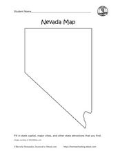
Nevada Map
In this state maps worksheet, students identify the state of Nevada. Students then fill in the state capital, major cities, and other state attractions for the state.


