Curated OER
Enduring Cultures
Students research the art, dance or a game from the Pacific Northwest Coast Aborigines. In this Canadian Cultures lesson, students view a PowerPoint about the Inuits. Students choose a game , type of artwork or dance to...
Curated OER
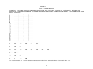
Canada Eh? Pre/Post Tests on Canada Using GPS
Students participate in a GPS activity and answer questions about Canada. In this Canada lesson, students identify location by using a GPS Unit and latitude and longitude. Students find an Inuksuk (station) and a complete worksheet.
Curated OER
World Continents
Students identify the continents of the world. In groups, students create a three-dimensional clay representation of their assigned continent. Using KidPix software, they draw and color their continent. Students research their continent...
Curated OER
A History of the War of 1812 and The Star-Spangled Banner
Learners examine the causes and outcomes of the War of 1812, and determine the chronology of the Star-Spangled Banner. In this War of 1812 instructional activity, students learn vocabulary and read a narrative about the War of 1812...
Curated OER
Amate Bark Paintings/Folk Arts of Latin America
Students explore the history of bark paintings in South America and produce their own version of these paintings.
Curated OER
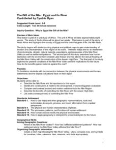
The Gift of the Nile: Egypt and its River
Students begin with a piece of a puzzle that shows an artifact from ancient Egypt. They find others who have pieces that go with their puzzle piece. Students work in these groups to construct a relief map of the Nile River Valley.
Curated OER
New Year Celebrations Around the World
Students share their New Year's traditions, then read a news article about how people around the world celebrate the start of a new year. In this current events lesson, the teacher introduces the article with a discussion and vocabulary...
Curated OER
Building an Empire Mapping China
Learners create travel brochures of China's nine regions and make a bulletin board display with them.
Curated OER
Reasons to Settle in America
Students complete a research project. In this American History lesson plan, students work in groups to research reasons that people wanted to settle in America. Students record the information, share what they found and write...
Curated OER
Geography: Alaska Geography Treasure Hunt
Middle schoolers locate features listed on the Treasure Hunt sheet.
Curated OER
The Birthplace
Students use a world map, to identify the country of origin of the target language and other countries and areas where the largest language is on e of the principal languages. They complete this assessment orally using a world map.
Curated OER
Virginia In the World: The Geography of Commerce
Students examine how Virginia connects with the world through export trade. Using a map, they use symbols to depict the value of trade and the direction of the flow of goods. They complete a scavenger hunt using electronic almanacs and...
Curated OER
Maps that Teach
Students study maps to locate the states and capital on the US map. Students locate continents, major world physical features and historical monuments. Students locate the provinces and territories of Canada.
Curated OER
Geography: My Community as a Region
Learners discuss the differences between formal, functional and perceptual regions in Alaska. They work in small groups to research community.
Curated OER
Water Sources in Cape Verde and West Africa
Young explorers study the scarcity and importance of a continuous supply of fresh water in Cape Verde. They research the five main ways that fresh water is obtained in these countries. Each research group prepares a presentation, and...
Curated OER
States in the USA Quiz
In this online interactive geography quiz worksheet, students respond to 50 identification questions about the states in the United States of America. Students have 4 minutes to complete the quiz.
Curated OER
"Place the State" Game
Students participate in a computer game in which they locate and place the U.S. states on a blank outline map. In small groups, they take turns dragging and dropping the states in the proper location on a map.
Curated OER
Facts, Fictions and Perceptions of Regions
Students examine the different characteristics of the regions of the United States. They discuss places they have visited in the U.S., and in small groups conduct research on a selected region of the U.S. Each group labels a map of...
Curated OER
Where We Live
Middle schoolers analyze Canada's population distribution. They access online information to gather demographic information about two Canadian cities. They compare and contrast the quality of life in the two cities and present their...
Curated OER
Geography of Early China
Students research and identify the primary geographic features of China. They investigate which features isolated China, and identify the significance of the Hwang River to Early Chinese civilizations. Finally, they research the Silk...
Curated OER
Current Events, Geography
Students read the newspaper to become aware of what is happening in their city, state, nation, and world. They summarize, find locations on a map and ask thought-provoking questions.
Curated OER
Geography: World Dynamics
Students discuss and examine how the world is changing. After reading an article, they discover the immediate changes that have taken place and how they have effected living things. They complete a worksheet identifying the changes as...
Curated OER
South America
In this map of South America worksheet, students study the map of South America and then write the names of the 15 countries and territories on the provided lines.
Curated OER
Iraqi Geography
In this word search worksheet, students discover for terms related to the country of Iraq. The terms include important geographical features, cities, countries and people.

