Curated OER
Trade in Precontact Alaska
Young scholars explore the geography of Alaska and its effect on trade. In this ancient Alaska lesson, students participate in a simulation that requires them to trade with those in the territory and outside of it.
University of Pennsylvania
Canaan and Ancient Israel
Planning for your next activity on ancient Israel, but not sure where to start? Check out this assortment of activities to help get the ball rolling. It includes a range of ideas on topics, such as Greek and Egyptian mythology,...
Curated OER
From There To Here...
Learners find out where some of the products in hour homes come from, then become aware of our local trash, landfills and incinerators. They chart and graph data and use maps for different purposes.
Curated OER
Let's Go to Korea
Students prepare for travel to Korea. For this Korean travel lesson, students discover to steps of obtaining passports, airline flight options to Korea, and study places to see and visit in Korea.
Curated OER
African Country Report
Sixth graders describe the relationship between the people of Africa and their environment. They examine the climate, economy and inhabitants of this land. Using maps graphic organizers and writing a report, 6th graders demonstrate how...
Montana State University
Meet Mount Everest
Learning about one landform might seem boring to some, but using the resource provided practically guarantees scholar interest. The second in a sequential series of eight covering the topic of Mount Everest includes activities such as a...
Curated OER
George Washington Teaches Map Directions
Learners follow teacher given directions, either oral or written to plot points on a grid to create a profile of George Washington. They apply cardinal and ordinal directions to find the points on the grid.
Curated OER
Geography of Spain
Students explore the geography of Spain. In this geography skills instructional activity, students create a map on their school gym floor in the shape of Spain. Students identify the locations of the Spanish states and capitals.
Curated OER
Oaxaca Geography and the Climate
Students examine the diverse geography of the country of Mexico and the state of Oaxaca. They analyze how the geography of the state of Oaxaca affects its climate and create maps showing the different climate areas.
Curated OER
Geography of Spain
Students explore Spain. In this geography skills lesson, students investigate a political map of Spain and record the names of states, capitals, and landforms. Students then practice tagging the states, capitals, and landforms on blank...
Curated OER
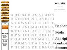
Australia Word Search
In this social studies worksheet, students find the words that are used to describe the continent of Australia and the answers are found by clicking the button at the bottom of the page.
Curated OER
Geography of the Study of the Spanish-speaking People of Texas
Students identify the physical features, demographic characteristics, and history of the four Texas towns featured in Russell Lee's photo essay, "The Spanish-Speaking People of Texas." They conduct Internet research, and create a travel...
Curated OER
Mapping Baseball
Students research how climate, distance, population shifts and immigration have influenced American baseball. They also consider how players from other countries have made their mark on American baseball.
Curated OER
Lesson 1: Map Data and the Census
Students learn about the history of the census. In this U. S. Census lesson plan, students develop an understanding about how the United States Constitution grants and distributes power and discover how the spatial organization of...
Curated OER
10 Biggest Islands Map Quiz
In this online interactive geography quiz worksheet, students respond to 10 identification questions regarding the biggest islands in the world.
Curated OER
Who's The Boss?
Upper elementary and middle schoolers research and analyze some different types of governments. Democracies, Monarchies, and Dictatorships are some of the types that are looked at. Learners use the Internet to gather information that...
Bowland
Alien Invasion
Win the war of the worlds! Scholars solve a variety of problems related to an alien invasion. They determine where spaceships have landed on a coordinate map, devise a plan to avoid the aliens, observe the aliens, and break a code to...
Curated OER
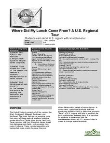
Where Did My Lunch Come From? A U.S. Regional Tour
Students explore the regions from which their food comes. In this social studies lesson, students identify the different agricultural products that are found in the major regions of the United States. Students create a lunch menu.
Curated OER
Europe Map Quiz (Easy)
In this online interactive geography quiz worksheet, students respond to 35 identification questions regarding the countries of Europe.
Curated OER
MAP GRIDS, CLIMATES AND HEMISPHERES
Students compare/contrast the grid and latitude/longitude system used on a globe. They describe the areas which are considered to be a tropical, temperate, and polar, based on knowledge of climates.
Curated OER
Clothesline Sleuth
Sixth graders investigate the origins of clothing production. In this Social Studies lesson, 6th graders examine the components of agriculture involved in making clothes. Students research cotton.
Curated OER
Latitude on World Maps
Sixth graders examine the purposes of maps. In this Geography lesson, 6th graders practice using latitude and longitude on a map.
US Mint
Absolutely and Relatively: The Puerto Rico Quarter Reverse
How much does your class know about Puerto RIco? How much can they learn from the back of a 2009 quarter? Use the coin, part of a series of quarters that depict US territories, to teach learners about the geography, culture, and history...

