Curated OER
Map Keys
In this geography worksheet, students identify who a cartographer is and what they do specifically. They study an outline map of a fictitious island and then, respond to the three questions that follow. Finally, students add three more...
Curated OER
Florida Cities Map Quiz
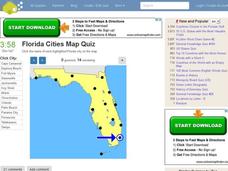
In this online interactive geography instructional activity, students examine a map of Florida and identify the 12 noted cities on the map using a pull down menu within 3 minutes.
Curated OER
Mapping South America
Middle schoolers explore South America. In this South American lesson, students use their geography skills to create population, terrain, biomes/vegetation, and major exports maps. Middle schoolers present their finished maps to their...
Curated OER
South America Map Quiz
In this online interactive geography quiz worksheet, students examine the map that includes all of South America's countries. Students identify the 13 countries in 2 minutes.
Curated OER
California Cities Map Quiz
In this online interactive geography quiz activity, students examine the map that includes 12 California cities. Students identify the names of the cities in 3 minutes.
Curated OER
Waldseemuller's Map: World 1507
Students investigate the 1507 word map. In this world geography lesson, students examine the details of each section of the map and then draw conclusions about how the people of 1507 understood the world. Students are evalated on...
Curated OER
Exploring the World's Geography
Students discuss the seven continents of Earth and the diverse geography. After discussion, they create their own paper-mache globes which properly display all seven continents, the equator, and the prime meridian. They conduct research...
Curated OER
Assessing and Making Maps
Students evaluate maps using the TODALSIGs basic map analysis system, explained on the worksheet. They create a map of Alaska using TODALSIGs. Students brainstorm the elements of maps.
Curated OER
Social Studies: Cultural New Orleans
Students observe the PBS film, "New Orleans," to explore such topics as race relations, cultural history, and urbanization. After examining n interactive map displaying the city at various dates in its history, students role-play as...
Curated OER
Europe Map
In this world geography worksheet, learners study the map of Europe and locate the 48 countries within the continent. Students write the names on the provided lines.
Curated OER
Washington, D.C. Map
Here is an outline map of Washington, DC. Some of the points of interest in the city are labeled, as are Maryland, Virginia and Arlington. There are plenty of important monuments and locations not identified, making for a good...
Curated OER
Year 3 Geography
In this social studies worksheet, middle schoolers find the words that are related to the concepts found in Geography and the answers are found at the bottom of the page.
Curated OER
My Top Interdisciplinary Social Studies Lesson Plans
Here are some top social studies lesson plans and activities which present concepts in a memorable fashion.
Curated OER
Compass Rose for the New Millennium
Sixth graders are introduced to the concepts of a compass rose and how it used in relationship to reading maps in geography. The lesson is meant to build upon prior knowledge and skills.
Curated OER
National Expansion
Students investigate the Manifest Denstiny. They explore how the idea was evident in 19th century American maps. Students brainstorm the relationships between maps and national expansion. They review a map from 1816 that called for...
Curated OER
What a Relief Map
Students create a map using cookie dough. In this geography lesson, students research the physical features of a country, draw a diagram and design and create a map out of cookie dough.
Curated OER
Name the States Worksheet 2
In this name the states learning exercise, students examine 6 state map outlines and identify each of them by writing the state names and postal abbreviations.
Curated OER
Name the States Worksheet 1
In this name the states worksheet, students examine 6 state map outlines and identify each of them by writing the state names and postal abbreviations.
Curated OER
Name the States Worksheet 5
In this name the states activity, students examine 6 state map outlines and identify each of them by writing the state names and postal abbreviations.
Geography 360°
Introducing Europe
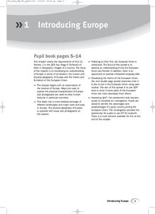
Provide your learners with a comprehensive introduction to Europe with this great set of worksheets. Map activities include matching European countries to their capitals and places on a political map, as well as...
US Mint
Symbols in My Eyes
Explore the hidden meanings behind the images on US currency with this elementary school lesson on symbolism. Starting with a class discussion about symbols, children go on to brainstorm different objects that represent the Unites...
Curated OER
Geography Booklet
Sixth graders explore geography terms. Students use resources to find real examples of landforms in the world. They create a map showing the landform. students label the surrounding features, countries and states. Students use each...
Curated OER
Mapping Community Values
Pupils discuss the origin of various maps focusing on the values behind them. Students also explore how human needs and geography influence community settlement patterns. Pupils extend learning by creating and mapping their own ideal...
Curated OER
Holocaust Map Studies
Middle schoolers analyze maps and answer discussion questions related to WWI. In this geography lesson, students analyze historic maps to determine causes and effects of WWI in Europe. Middle schoolers read testimonies of Holocaust...


