Curated OER
Attu Battlefield: U.S. Army and Navy Airfields on Attu
Students use maps, readings, drawings and photos to research the World War II Battle of Attu. They explain the importance of the battle, discuss the valor and loyalty of both American and Japanese troops and analyze sources of historical...
Curated OER
50 States: New England States
Students discover where certain states are located and what the look like. They look for their information on a web site. Each student is assigned a state which they must research then present to the entire class.
Curated OER
Where in the World Is That Volcano?
Identify the Earth's major volcanoes with an earth science lesson plan. Elementary and middle schoolers locate major volcanoes on a world map. Then, in groups, they research how the volcano affects the region in which it is located.
Curated OER
Trouble in the Troposphere
Young scholars create graphs using NASA data, compare ozone levels of several U.S. cities, analyze and evaluate the data and predict trends based on the data, and discuss and describe how human activities have modified Earth's air quality.
Curated OER
The World At Your Fingertips
In this the world at your fingertips worksheet, students bring in 5 items from home that are not made in the U.S., then complete a chart, indicate on a map and answer 6 questions about imported items.
Curated OER
My Name is Osama - Bullying and Name-Calling
Students read the story of an Iraqi immigrant boy named Osama who faces taunts of terrorist in his U.S. school after the attack of September 11.
They discuss the characters and their struggles in the story. Students respond to...
Curated OER
Trouble in the Troposphere
Students Use data sets from MY NASA DATA to produce graphs comparing monthly and yearly ozone averages of several U.S. cities. They analyze and evaluate the data and predict trends based on the data. In addition, they discuss and...
Curated OER
National Marine Sanctuaries Shipwrecks
Junior oceanographers access the Channel Islands National Marine Sanctuary Shipwreck Database and plot the locations of several shipwrecks. Shipwrecks are always an enthralling subject and this activity allows your learners to act as...
Curated OER
Internet Fact Hunt at the "Fact Monster" Web Site- Hunt #33
In this Internet fact hunt worksheet, students access the "Fact Monster" web site to locate the answers to 5 multiple choice questions. They answer questions about US history, geography, literature, and science.
Science Matters
Ring of Fire
Over a period of 35 years, earthquakes and volcanoes combined only accounted for 1.5 percent of the deaths from natural disasters in the United States. The 15th lesson in a 20-part series connects the locations of earthquakes and...
Curated OER
Tears of Joy Theatre Presents Anansi the Spider
Accompany the African folktale, Anansi the Spider, with a collection of five lessons, each equipped with supplemental activities. Lessons offer multidisciplinary reinforcement in English language arts, social studies, science,...
Curated OER
The Treaty Trail: U.S. Indian Treaty Councils in the Northwest
Students create a timeline with the major events of the 19th and 20th century dealing with Native Americans. They examine artifacts and discuss how they reflect culture. They also identify trade routes the Native Americans used.
Curated OER
Comparative Geography I
Students use population density and other statistics to compare countries. They find the population density for the countries listed in the table. Students compare findings with a partner, and then share with the class.
Curated OER
As Simple as Beans: Canada's Population
Students gather facts about Canada from various maps. In this Canada activity, students use beans to relate the populations of the U.S. and Canada. Students create population distribution maps based on the placement of the beans.
Curated OER
You Can Find It!
Students locate different places including U.S. cities using longitude and latitude coordinates. In this longitude and latitude lesson plan, students locate 10 different locations.
Curated OER
The Cuban Missile Crisis of 1962
Sixth graders explain the importance the Cuban Missile Crisis of 1962 and the role it played in the Cold War. After studying the crisis, 6th graders compose an essay describing the crisis and how the U.S. became vulnerable to nuclear...
Curated OER
USA Immigration by Country Quiz
In this online interactive geography quiz worksheet, students respond to 30 identification questions about countries U.S. citizens have immigrated from. Students have 5 minutes to complete the quiz.
Curated OER
Labeling the World
Sixth graders conduct research on the countries found on the labels on their clothing. They locate the countries on a map, research the labor practices on countries that export clothing to the U.S., and create a graph using the information.
PBS
Dear Pen Pal
Explore cultures from around the world with an engaging pen pal resource. Through a series of classroom activities and written correspondence, children learn about the favoritec pastimes, schooling, geography, and weather that is...
Curated OER
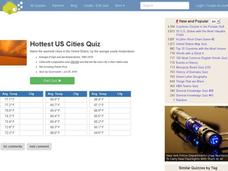
Hottest US Cities Quiz
In this online interactive geography quiz worksheet, students respond to 20 identification questions about the hottest cities in the United States. Students have 4 minutes to finish the timed quiz.
Curated OER
Map Activities
In this geography worksheet, learners follow the directions and shade 3 different regions of a UK political map, shade European Union countries on a political map of Europe, match 4 physical feature of Africa to their descriptions, and...
Curated OER
Mapping Population Changes In The United States
Students create a choropleth map to illustrate the population growth rate of the United States. They explore how to construct a choropleth map, and discuss the impact of population changes for the future.
National Museum of the American Indian
The A:Shiwi (Zuni) People: A Study in Environment, Adaptation, and Agricultural Practices
Discover the connection of native peoples to their natural world, including cultural and agricultural practices, by studying the Zuni people of the American Southwest. This lesson includes examining a poster's photographs, reading...
Texas State Energy Conservation Office
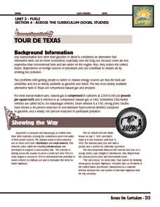
Investigation: Tour de Texas
Teams of Texas tourists gather into groups to analyze what they can do with $50 worth of an alternative fuel. They write checks, keep a balance sheet, and map out their sight-seeing route taking into consideration the location of...
Other popular searches
- U.s. Geography Lesson Plans
- U.s. Geography Southeast
- U.s. Geography Slavery
- U.s. Geography Northeast
- U.s. Geography California
- U.s. Geography Oregon
- U.s. Geography and Economics
- U.s. Geography Pdf
- U.s. Geography West
- U.s. Geography Activity
- U.s. Geography + Slavery
- U.s. Geography Southwest


