Curated OER
Northeast States and Tribes Word Search
In this geography instructional activity, students find the words that are used to describe places in the Northeastern United States. The answers are found at the bottom of the page.
Curated OER
National Parks
In this geography worksheet, students examine the names of 15 National Parks in America. Students locate the names in a word search puzzle.
Curated OER
American Indians
Sixth graders review and study the major regions of Native Americans and how their cultures were influenced by geography, natural resources and religious beliefs. They utilize chronological thinking, historical analysis and historical...
Curated OER
Rivers Bridge State Historic Site
Students use maps, readings, illustrations and photos to analyze the Civil War Rivers Bridge battlefield and describe how geography affected the outcome of the battle. They explore and explain the causes for the battle's heavy human...
Curated OER
Let's Go to Korea
Students prepare for travel to Korea. For this Korean travel lesson, students discover to steps of obtaining passports, airline flight options to Korea, and study places to see and visit in Korea.
Curated OER
MAKING CONNECTIONS WITH MAPS
Students define choropleth map. They construct a choropleth map. They interpret a choropleth map. They present geographic information.
Curated OER
Location of Cities 201
Students work in pairs to locate the ancient cities on a world atlas using the longitude and latitude measurements. They examine the physical and human futures that explain their locations.
Curated OER
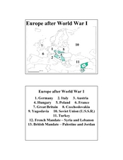
Europe after World War I
In this Europe after World War I map worksheet, students note the 11 regions of the Europe labeled on the map.
Curated OER
States and Mates
Discuss and reflect on the concept of allies and alliances. The class examines the competition between the United States and Venezuela. Using the New York Times, they search for examples of geopolitical alliances. In addition, they write...
Curated OER
You Are Here
Students map local places and learn to use scale and distance. In this mapping lesson plan, students map their school and a favorite place. Students recreate their maps showing distance and scale sizes. Students locate their...
Curated OER
Looking At African Art
In this social studies instructional activity, students find the words that are related to the concept of African art and the answers are found at the bottom of the page.
Curated OER
The Former Soviet Union
In this social studies worksheet, learners find the names of the republics for the former Soviet Union and the answers are found at the bottom of the page.
Curated OER
Peru's Word Search
In this social studies worksheet, students find the words that are associated with the country of Peru and the answers are found at the bottom of the page.
Curated OER
States And Capitals
In this states and capitals activity, students research, analyze and memorize the fifty United States states and their capitals. Students complete a word scramble puzzle containing the fifty states and capitals.
Curated OER
How Far Is It?
Students use a map key to estimate the distance from Salt Lake City, Utah, to ten other cities. Then they use an online distance calculator to see how close their estimates come!
Education World
The African American Population in US History
How has the African American population changed over the years? Learners use charts, statistical data, and maps to see how populations in African American communities have changed since the 1860s. Activity modifications are included to...
Curated OER
Kid City, USA
What a model community would look like? Get your kids talking with an activity that allows them to create their own town. After printing out a "fold out village," groups of students use a variety of resources to help them build an actual...
Curated OER
Winter Olympics History Year by Year
Investigate the history of the Winter Olympic Games. After researching this event and compiling necessary statistics, pupils use a graphic organizer to chart their findings. A template for a chart is included in this resource. Have your...
Curated OER
Will There Be a White Christmas This Year?
Young scholars examine historical weather data, and create map and color key that illustrates the likelihood of a white Christmas in different locations across the United States.
Education World
Edible Resource Maps!
Young scholars discuss resource maps and examine examples from library resources. Working in groups, they create edible resource maps by drawing examples, such as popcorn on the border of Iowa and Nebraska. Then they use cookies in the...
Curated OER
In the Wake of Columbus
Students explore how the population decreased in native cultures.
Curated OER
Map Your Favorite Sports Team's Next Road Trip
Students track a sports team across the country. They use a map scale to calculate the number of miles traveled by their sports team on a trip, conduct Internet research, and calculate how much it would cost them to go along on the trip.
Curated OER
Taking a Stand: Pros and Cons of Forest Fires
Learners explain the components of fire, explain how forest fires impact man and the environment, analyze data in order to recognize areas that are at risk for forest fires, make recommendations based on research.
Curated OER
Mapping Your State's Role in the Vietnam War
Students recognize reasons to celebrate Memorial Day. Students create a map of victims of the VIetnam War. Using the internet, students research information about soldiers from their state who were killd in action in Vietnam. Students...
Other popular searches
- U.s. Geography Lesson Plans
- U.s. Geography Southeast
- U.s. Geography Slavery
- U.s. Geography Northeast
- U.s. Geography California
- U.s. Geography Oregon
- U.s. Geography and Economics
- U.s. Geography Pdf
- U.s. Geography West
- U.s. Geography Activity
- U.s. Geography + Slavery
- U.s. Geography Southwest


