Education World
The African American Population in US History
How has the African American population changed over the years? Learners use charts, statistical data, and maps to see how populations in African American communities have changed since the 1860s. Activity modifications are included to...
Curated OER
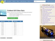
Coldest US Cities Quiz
In this online interactive geography quiz worksheet, students respond to 20 identification questions about the coldest cities in the United States. Students have 4 minutes to complete the quiz.
Curated OER
Biggest US City by Letter Quiz
In this online interactive geography quiz worksheet, students respond to 26 identification questions about U.S. cities. Students have 5 minutes to complete the quiz.
Curated OER
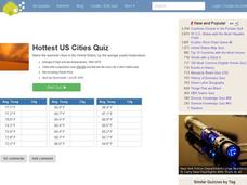
Hottest US Cities Quiz
In this online interactive geography quiz worksheet, students respond to 20 identification questions about the hottest cities in the United States. Students have 4 minutes to finish the timed quiz.
Curated OER
US Newspapers Quiz
In this online interactive geography quiz worksheet, students respond to 13 identification questions about the names of newspapers in the listed U.S. cities. Students have 3 minutes to complete the quiz.
Curated OER
Understanding Latitude and Longitude
Teaching learners about latitude and longitude can get a little complicated. Present the concept by first representing it as a graph. Just like finding a location on a graph using the x and y-axis, learners will be able to locate items...
Curated OER
Using Literature to Introduce the Five Themes of Geography
Students listen to a read aloud of "If You Grew Up With Abraham Lincoln". Using the text, they identify examples of the five themes of geography and write them down. Using a map, they plot the places mentioned in the book and sort facts...
Curated OER
Using Google Squared to Compare and Contrast Canada and the US
Sixth graders compare and contrast Canada and the United States. In this geography skills lesson, 6th graders use Google Squared to research information so that they may compare the geography of Canada and the United States.
Curated OER
Themes of Geography in the News Contest
Students discuss current events in the world today. After choosing one to focus on, they identify the themes of Geography present in them and practice using new vocabulary. They use the internet to find all of the themes present in...
Curated OER
Victims of Geography
Learners examine the toll taken on New Orleans by Hurricane Katrina. In this current events lesson, students visit selected websites to discover details about the geography of the city and the hurricane itself.
Curated OER
Feudal Powers in Japan
A traditional textbook chapter focuses on feudal powers in Japan, and includes vocabulary, note-taking tips in the sidebar, main ideas, and follow-up assessment questions. It also incorporates opportunities for art...
Freecloud Design
Stack the Countries™
This resource does an excellent job of engaging and educating people on world geography. It includes informational flashcards as well as games. Though the graphics are designed for elementary players, people of all ages will...
PBS
Pass the Past
Prepare your class members for history and geography exams with an educational game that not only tests content knowledge, but also requires students to demonstrate their reading comprehension skills.
Curated OER
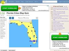
Florida Cities Map Quiz
In this online interactive geography learning exercise, students examine a map of Florida and identify the 12 noted cities on the map using a pull down menu within 3 minutes.
Curated OER
Shaky New Zealand
Students explore geography by answering study questions in class. In this plate tectonics lesson, students identify the earthquake data concerning the country of New Zealand and answer questions regarding the data. Students identify...
Curated OER
Tactics in the Persian Gulf: From Diplomacy to Force
Students trace the United States' involvement in Iraq from 1991 to today. They interpret a map of Iraq, evaluate possible causes and effects of events. They participate in, collect and analyze a poll regarding the next steps the US...
Curated OER
Establishing Borders: The Expansion of the United States 1846-48
Students investigate how the United States acquired land after the Revolutionary War ended. In this establishing borders lesson, students use maps to identify territories acquired by the US and the states that later developed. Students...
Curated OER
U.S. Archaeological Sites: Geography Practice
In this archaeological sites worksheet, students read about sites in the Unites States and use a map to complete a set of 7 short answer questions.
Curated OER
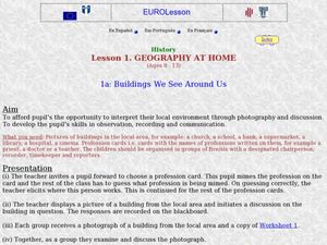
Geography at Home: Buildings We See Around Us
Students explore architecture. For this architecture lesson, students examine photographs of buildings in their communities. Students collaborate to discuss their observations regarding the buildings. Students record their observations...
Curated OER
State Capitals- Online Interactive
In this state capitals worksheet, students learn to match the capital cities to the 50 states. Next to each name of the state, students fill in the capital city from a list that is provided. This is an online interactive worksheet.
Curated OER
US Immigration
Learners examine the history of immigration in the United States. Using primary source documents, they identify the areas of origin for people settling in Minnesota and describe the push and pull factors that brought them there. They...
NASA
Precipitation
Here is a fabulous collection of lessons for your emerging meteorologists! In them, learners will utilize satellite data to determine distribution of rainfall, research global rainfall patterns, and utilize their knowledge to propose new...
Howard Hughes Medical Institute
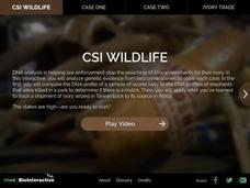
CSI Wildlife
Can DNA fingerprinting prevent the extinction of elephants? Young scientists learn about DNA fingerprinting before applying their knowledge to case studies of elephant poaching. The first case requires them to match the DNA from a tusk...
Curated OER
States and Capitals, Mountains and Rivers
Students identify geographical locations in the midwestern United States. In this geography lesson plan, students identify 12 states and capitals and geographical features in the region by using U.S. maps. Students use blank maps to fill...
Other popular searches
- Us Geography Climate
- Us Geography Skills
- Geography Map Skills Us
- Us Geography Pdf
- Us Geography Scavenger Hunt
- Us Geography Northeast
- Us Geography Activity
- Us Geography Slavery
- Us Geography and Economics
- Geography Us
- Us Geography West
- Us Geography Southeast

