Curated OER
World: Physical Map
In this world physical map instructional activity, students make note of the major landforms located on this Robinson projection map.
Curated OER
World Climate Map
In this world climate map worksheet, students examine the tropical, dry, warm temperate, cool temperate, polar and subartic, and highland climate regions of the world.
Curated OER
World: Continents Map
In this World outline map worksheet, students note the political boundaries of the continents of the world on this Robinson projection map.
Curated OER
World: Political Map
In this world political outline map worksheet, students examine boundaries of each of the countries in the world. This map not is labeled.
Curated OER
World Pacific Map
In this world Pacific projection outline map worksheet, students examine boundaries of each of the countries in the world. This map not is labeled.
Curated OER
World Political Map
In this blank outline map worksheet, students note the political boundaries of the nations of the world on a Mercator projection map.
Curated OER
World: Continents
In this blank outline map worksheet, students note the political boundaries of the continents of the world on a Robinson projection map.
Curated OER
World: Continents Map
In this outline map worksheet, students note the political boundaries of the continents of the world. The map is labeled with the names of the 7 continents.
Curated OER
World Landforms
In this blank outline map worksheet, students note the major landforms of the 7 continents of the world on a Robinson projection map.
Curated OER
Wow! You're Eating Geography
Learners examine patterns of food producing areas, and identify foods that are grown locally, in the U.S., and around the world. They map and graph the major food crops of their local area, the U.S., and other countries, and discuss the...
Curated OER
Book: First Encounters Between Spain and the Americas: Two Worlds Meet
Young scholars, after reading Chapter 1 in the book, "First Encounters Between Spain and the Americas: Two Worlds Meet," design and create a map of the Aztec Empire at the time of the first contract with the Spanish. They create the map...
NASA
Outline Maps
Don't miss this gold mine of blank maps for your next geography lesson! Regions include traditional continents such as Asia, Europe, and Africa, as well as other major world areas such as the Pacific Rim and the Middle East.
Space Awareness
How To Travel On Earth Without Getting Lost
Have you ever wanted to travel the world? Take a virtual trip with a geography lesson that uses longitude and latitude, the position of the sun, an astronomy app, and a classroom globe.
Freecloud Design
Stack the Countries™
This resource does an excellent job of engaging and educating people on world geography. It includes informational flashcards as well as games. Though the graphics are designed for elementary players, people of all ages will...
Sharp School
Travel Brochure Project
Designing a travel brochure is a classic project that will help your class members develop a variety of skills, such as researching informational texts, designing creative visual products, and communicating what you have learned.
Curated OER
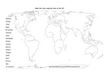
Rivers of the World
In this river worksheet, students focus on various rivers across the planet. Students label the names of 18 rivers on the world map provided.
Curated OER
Map Puzzles
Young scholars make puzzles from world maps, dramatizing how much of the globe is covered by ocean.
Curated OER
Mexico: Culture, Language, and History
Study the culture, language, and history of Mexico in this collection of lessons. Create maps of Mexico's geography, study Spanish language phrases, and create a fiesta, along with a Mexican Marketplace scene.
American Museum of Natural History
Mythic Creatures Challenge
Mythic creatures and where to find them is the subject of an engaging interactive resource. Young anthropologists click on a bright red X on a world map to see an image of and learn the stories of 15 legendary creatures.
K20 LEARN
If Our Classroom Were The World: Proportions And Percents
It's a small world after all. Classmates consider world population, languages, and religions in a cross-curricular lesson. Applying percentages and proportions, they determine what the class make-up would be if the class represented the...
Curated OER
Hershey and the World: The 5 Themes of Geography and Google Earth
Students invsestigate cocoa producing regions in the world. In this geography skills lesson, students examine how the 5 themes of geography affect the Hershey Chocolate Company as they compare and contrast cocoa production in America,...
Curated OER
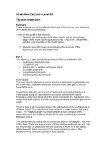
Shaky New Zealand
Students explore Earth science by building a model in class. In this tectonic plate lesson, students identify the impact tectonic shifts have on humans and animals and where the plates and faults lie under New Zealand. Students examine...
University of Kansas
Newspaper in the Classroom
Newspapers aren't only for reading—they're for learning skills, too! A journalism unit provides three lessons each for primary, intermediate, and secondary grades. Lessons include objectives, materials, vocabulary, and procedure, and...
Curated OER
Europe Map
In this world geography worksheet, learners study the map of Europe and locate the 48 countries within the continent. Students write the names on the provided lines.


