Curated OER
Scientists Discover Giant Frog Fossil
Students examine a world map and read a news article about the discovery of a giant frog fossil. In this earth science and current event lesson plan, the teacher introduces an article with a discussion about continental drift and a...
Curated OER
Many Uses of Plants
Students research and discuss non-food plant products that are in common use, and mark on a world map the name of the country where the plant is grown.
Curated OER
Recent Volcanoes And Earthquakes:
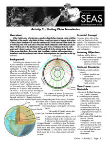
Students investigate the current model for the structure of the Earth. On a world map, they mark areas where they think earthquakes and volcanoes occur and compare those areas with earthquake and volcano location patterns.
Curated OER
Will Smog be a Problem at the Olympic Games?
Students locate China on a world map, then read a news article about pollution in Beijing. In this current events lesson, the teacher introduces the article with a discussion about smog and a vocabulary activity, then students read the...
Curated OER
Using Old Maps as Tools to Explore Our World
Students explore historical maps. In this primary source analysis lesson, students uncover the meanings in selected historical maps as they use them to enhance lessons on historical events. Samples for classroom use are provided in this...
Curated OER
Geography and Its Five Themes
Geography is not limited to just learning about the Earth and its physical features.
Curated OER
Journeys...The Voices of Change
Students trace the immigration patterns of their ancestors. They plot information on a world map, develop a timeline of target immigration patterns, research and write a report on immigration and participate in a class play.
Curated OER
Human Impacts on Major Rivers of the World
Middle schoolers explore motivations behind human intervention in the stream flow of selected rivers, infer kinds of interventions and their results, and evaluate level of success of such interventions of stream flow as well as...
Curated OER
The Fabric of Our World
Students discuss cultural diversity, and examine how the community reflects the cultural background of the inhabitants. They read the book, People, take a community walk, create a rainbow chart, and research other states for relocation...
New York City Department of Education
Geography and Early Peoples of the Western Hemisphere
Young historians discover the early people of the western hemisphere. The unit explores how the land changed, how it was used and homes of early Americans such as Incas, Mayans, Inuits, Aztecs, and Pueblos. Individuals also examine these...
Virginia Department of Education
World History and Geography: 1500 A.D. (C.E.) to the Present
Intended to help Virginia teachers align their curriculum to the state's history and social science standards, this packet provides a wealth of materials for any social studies or science instructor. Loaded with plans,...
Education Development Center
Geography of the Number Line
It's more than just numbers on a line, its an organizational, mental math machine to help learners understand the value of numbers. The tool is handy when introducing positive and negative integers to see their values and...
Education Development Center
Geography of the Coordinate Plane
Put the graph into graphing and allow learners to understand the concept of point plotting and how it relates to data. The worksheet provides a nice way to connect data analysis to a graph and make predictions. The worksheets within...
Education Development Center
Micro-Geography of the Number Line
Young mathematicians dive into the number line to discover decimals and how the numbers infinitely get smaller in between. They click the zoom button a few times and learn that the number line doesn't just stop at integers. Includes...
Space Awareness
Let's Map the Earth
Before maps went mobile, people actually had to learn how to read maps. Pupils look at map elements in order to understand how to read them and locate specific locations. Finally, young cartographers discover how to make aerial maps.
Quaver
World Percussion — Latin America Project Book
What's the most popular music style in Brazil? What about Cuba? Or the Dominican Republic? An immersive project teaches young learners about the salsa, the samba, and the merengue with research assignments and dance performances.
NY Learns
Geography of the Fertile Crescent by ECSDM
Using Google Earth, a vocabulary assignment, and map handout, your class members will outline the Fertile Crescent in Mesopotamia and identify the source of the Tigris and Euphrates rivers. They will then complete graphic organizers...
Bowland
Alien Invasion
Win the war of the worlds! Scholars solve a variety of problems related to an alien invasion. They determine where spaceships have landed on a coordinate map, devise a plan to avoid the aliens, observe the aliens, and break a code to...
Howard Hughes Medical Institute
BiomeViewer
Which holds more influence, the environment over humans or humans over the environment? Young scientists explore an online interactive that addresses this discussion. They observe changes in the natural world over time and see which...
Curated OER
Global Perceptions: How Your Students View the World
Students examine their own perceptions and attitudes about places around the world. Using their mental maps, they compare and contrast it with a world map from different periods in history. They review the various types of map...
Curated OER
Finding Your Spot in the World
Learners investigate a world map, a United States map, a state map, a county map and a city map. They locate each student's house on the city map and put a length of yarn from their house to a country of one of their ancestors.
Curated OER
The World At Your Fingertips
In this the world at your fingertips worksheet, students bring in 5 items from home that are not made in the U.S., then complete a chart, indicate on a map and answer 6 questions about imported items.
Curated OER
The European Union
Students complete an in-depth exploration of the European Union using the five themes of geography as a guide. In small groups, students use traditional and technological resources to answer questions about the European Union, with each...
Curated OER
Living In the UK
In this geography worksheet, students complete activities on 16 worksheets pertaining to the geography and culture of the countries of the United Kingdom. This is intended for ESL students.
Other popular searches
- World War I Map
- Mapping Penny's World
- Map of the World
- World Outline Maps
- Blank Maps of World
- World War 2 Map
- World War 1 Maps
- World War I Outline Map
- Map of World
- World Climate Map
- Blank World Outline Maps
- World Biomes Map


