Curated OER
US: Midwest Region Map
In this U. S. outline map worksheet, students examine boundaries of the Midwest Region states and the placement of the capital cities. This map is labeled.
Curated OER
Southeast Asia and the South Pacific: Political
For this Southeast Asia and the South Pacific political map worksheet, students examine boundaries of each of the countries and the placement of the capital cities. The major bodies of water are labeled.
Curated OER
South east Asia and the South Pacific: Political: Labeled Map
In this Asia and the South Pacific map worksheet, students examine the boundaries of the nations in this region of the world. Students also note the location of capital cities as they are denoted by stars. This map is labeled.
Curated OER
Central & Southwest Asia: Labeled Map
In this Central and Southwest Asia outline map worksheet, students examine boundaries of each of the countries in the region. This map is labeled.
Curated OER
South Asia: Political Map
In this South Asia outline map learning exercise, students & examine boundaries of each of the countries in the region. This map is labeled with the country and capital city names.
Curated OER
World: Political Map
In this world political outline map instructional activity, students examine boundaries of each of the countries in the world. This map not is labeled.
Curated OER
World Pacific Map
In this world Pacific projection outline map instructional activity, students examine boundaries of each of the countries in the world. This map not is labeled.
Curated OER
United States of America Map
In this United States of America map worksheet, students examine boundaries of each of the 50 states in the nation. This map not is labeled.
Curated OER
South US Region Map
In this United States regional outline map, learners examine the state boundaries of the states in the Southern Region. Capital cities are denoted with stars.
Curated OER
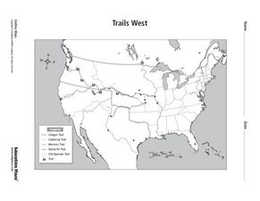
Trails West Map
In this United States historical map worksheet, students examine the trails that settlers of the Western United States took during the period of Western Expansion.
Curated OER
Asia and the South Pacific: Political Map
In this Asia and the South Pacific map worksheet, students examine national political boundaries and national capitals in this region of the world.
Curated OER
Asia and the South Pacific : Political Map
In this Asia and the South Pacific map worksheet, students examine the boundaries of the nations in this region of the world. Students also note the location of capital cities as they are denoted by stars. Major bodies of water are labeled.
Curated OER
US: Western Region Map
In this U. S. Western Region outline map worksheet, students examine boundaries of each of the states and the placement of the capital cities. This map is not labeled.
Curated OER
The Size of the European Union and its Member States
In this European Union learning exercise, students select an activity to complete. Two activities regarding the size of the European Union are offered.
Curated OER
Travel in Europe
In this European travel worksheet, learners respond to 11 short answer questions that require them to research travel throughout the countries in Europe.
Curated OER
Central America Region: Physical Map
In this Central America physical map worksheet, students make note of the major landforms located in this region of the world.
Curated OER
World: Continents
For this blank outline map worksheet, students note the political boundaries of the continents of the world on a Robinson projection map.
Curated OER
North America: Three Countries Map
In this North American political map activity, students examine the boundaries of the three countries of North America.
Curated OER
United States Regions
For this United States political map worksheet, students examine regional census boundaries of the US. State boundaries are also included.
Curated OER
World Landforms
In this blank outline map worksheet, learners note the major landforms of the 7 continents of the world on a Robinson projection map.
Curated OER
United States Map
In this United States political map worksheet, students examine national and state boundaries. The map also highlights the location of each of the state capitals and the national capital.
Curated OER
California: Landform Regions Map
In this California landforms map worksheet, students examine the landform regions located within the state of California.
Curated OER
Eurasia Physical Map
In this Eurasia physical map instructional activity, students make note of the major landforms and bodies of water located in this world region.
Curated OER
Australia and Oceania: Physical Map
In this Australia and Oceania physical map worksheet, students make note of the major landforms and bodies of water located within this region.


