Curated OER
America's Heartland
Students complete geography and trade activities about global trade. In this geography and trade lesson, students read information to learn about absolute advantage, comparative advantage, trade factors, U.S. trade partners, and...
Curated OER
Making a Brand for Ourselves the "Cowboy" Way
Students define cowboys and learn about their roles on rangelands. In this rangeland lesson, students define cowboys and cowgirls and complete a KWL chart. Students read Cattle Kids and Til the Cows Come Home. Students visit the Diamond...
Curated OER
Navigating With Explorers
Learners retrace the steps of European explorers to the New World and recreate the early exploration through online research and multimedia presentations. In this world history and technology lesson, students research early explorations...
Curated OER
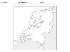
Netherlands Outline Map
In this outline map worksheet, students examine the political boundaries of the European nation of the Netherlands. The map may be used in variety of activities that individual teachers create to accompany it.
Curated OER
Europe Outline Map
In this outline map worksheet, students examine the political boundaries of the continent of Europe. The map may be used in variety of activities that individual teachers create to accompany it.
Curated OER
Iowa - Here We Come
Students practice their geography skills. In this geography instructional activity, students plan a trip in their state that includes calculating mileage, time, and other costs. Students also submit a written trip itinerary.
Curated OER
Blank US Map
In this blank outline map worksheet, students study the physical boundaries of the 50 states that make the United States. This outline map may be used for a variety of geographic activities.
Curated OER
Travel
In this travel worksheet, learners read a table and graph related to passenger travel and modes of transportation, then keep a travel log of their own, in order to gain an understanding of the environmental impact of travel. The...
Curated OER
Geography Skills
High schoolers practice their geography skills. In this geography skills activity, students locate, plot, and label places on maps and globes.
Curated OER
Malnourishment and Poverty
Students discover how poverty impacts people in many developing countries. In this Student Voices against Poverty lesson, students calculate data on numbers of children suffering from Vitamin A deficiency and numbers of people hungry to...
Curated OER
The Geography of South Asia
In this online interactive geography worksheet, learners answer 9 multiple choice questions regarding the geography of South Asia. Students may submit their answers to be scored.
Curated OER
Modern Africa (1)
For this online interactive current events activity, students answer 10 multiple choice questions regarding modern Africa. Students may submit their answers to be scored.
Curated OER
The Geography of Japan
In this online interactive geography worksheet, students answer 10 multiple choice questions regarding the geography of Japan. Students may submit their answers to be scored.
Curated OER
General Geography Concepts
In this online interactive geography worksheet, students answer 10 multiple choice questions regarding geography skills and vocabulary. Students may submit their answers to be scored.
Curated OER
The Geography of China
For this online interactive social studies worksheet, students respond to 9 multiple choice questions regarding the geography of China. Students may check their answers immediately.
Curated OER
Early Japanese History & Culture (2)
In this online interactive social studies worksheet, students respond to 8 multiple choice questions regarding the history and culture of Japan. Students may check their answers immediately.
Curated OER
Geography of the Middle East
For this online interactive social studies worksheet, students answer 9 multiple choice questions regarding the geography of the Middle East. Students may submit their answers to be scored.
Curated OER
Country Comparison Chart
In this country comparison worksheet, students use their research skills to find the population, per-capita GDP, urban numbers, rise in population, literacy rate, and life expectancy of the each of the 10 nations listed.
Curated OER
The Council of Europe
In this European law worksheet, students respond to 3 short answer questions regarding laws and the role of the Council of Europe.
Curated OER
Europe 1914
In this Europe 1914 map worksheet, students note the 9 regions of the Europe labeled on the map and their relevance to World War II.
Curated OER
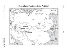
Central and Northern Asia: Political
In this Central and Northern Asia outline map, students examine the political boundaries of the nations in this region and note the location of their capital cities. This unlabeled map may be used in a variety of classroom activities.
Curated OER
RACED Comprehension Sheet
In this race worksheet, students respond to 10 short answer questions regarding geography concepts that feature the letters of the word "raced" as mnemonic hooks.
Curated OER
Central and Northern Asia: Political
In this Central and Northern Asia map learning exercise, learners examine national political boundaries and national capitals in this region of the world. The map is labeled.
Curated OER
New York City Map
In this New York city map worksheet, students examine the city. The map highlights some of the points of interest in the city.


