Curated OER
Where is Everybody?
Students collect data from different grade levels at their school and develop thematic maps which show population density, and determine how this might affect the school and themselves in the future.
Curated OER
Population Pyramid
Students learn about demographic population pyramids. They then design and fictitious nation and draw its population pyramid.
Curated OER
Where Should We Put a Store?
Students analyze population data. They convert population data into simple density maps to help make decisions about their world. They select the best location for a school store based on population density. They present their maps...
Curated OER
Why We Count
Learners visualize census data on a map and use a map key to read a population map. In this census lesson, students use a map of the Virgin Islands and corresponding worksheets to gain an understanding of population density.
Curated OER
Census Report
Pupils write and or present a report contrasting geographic and demographic features (e.g., average annual income, population density, mortality rate, literacy rate) of countries where the target languages is spoken to the U.S. They...
Curated OER
People, Goods, and Railroads
Middle schoolers compare population distribution and density railroad network in 1878, identify areas of expanding population density, and evaluate geographical and economic factors that influenced railroad expansion in late 19th century...
Curated OER
Create a City: An Urban Planning Exercise
Students explore the effects of population growth in Arizona. In this history lesson, students work in small groups to create a "perfect" city. Activities include examining the Arizona census results then discussing the importance of...
Curated OER
Weather Investigation Through The Internet
Students explore the Earth's climatic regions and their characteristics. Using the Internet, they evaluate regional vegetation, agriculture, and population density. Students name and describe instruments that measure weather. They...
Curated OER
Learning and Population Information - Where I Live
Students study their county populations in a multimedia presentation format. In this populations lesson, students work in groups of 3 to research the county populations in their state. Students chart their results in an Excel document...
Concord Consortium
School Bus Routes
Plan the way to school. Given a map of a school district, class members portray a transportation consultant hired to develop a bus transportation plan that will pick up the eligible riders and get them to school. The plan must contain...
Curated OER
Urban Ecosystems 5: In Defense Of Cities
Students explain that while cities have unattractive features, the density of human life enables energy efficiency, mass transit, recycling, and other benefits which are difficult or impossible in rural areas. This is the fifth in an...
Curated OER
Postcards from California: A Unit on Geography, Social Studies, History and California's Resources
Fourth graders examine patterns that influence population density in the various regions of California. The unit's three lessons utilize graphic organizers for the interpretation and presentation of data.
Curated OER
Mapping South America
Learners explore South America. In this South American lesson, students use their geography skills to create population, terrain, biomes/vegetation, and major exports maps. Learners present their finished maps to their classmates and...
Curated OER
A Sense of West Virginia
Students consider their perceptions of the world through their 5 senses while visiting the West Virginia State Museum. In this West Virginia history lesson, students discover how knowing about the past helps with their understanding of...
Curated OER
Life Beyond the Fifty Yard Line -- An ecological look at our backyard
Students, in groups, stake out and rope off their study area, do population counts and density studies. They construct a map of the whole area, collect plants and insects, and mount and identify the organisms using keys.
Curated OER
Chinese Landscapes
Students explain some of the topographical features of China's landscape. They view a Chinese landscape and discuss their view of the harmony between man and nature, then create their own karst mountain scene.
Curated OER
Geographic Features and Human Settlements
Third graders examine geography and settlements. In this geography lesson, 3rd graders participate in classroom activities that center on the idea that people settle where there are geographical features that sustain life.
Curated OER
Create a Country
Learners work in small groups to list features and elements found on a variety of grade- appropriate maps. They develop a class list of map features and elements to draw from as they create a map of an imaginary country.
Curated OER
Create a New Animal
Students understand what physical adaptations are and how they help an animal to survive. For this adaptations lesson, students research four animals and then make an original animal that has adaptations to make them survive.
Curated OER
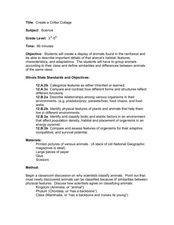
Create a Critter Collage
Students create a collage. In this animal classification lesson, students discuss why and how scientists classify animals. Students view pictures of different animals and decide which class each animal belongs to. Students compare...
Curated OER
Habitat Art: Florida Panthers
Young scholars discover the lifestyles of a Florida Panther by investigating its habitat. In this wild animal lesson, students utilize the Internet to research the habits of a Panther and what their habitat is. Young scholars create an...
Curated OER
Quilt Squared
Students study West Virginia quilts. In this mathematics instructional activity, students use symmetry, geometric shapes, and patterns to create their own quilt square.
Curated OER
Finding Your Way On the Farm
Third graders explore the food industry by viewing a presentation about farming. In this farming geography lesson, 3rd graders view globes and maps while identifying the prime geographical locations for fertile land. Students view a...
Curated OER
Loco for Cocoa
Third graders research the history of cocoa. In this cocoa activity, 3rd graders investigate how the cocoa bean has been traded from one country to another. Students create a timeline and map to track the history of the cocoa bean.
Other popular searches
- Population Density Maps
- Human Population Density
- Geography Population Density
- Comparing Population Density
- Biology Population Density
- Us Population Density
- Population Density in Mali
- Population Density of Cinda
- Population Density of Cina
- Animal Population Density
- Population Density Problems
- Population Density in Canada


