Curated OER
Reading a Local and National Weather Map
Students investigate weather maps. In this weather lesson plan, students discover the meaning of different weather icons and symbols. Working independently, students use the local forecast to correctly label a state map.
Curated OER
The Weather
Students explore earth science by reading articles in class. In this weather identification lesson, students analyze weather science articles on the Internet and view their own local weather patterns as well. Students define a list of...
Curated OER
Learning Lesson: Analyzing a Weather Map
Students use weather maps to locate warm and cold fronts. They discover the different types of weather associated with these fronts. They also observe the weather in their local area.
Curated OER
Fantasy / Art Maps
Ninth graders analyze a fantasy art map by Jeremy Anderson, paying careful attention to the way the topographic features of the land are represented. They create a similar map of Sacramento that includes topographical features as well as...
Curated OER
What's Up? Clouds and Your Weather
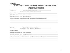
Seventh graders identify clouds and the weather that is associated with them. In this weather instructional activity students work in groups and design their own weather map.
Curated OER
Mapping Community Values
Students discuss the origin of various maps focusing on the values behind them. Students also explore how human needs and geography influence community settlement patterns. Students extend learning by creating and mapping their own ideal...
Curated OER
Weather in Your City
Students observe weather conditions of a particular city. Multiple intelligences are explored within this lesson. They locate their particular city on a United States map. Each student writes about their discoveries in his/her journal...
Curated OER
Comparing Temperatures and Latitudes
Eighth graders collect weather data from a variety of cities at the same latitudes, but on different continents. They organize data using spreadsheet program, generate graphs, and incorporate into a word processing document. Students...
Curated OER
Weather Symbols
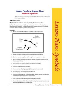
Students study weather symbols. In this weather symbols instructional activity, students review the symbols for cold, warm, and stationary fronts. Students use a weather map to study the weather symbols, complete a weather illustration...
Curated OER
Make Your Own "Weather" Map
Learners create their own "weather" map using data from x-ray sources. They analyze and discuss why it is important to organize data in a fashion in which is easy to read. They compare and contrast different x-ray sources using a stellar...
Curated OER
Trends Forecasting
Students practice trends forecasting to predict the weather. For this forecasting lesson plan, students learn how meteorologists predict the weather by looking at weather trends. They then predict their own forecast, analyze the results,...
Curated OER
Project Jukebox
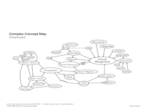
Students analyze an interview with the Climate Change Project Jukebox in order to help them undertand how to use a concept map. In this writing and climate change instructional activity, pairs of students log onto the Internet site for...
Curated OER
WEATHER SATELLITE PREDICTION PROJECT
High schoolers compile weather satellite data from three satellites for one month, obtain weather reports and data from professionals, then create a document with predicted results.
Curated OER
Transportation
Engage in an 8-day study of different modes of transportation. Your students explore the concept of location and define the physical characteristics of places, such as, land forms, bodies of water, natural resources, and weather.
Curated OER
Scatter Plots
Seventh graders investigate how to make and set up a scatter plot. In this statistics lesson, 7th graders collect data and plot it. They analyze their data and discuss their results.
Curated OER
To Fish or Not to Fish?
Students demonstrate the decision-making process for marine reserves designations. In this role-playing lesson students analyze maps and data relating to a proposed reserve. They formulate the best decisions based on overall issues.
Curated OER
Under The Sea
Second graders study how a tsunami is formed by underwater events such as earthquakes, volcanoes or landslides. They discuss what they knew about living and non-living things in the ocean.
Curated OER
The Window
Students read a story entitled, "The Window," and discover how some cultures are rejected by others. Students write a letter expressing feelings of rejection and keep a journal of significant events in the story. Using a graphic...
Curated OER
Hurricane Frequency and Intensity
High schoolers examine hurricanes. In this web-based meteorology lesson plan, students study the relationship between ocean temperature and hurricane intensity. They differentiate between intensity and frequency of hurricanes.


