Curated OER
Geographic Features and Human Settlements
Third graders examine geography and settlements. In this geography lesson, 3rd graders participate in classroom activities that center on the idea that people settle where there are geographical features that sustain life.
Curated OER
Geographical Features
Fourth graders explore geographical features through the creation and construction of an original island. In small groups they write a description and draw a blueprint of their island using a draw/paint computer program, and using...
Owl Teacher
Five Themes of Geography Book Project
Young geographers choose a country to research and design a book explaining how their country applies to the five themes of geography, including three facts or details for each of the themes.
Curated OER
Exploring California's Regions
Students participate in small groups to create a California's Region map. They research and identify the climate, geographic features, and one or two special features of their assigned region.
Curated OER
Geography With Dr. Seuss
Students read the book, The King's Stilts by Dr. Seuss and discuss the geographical information given in the book. Then they discuss and locate on a map the physical features that make up the continent of Africa. They create an original...
Parkwood Hill Intermediate
Map Skills Project
Young pupils develop their mapping skills and knowledge by designing their own islands, using geographic terms and physical features they have learned as features of their work.
Curated OER
Creating a Map
Students create a map of their community. In this mapping lesson plan, students identify various geographical features and the cardinal directions on maps displayed in the classroom. Students are divided into three groups to create a...
Curated OER
Map It With Pixie
Fourth graders use the computer program 'Pixie' to create a topographic, detailed map for the state they live in. In this mapping skills lesson plan, 4th graders use Pixie to make a map of their state that includes topographic features,...
Curated OER
Geographic Regions Travel Brochure
Seventh graders research the four geographic regions of Texas and create a travel brochure describing each of the four regions in detail. They also evaluate the advantages and disadvantages of living in a selected region.
Fremont Unified School District
4th Grade California Relief Map Project
Bring life to your next California geography lesson with this great project! Learners design a three-dimensional wall relief map of California, painting and decorating regions using a variety of materials and labeling major geographical...
Curated OER
Your Own Backyard
Students study Earth's features and their local environments. In this Earth's features lesson, students take a field trip to observe a natural environment and students sketch their observations of the nature. Students watch videos about...
Curated OER
Informational Brochure
Students design and create brochures for a foreign country. They select a foreign country where their target language is spoken. They research the natural resources, location, geographical features, climate, tourist attractions and...
Curated OER
WANTED EXPLORERS
Students create their own country and explore other unknown lands. Students identify past explorers and complete the included case of the missing trunks webquest. Students research resources and geographical features for their created...
Curated OER
Early Explorers
Fifth graders study early explorers. For this World history lesson, 5th graders draw an outline of a map labeling each part, build geographical features out of dough, and paint each of the land and water features.
Curated OER
Underwater Mountains & Trenches
Students determine Earth's deepest trench, outline continents, major ocean mountains, and trenches on color-key map using Crayola Erasable Colored Pencils, identify oceans' geographic features, locate significant oceanic features around...
Curated OER
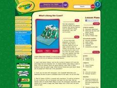
What's Along the Coast?
Students research an area with at least one dominant geographical feature. Then they display their findings in a realistic 3-dimensional presentation. Students also prepare ancillary material to support their project. Finally, they chart...
Curated OER
Watershed Island
Students make a clay model and a geographic map of a watershed. They talk about the differences between the two representations and the potential human threats to watersheds.
Curated OER
Physical Features
Students draw physical land features using ClarisWorks or Kid Pix, write their definitions, create slideshow, and create class geography book.
Curated OER
Your Neighborhood Geography
Tenth graders observe geographical characteristics of their own neighborhoods. They take digital pictures and write a summary of the geographical features they find which they present to the class.
Curated OER
Train Across Canada
Students are taught the historic and contemporary significance and routes of both freight and passenger railway systems in Canada. They study the Canadian terrain and identify its varied geographic features. Students depict a 3-D train...
Curated OER
Map It!
Fourth graders demonstrate map making skills by using the computer to create maps of the geographic features, regions, and economy for their state.
Teachers' Curriculum Instituted
The Roman Record
Using Google Earth, Google Docs, and other Google Tools, collaborative groups of seventh graders research and then create and share online newspapers reporting on the early development, geographical features, political issues, and family...
National Geographic
Mapping the Americas
Celebrate the geography of the Americas and develop map skills through a series of activities focused on the Western Hemisphere. Learners study everything from earthquakes and volcanoes of the Americas and the relationship between...
Curated OER
Geography of Our Environment
Students explore geographical elements. In this geographical elements lesson plan, students create a map showing the geographical elements in their area. Students take pictures of these elements to glue to their map and present it to the...
Other popular searches
- Egypt Geographic Features
- Geographical Features of Utah
- Geographic Features of Congo
- World Geographical Features
- World Geographic Features
- Earth Geographic Features
- Geographic Features Map
- Egypts 3 Geographic Features
- Africa/geographical Features
- Missouri Geographical Features


