Curated OER
Earth from Space Maps
Students use photo images from space to create a large map of the United States or the world, find where they live and label other places they know. They are exposed to a Web resource that allows them to view photo images of Earth taken...
Curated OER
Mapmaker, Mapmaker, Make Me a Map
Second and third graders practice with basic map skills. They create their own map including a legend and a compass rose. This fabulous plan has many excellent websites linked which allow learners to explore maps of all kinds; including...
Curated OER
Scaling it Down: Caves Have Maps, Too
Measurement and map skills are the focus of this lesson, where students crawl through a "cave" made out of boxes, desks and chairs, observing the dimensions. Your young geographers measure various aspects of the cave and practice math...
Curated OER
Map Your School
Learners participate in a project to map their school. They measure and graph various areas around the school. Students find the longitude and latitude of the school and research the school's history, and highlight special important areas.
Curated OER
Lewis and Clark
Students investigate Lewis and Clark. In this Lewis and Clark lesson plan, students search the Internet for information about Lewis and Clark and the Corps of Discovery. Students use maps to understand the explorations and decide which...
Curated OER
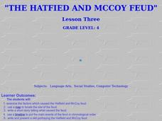
The Hatfield and McCoy Feud
Fourth graders investigate the Hatfield and McCoy feud. In this Hatfield and McCoy feud lesson, 4th graders examine factors that caused the feud. Students also locate on a map where the feud took place, make a timeline of the main events...
Curated OER
Maps
Maps, globes, and computer software aid young explorers as they locate state capitols, major cities, geographic features, and attractions for states they are researching. They then use desktop publishing software to create a map to share...
Curated OER
Winter Wonderland: Internet Literature Project
Students, using the Internet, communicate with peers around the world about winter-themed books. They study authors, write book reviews, re-write endings, interview book characters, create scene dioramas, paint murals, and write...
Curated OER
Geography of South America
Young explorers study South American geography. They study maps and create a physical map of the Andes themselves! They also research the geography, environment, and the culture of the Andes and present a report to the class.
Curated OER
Finding Your Way Around the World
Students plan a trip around the world and create a PowerPoint presentation of the journey. In this map, atlas, and technology lesson, students plan a trip around the world in which they avoid using an airplane. Students will consider...
Curated OER
Gopher It! Exploring German Cyberspace
Students are introduced to the Gopher research tools. In groups, they compare and contrast English and German services on the gopher servers. They create their own dictionary of computer related terms and spend time downloading picture...
Curated OER
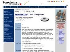
A Visit to Hogwarts
Young scholars collaborate in groups to read excerpts or entire selections from two Harry Potter books, use educational software to create concept maps detailing similarities and differences between first two Harry Potter books, and...
Curated OER
Labeling a Map of Australia
Third graders label a map of Australia. Using the internet, they research the history and maps of the continent and print a blank map. They review on how to use a compass rose and legend. In groups, they create a brochure to share...
Curated OER
Tasty Mapping
Students create an edible map. In this civics and geography lesson, students research their town's features and local government. Students work in groups to design and create a physical map of their town based on research.
Curated OER
Reading a Local and National Weather Map
Students investigate weather maps. In this weather lesson plan, students discover the meaning of different weather icons and symbols. Working independently, students use the local forecast to correctly label a state map.
Curated OER
What Is A Map?
Students become familiar with a map and what it is used for and become familiar with school and home surroundings. With the familiarity of their surroundings they discover that maps can be created to help them with directions and how to...
Curated OER
Paint My Counties: Map Coloring the Counties of Arizona
Fourth graders identify the counties of Arizona. In this social studies lesson plan, 4th graders color a county map of Arizona using the fewest number of colors possible. Students write a persuasive paragraph.
Curated OER
FUN WITH MAPS
Second graders receive a general overview about how maps are made and used, how specific information can be derived from them, and how a student can gain personal information about their surroundings from examining them.
Curated OER
Weaving Weather Maps with the World Wide Web
High schoolers access the Internet and use real time data from the American Meteorological Society to create a detailed weather map. They make weather predictions based on the data collected.
Curated OER
Mapping Electricity
Students complete Internet research and use their map reading skills to learn about how the United States creates and uses electricity in different states. In this energy sources lesson plan, students study the mini map of energy usage...
Curated OER
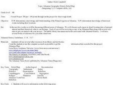
Arkansas Geography/History Relief Map
Sixth graders research a number of sources including the Internet to find information about the regions of Arkansas while locating sites of national historic interest. They located sites on maps while working at assigned websites. They...
Curated OER
Exploring Our Community Schools
Second graders access information regarding schools from the Internet. They e-mail other schools to gather information such as, size, number of students and teacher, origin of the school's name, and interesting facts about the school.
Curated OER
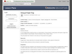
Virtual Field Trip
Are we there yet? Young trip planners learn about their state and plan a trip. They will select sites to see in three cities in their state, and record associated costs in a spreadsheet. While this was originally designed as a...
Curated OER
Mapping the Transcontinental Journey
Students develop their geography skills. In this Lewis and Clark lesson, students collaborate to calculate the time and distance of different segments of the expedition. Students compare their estimate to Lewis and Clark's.


