Curated OER
Project Based Technology in Second Grade
The many activities in this resource serve to introduce second graders to the Macintosh computer and to various programs and their creative product options. They make sideshows using KidPix, practice using email with the Journey South...
Curated OER
Learning About Maps
Students take a "field trip" with the teacher through the school then draw a diagram of what they saw. They bring the maps to the computer lab where they create electronic maps using the software program Neighborhood Map Machine.
Curated OER
Pirate Map
Students write directions explaining how to get from one location to another by using a map of their town and use simple maps to identify and locate places.
Curated OER
Lewis and Clark
Students investigate Lewis and Clark. In this Lewis and Clark lesson, students search the Internet for information about Lewis and Clark and the Corps of Discovery. Students use maps to understand the explorations and decide which...
Curated OER
Way to Go! Create a Road Map Game
Young scholars create a travel game of one of the United States. They research a state of their choice and create a travel game using a common road map. They interpret map symbols as they calculate map mileage for their games. They...
Curated OER
Map It!
Fourth graders demonstrate map making skills by using the computer to create maps of the geographic features, regions, and economy for their state.
Curated OER
All About Me
Using technology, learners create and deliver a multimedia autobiographical presentation to present to the class. This ambitious lesson has learners use a variety of sources both old and new; magazines, poster board, the Internet, and...
Curated OER
Create A Park Map
Students design ultimate park experience for Florida families as they demonstrate their knowledge of map legend skills.
Curated OER
Finding Your Way Around the World
Students plan a trip around the world and create a PowerPoint presentation of the journey. In this map, atlas, and technology instructional activity, students plan a trip around the world in which they avoid using an airplane. Students...
Curated OER
Map the Civil War
Students explore the Civil War through original maps. In this mapping lesson, students calculate distance and show it on an original map. Students examine the type of landscape and its landmarks and draw symbols on the map.
Curated OER
MAKING CONNECTIONS WITH MAPS
Students define choropleth map. They construct a choropleth map. They interpret a choropleth map. They present geographic information.
Curated OER
Map Skills: Explorers, Continents, and Oceans
Third graders use a software program to make and label a map of the world. On the map, they locate the seven continents, oceans and the countries of Europe. They also draw the routes of Christopher Columbus, Juan Ponce de Leon and...
Curated OER
Labeling a Map of Australia
Third graders label a map of Australia. Using the internet, they research the history and maps of the continent and print a blank map. They review on how to use a compass rose and legend. In groups, they create a brochure to share...
Curated OER
Map Skills
Students examine the nations, battlefields, troop movement of the Germans through Belgium and the location of both fronts during World War I by creating a map. They visualize the strength of the Germans early in the war.
Curated OER
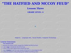
The Hatfield and McCoy Feud
Fourth graders investigate the Hatfield and McCoy feud. In this Hatfield and McCoy feud activity, 4th graders examine factors that caused the feud. Students also locate on a map where the feud took place, make a timeline of the main...
CJ Hatcher & Associates, Inc.
Skill Building with the Newspaper
Extra, extra, read all about it! Use a newspaper as the primary resource in a special education classroom to teach reading, writing, and math skills. The activities help class members build their reading skills as well as their...
Curated OER
Technology Integration
Third graders describe and locate the five geographical regions of the state of Virginia. Using that information, they organize the descriptions in a database they created. They are graded based on accuracy and spelling all noted on a...
Curated OER
Inspirational Mapping for the Corps of Discovery
Third graders use a computer software entitled, Inspiration, in order to create a map or web of what Lewis and Clark should have packed for their journey west. They are given the expectations of the teacher and a scoring guide is...
Curated OER
Map Maker Map Maker
Students create their own maps. In this map making lesson, students go to Microsoft Word and create a chart. They label directions, buildings, streets, and distance.
Curated OER
Lesson 4 Activity 1: Mapping the Third Dimension
Young scholars work in pairs to construct a simple stereoscope.
Curated OER
Summer Trip
Fourth graders search for information and directions to specific cities from their homes, figure cost of trip when given miles per gallon, distance, and cost per gallon of gas, develop outline budget for summer trip, and draw and label...
Curated OER
From Claws to Jaws: Atlantic Regions of the United States
Students explore New England, Mid-Atlantic, and southeastern regions of the United States. In this social studies thematic unit, students research a state and make a regional quilt. Students wrte a book report and read two novels...
Curated OER
Neighborhood Map Machine
Second graders study building placements in a neighborhood. They discuss businesses, roads, houses, rivers, police/fire stations, and use Neighborhood Map Machine to create a new map. They complete an exploratory map and community of...
Curated OER
Geological Maps of the Western Regions
Students study the geological makeup of the West. In this geological maps lesson students creat a map that includes a key and present it to the class.


