Curated OER
Finding Your Spot in The World; Geography, Maps, Multi-Culturalism
Students use a variety of maps to locate their home, their school and the origin of their ancestors.
Curated OER
North Carolina Salt Dough Map Social Studies Project
In this lesson, North Carolina Salt Dough Map, 4th graders create a salt dough map of North Carolina, Students use dough to form the shape of the state of North Carolina. Students label the three regions of North Carolina and all of...
Curated OER
Labeling a Map of Australia
Third graders label a map of Australia. Using the internet, they research the history and maps of the continent and print a blank map. They review on how to use a compass rose and legend. In groups, they create a brochure to share...
Curated OER
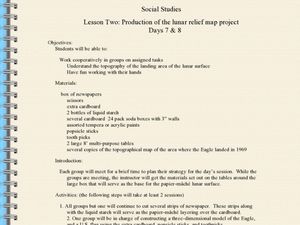
Production of the Lunar Relief Map Project
Young scholars replicate the lunar surface. For this mapping skills lesson, students study the topography of the moon. Young scholars then use craft materials to create topographic maps of the lunar surface where the Eagle landed.
Curated OER
Cinderella Map Key
Young scholars design a map key in order to show where the different Cinderella stories have taken place. In this map key lesson plan, students place symbols on a map to show the diversity of the stories.
Curated OER
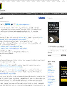
Australia
Students research Australia using the Internet. They draw a flag, identify and label Australia's major cities. They discover facts about Australia's tourists attractions and culture. They design a travel brochure using the facts.
Curated OER
Malta: The Landscape
Pupils work in small groups to create a topographic map of Malta. They must include labeled line drawings of bordering countries and bodies of water. Students use salt and flour clay to make Malta three dimensional, showing the nearest...
Curated OER
Exploring Countries and Cultures
Fifth graders choose a country associated with a family member and research its location, government, language, economy, history, holidays, foods, sports, and famous people. They write to inform using this data and draw a map identifying...
Curated OER
Hispanic Heritage: Introduction to Hispanic Culture
Third graders locate the country of Mexico on a map and discuss its relationship to the United States. They examine the Mexican flag and discuss the colors and symbolism used in the flag. They create an original and accurate drawing of...
Curated OER
The Archer and The Sun
First graders explore Chinese folktales. For this Chinese folktale lesson ,students read Chinese folktales, locate China on a map, and color the Chinese flag. Students are given sentence strips to hold and must arrange themselves in the...
Curated OER
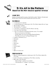
It's All in the Pattern
Here is a fantastic, nine-page, multi-session lesson plan on the Zia Sun Symbol (found on the New Mexico state flag), and the seasons of the Earth. Everything you need to implement the lesson is here, and the many engaging activities are...
Curated OER
European Explorers: Research Project
What will your students choose to include in their explorer's treasure chest? Youngsters research an early European explorer and gather items to reflect their research, such as a detailed map of the explorer's voyages, portrait, flag,...
Mesa Public Schools
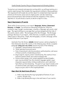
Country Project
Give your young learners the chance to discover more about countries in their world community with a research project. Class members write reports on an assigned country and include such major features as geography, important historical...
Curated OER
Create Your Own Country Project
Young scholars demonstrate their knowledge of geography with this fun, collaborative social studies project. Working in small groups, students develop their very own countries, writing descriptions of their physical location, social...
Curated OER
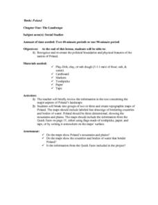
The Landscape of Poland
Students recognize and re-create the political boundaries and physical features of the nation of Poland. They create three dimensional topographic maps of Poland. In addition, they compose two journal entries written in two different...
Curated OER
Examine the Trees in Your Community Forest
Twelfth graders examine selected tree species. In this tree lesson, 12th graders examine twenty selected tree species, identify them, and correctly map out the trees in the area.
Curated OER
Back-to-school ESL Ideas
Pupils share their countries and languages, flags, cultural identity, and pride in home culture.
Curated OER
Hungary: The Landscape
Learners work in small groups to create a topographic map of Hungary. The map will include labeled line drawing of the bordering countries. Hungary should be three dimensional, made of salt and flour clay. The mountains, plains and...
Curated OER
Italy: The Landscape
Students work in small groups to create a topographic map of Italy. They must include labeled line drawings of bordering countries and bodies of water. Students use salt and flour clay to make Italy three dimensional, showing the many...
Curated OER
United Kingdom
Middle schoolers investigate the geographical features of the United Kingdom. They create a clay, playdoh, or salt and flour map of the region. The maps should be labeled with landmarks and bodies of water. They can also draw maps on...
Curated OER
Louisiana
Third graders study factual information about Louisiana including the state flag, bird, tree, and important geographical points using the Internet and maps. They explain the different groups that settled the state in this mini-unit.
Curated OER
The Shapes of Our World
Students utilize shapes and spatial relationships in a practical context by creating maps and writing a critical essay.
Curated OER
Johnny Tremain for the 21st Century
Seventh graders complete a unit of lessons on the American Revolution based on the novel, 'Johnny Tremain.' They define key vocabulary terms, develop a timeline, write a report on a colonial craft, make a colonial flag, and create a...
Curated OER
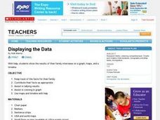
Displaying the Data
Students gather facts about their parent's families through the completion of parent interview forms. Using tally marks, the data gathered is counted, transferred to graphs and used to create family timelines.
Other popular searches
- Australian Maps and Flags
- Thai Maps and Flags
- Maps and Flags Caribbean
- Maps and Flags Mexico
- Area Studies Maps and Flags
- Illinois Maps and Flags


