Curated OER
Countries Involved in World War II
Students create their own floor map of Europe, Northern Africa, and the Pacific. They locate, identify, and speak for one of the countries involved. In addition, they classify the country they represent as an Axis Power or as an Allied...
Curated OER
Christopher Columbus: The Man, the Myth, the Legend
Learn more about maps by examining Christopher Columbus's voyage to the New World. Kindergartners will learn about basic map skills and how to identify the compass rose, oceans, and land masses. They will also discover the purpose of...
Curated OER
Europe
Young scholars examine the reasons how and why the European Union was formed. They locate Europe on a map and identify the countries in the European Union. They create a tourist brochure for one of the countries.
Curated OER
Map Skills: Explorers, Continents, and Oceans
Third graders use a software program to make and label a map of the world. On the map, they locate the seven continents, oceans and the countries of Europe. They also draw the routes of Christopher Columbus, Juan Ponce de Leon and...
Curated OER
European Elevation Sort
Given a prepared database of European countries, sixth graders sort the countries in ascending order by elevation and identify the five countries with the highest elevations. This cross-curricular activity combines elements of computer...
Curated OER
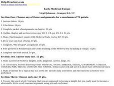
Early Medieval Europe
Students engage in a host of activities during an examination of early Medieval Europe. They draw coats of arms, make collages of architectural designs, and create posters of knights, serfs, and castles. Students role-play as sons of...
Curated OER
Silk Roads Big Map: A Silk Roads Encounters Project
Students are introduced to the Silk Road and its purpose. Using a map outline, they create an oversized replica of the Silk Road from Europe to Asia. They add political and physical features to the map along with the routes of travelers.
Curated OER
Transatlantic Travel
Students design an interactive map with modes of transportation that actually move across the ocean. They construct transatlantic maps of the northern hemisphere and imagine what it would be like to operate various modes of...
Curated OER
European Agriculture
Students make inferences on how physical geography affected the development of early civilizations and come up with solutions to global issues. In this physical geography lesson plan, students compare maps of the past to maps of today to...
Curated OER
Getting to the Core of World and State Geography
Students create topography relief maps. In this geography skills lesson, students review geography core knowledge skills, design and make a state relief map, and compile a student atlas.
Curated OER
Geomnemonics: Facilitating the Teaching of Social Studies Content with Geography Skills
Students explore how to draw a world map by hand and how to locate countries.
Curated OER
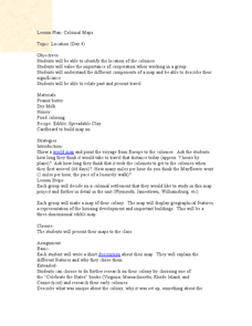
Colonial Maps
Students discover the history of America by identifying the traditional colonies. In this U.S. history lesson, students examine a world map and identify where the voyagers left from Europe to arrive at the United States. Students...
Curated OER
We've got the whole world in our hands
Students explore spatial sense in regards to maps about the globe. In this maps lesson plan, students label oceans, locate the continents and poles, follow directions, and explain the symbols on a map.
Curated OER
Animal Invasion
Students research and illustrate the natural habitats and evolution of giraffes and other animals imported into ancient Rome. They draw a map of Europe, North Africa, and West Asia and draw the animals from each region in their proper...
Curated OER
Brave New World
Students view a video about the effects of World War II on the map of Europe. They discuss the video and answer questions. They work together to identify accomplishments that best represent American culture.
Curated OER
On a Pilgrimage
Sixth graders engage in a variety of learning experiences surrounding the study of the Middle Ages. They construct a map of Europe, create a graphic organizer for the hierarchy of feudalism, design their own family crest, and write their...
Curated OER
Ottoman Lyric Poetry
Young scholars explore the Ottoman style of poetry. They view a video, Suleyman the Magnificent, and view maps of Europe, Asia, Africa and the Mediterranean Sea. They research the Ottoman Empire and keep a journal. They read various...
Curated OER
The Silk Roads Big Map
Students generate oversized rendition of the Silk Roads from Europe to East Asia, apply elements such as political and topographic features, the Silk Roads, products of the regions, and the routes of key travelers.
Curated OER
Food Detectives
Students investigate the regions in which particular grains are grown. Using the packaging from a variety of foods, grains are identified and the general locations where they are grown are plotted on a map.
Curated OER
Getting to Know My World
Students participate in hands-on activities using maps and globes to identify geographical features. Students use map legends to identify direction. Students locate oceans, continents, countries, states and cities. Handouts and...
Curated OER
Continents
Young scholars investigate World Geography by researching the different continents. In this Asian Geography lesson, students discuss the continent of Pangaea and color a worksheet of the continents. Young scholars locate China on the map...
Curated OER
Babar's Travels
Students read the story The Story of Babar and have a class discussion about his travels, discuss their families, design a map, pick music, and more. For this cross curricular musical lesson plan, students create a music map for each of...
Curated OER
Exploration Resume Project
Seventh graders take on the role of a European explorer and create a resume, or personal data sheet, listing his achievements in reverse chronological order. They draw and label a map and list what the explorer did to add to Europe's...
Curated OER
Renaissance Trade and Exchange
Sixth graders map out trade routes. In this Renaissance time period lesson, 6th graders complete a Christopher Columbus Map Activity, discuss and identify the parts of a map, and locate Asia, Europe and the Middle East. Students...
Other popular searches
- Blank Maps of Europe
- Outline Maps of Europe
- Geography Maps of Europe
- Maps of Europe 1914
- Maps of Europe Political
- Maps of Europe Ppt
- Maps of Europe Pot
- Maps of Europe 1919
- Europe Maps
- Europe Outline Maps
- Europe Geography Maps
- Western Europe Maps


