Curated OER
Lesson 3: Seven Day Road Trip
Students plan a seven day road trip. In this travel lesson, students plan a driving trip that includes five major cities or attractions in Florida or another state of their choice. They show the trip on a map, calculate distances that...
Curated OER
Marco Polo Takes A Trip
Students identify Marco Polo and discuss why he took his trip, indicate on map routes Marco Polo took to China and back, describe challenges of traveling along Silk Road, list several interesting aspects of 13th Century Chinese culture,...
Curated OER
All Aboard!
Learners, in groups, create a display showing a "train trip" to a destination of their choice from a teacher-made list. They also answer a series of questions related to their trip. Groups present their displays.
Curated OER
Central Oregon Road Trip
Students work together to plan a six-day road trip through central Oregon. Using a map, they locate any place mentioned and create a list of attractions throughout the area. They list the places in the order they are going to visit them...
Curated OER
What A Trip!
High schoolers plan a vacation trip from start to finish. Given a budget, they make decisions regarding where they would like to go, what mode of transportation they will use, where they will lodge, and what attractions they will visit...
Curated OER
Exploring Michigan
Learners create and present an itinerary for a trip. In this travel instructional activity, students list ideas of travel experiences for their country. Learners then pretend they are taking a trip to Michigan and read an example letter...
Curated OER
Coast to Coast Virtual Trip
Students complete a variety of exercises and activities as they plan a coast to coast trip across America. They keep a journal that includes where they went, what they did, what they saw, etc. They compare two cities they visited along...
Curated OER
Touring Delmarva
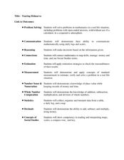
Students plan a trip. In this trip planning lesson, students use a map to find where they would like to visit with a pretend family of 4. They get a specific amount of money and time and need to decide where they will stay and what...
Curated OER
Wellington Fault Field Trip
Students take a field trip to Harcourt Park in California to view the results of river erosion and an active fault line. In this science lesson plan, students go to different parts of the park to discuss the results.
Curated OER
Trip to Mount Vernon
Students compare and contrast travel in the 18th century with current methods of travel by participating in a simulated trip to Mount Vernon. In this US history lesson, students write a letter to George Washington for permission to visit...
Curated OER
See the State
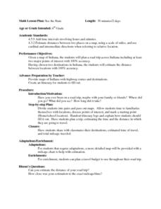
Fourth graders are given a map of Indiana and have to plan a road trip including at least two major points of interest with 100% accuracy. The students estimate the distance between their two chosen locations with 100% accuracy.
Curated OER
Ratios, Proportions, and Percents
Eighth graders use ratios and proportions to solve real-life problems. In this using ratios and proportions to solve real-life problems lesson, 8th graders estimate the cost of a road trip. Students estimate the distance...
Curated OER
Compare and Contrast Photograph Art
Take a trip down Pearblossom Highway with this lesson about comparing and contrasting. Using David Hockney's Pearblossom Hwy and another image of the same highway (photograph or other image), students compare and contrast the two...
Curated OER
From Here To There
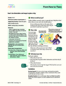
Students plan a trip while using maps and times tables. In this trip planning lesson plan, students work in pairs, and complete problems about gas, travel time, and more.
Curated OER
Project Whistlestop:Missouri Vacation Learning Unit
Fourth graders reserach the state of Missouri. In this Missouri History lesson, 4th graders plan a vacation to a region of Missouri. Students work in collaborative groups to determine all aspects of the trip. Students use math...
Curated OER
Exploring Women's History
Students read and analyze Jessie Benton Fremont's travelogue of her trip out west in 1849 to identify the gender roles, social attitudes and class distinctions of the time. They then adapt the the travelogue into a film script.
Curated OER
All Across America
Students share experiences of places they have visited or would like to visit. They create travel guides for trips to take in the United States based on themes from their studies, incorporating both historical and current data about...
Curated OER
Where Do You Live?
Students discuss the community in which they live. They take an observation field trip and then use paper and boxes to design and construct a model of their community.
Curated OER
Discovering New Mexico
Seventh graders discuss the elements of maps and using basic linear measurement. They calculate the distance between the cities and create a simulated journey around New Mexico using a road map. They write out the directions for their...
Curated OER
Level III: Technology Integration
Fourth graders prepare two spreadsheets each with an embedded line graph that displays data about the growth of the bitter rot fungus on apples and on petri dishes that were stored in the refrigerator and the classroom. They prepare a...
Curated OER
Tell a Totem Story
Students study and view pictures of Native American totem poles on the internet. They create totem poles using PowerPoint that represent their family histories using symbols to designate historic events.
Curated OER
Roller Coasters: They're Fun, But Are They Safe?
Students survey people to find out what roller coasters they like, conduct Internet research to find information on dangers in amusement parks, contact experts on subject, and write feature that shows pros and cons of coasters.
Curated OER
Rocks and Minerals
Review the difference between rocks and minerals using this resource. Learners identify and investigate the physical properties of these objects. They create a Venn diagram to compare and contrast types of rocks. This is a motivating way...
Curated OER
Roller Coaster Mania
Fifth graders extend their knowledge of developing maps. They work in cooperative groups to develop an amusement park display and a brochure.


