Curated OER
Canada's Natural Regions and Their Varied Characteristics
Students examine Canada's six natural regions, with all their underlying human and economic activities, identify specific characteristics of each region, discover economic and human riches of natural regions and, create presentations to...
Curated OER
Exploring California's Regions
Students participate in small groups to create a California's Region map. They research and identify the climate, geographic features, and one or two special features of their assigned region.
Curated OER
Wattle and Daub Using Natural Resources to Survive
Seventh graders create list of materials that family of four would need to live and survive in the forest, identify four natural resources used by Cherokee Indians to build shelter, create poster that depicts Cherokee hamlet in summer or...
Curated OER
MATERIALS, Using What’s Local: Native Materials, Local Sources
Middle schoolers consider the development of different societies. In this environmental building activity, students consider local resources and how societies choose to use them. Middle schoolers use their findings to design a 'green'...
Curated OER
From Claws to Jaws: Atlantic Regions of the United States
Students explore New England, Mid-Atlantic, and southeastern regions of the United States. In this social studies thematic unit, students research a state and make a regional quilt. Students wrte a book report and read two novels...
Curated OER
Texas Regions and Native Americans of Texas
Fourth graders research to find the regions of Texas. In this technology lesson, 4th graders create a Kid Pix project showing the location of various regions of Texas. Students show where in those regions Native American...
Curated OER
Region Reality
Eighth graders compare and contrast world regions and explore the theme of world regions. In this world geography instructional activity, 8th graders name regions in the U.S. and mark them on a map. Students discuss the cultural and...
Curated OER
Regions of the United States
Your learners practice writing ideas on paper and logically presenting them in an organized manner. They brainstorm ways to write down ideas while creating a travelogue about a particular U.S. geographic region. When they present...
Curated OER
Geographic Regions Travel Brochure
Seventh graders research the four geographic regions of Texas and create a travel brochure describing each of the four regions in detail. They also evaluate the advantages and disadvantages of living in a selected region.
Ohio Literacy Resource Center
Regions of the United States
Young scholars create a travelogue of a particular U.S geographic region that includes aspects of population, climate, landforms, culture, famous people, and places as well as any natural resources. They present the travelogue to the class.
Curated OER
Regions of the United States
Fifth graders collect data about regions of the United States using the Internet, library books, and encyclopedias. They write an essay persuading people to visit their state.
Curated OER
Midwest Region Commercials
Third graders research their assigned state using a variety of resources including a website, books, and travel brochures. They complete questions on a worksheet to use when writing a commercial for the state. They film the commercial...
Fremont Unified School District
4th Grade California Relief Map Project
Bring life to your next California geography lesson with this great project! Learners design a three-dimensional wall relief map of California, painting and decorating regions using a variety of materials and labeling major geographical...
Curated OER
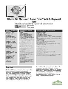
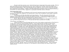
Where Did My Lunch Come From? A U.S. Regional Tour
Students explore the regions from which their food comes. In this social studies lesson, students identify the different agricultural products that are found in the major regions of the United States. Students create a lunch menu.
Curated OER
Geothermal Energy in Latin America
Here is a wonderful series of lessons designed to introduce learners to the variety of renewable, clean energy sources used by people all over the world. Geothermal energy is the resource focused on. This particular sources of energy...
Montana State University
Ice in Action
Make your own bite-size glacier! A resource teaches about the formation and melting of ice. Activities include videos, a hands-on activity where your pupils build glaciers, and a photographic analysis to teach individuals the chilling...
Curated OER
Environmental Exchange Box
Students examine the characteristics of their own environment and compare them to another region. They prepare a box filled with items and stories about their own region, exchange the box with another class in another region, and...
Montana State University
One Mountain, Many Cultures
Americans may think of Mount Everest as a region dedicated to adventurous hikers, but many cultures have flourished there! Learners read informative books, watch videos, participate in classroom discussion, analyze folk tales, and...
Curated OER
The Southeast Region
Students write a song about the southeast region. In this southeast region lesson plan, students view pictures of landforms, hear music, look at maps of states, and more.
Curated OER
Natural Regions of Texas Archeology
Seventh graders, in groups or individually, research Texas archeological sites and create a mural of the natural regions and the sites found in them. They conduct online research to discover the importance, age, and the inhabitants of...
Curated OER
Arkansas History Lesson Plant One: Play-Do Soto
Fifth graders complete a variety of projects to learn about Arkansas history. In this Arkansas lesson plan, 5th graders go on a field trip to a state park, explore an Arkansas map, put play-dough on the trail of De Soto, color regions of...
Curated OER
The First North Americans
Students identify and interpret the different North American Indian groups, by region, and the type and impact of their interaction with Europeans.
Then they complete an overview of one main Native American group during the age of...
Curated OER
Learning About Maps
Learners take a "field trip" with the teacher through the school then draw a diagram of what they saw. They bring the maps to the computer lab where they create electronic maps using the software program Neighborhood Map Machine.
Curated OER
Trade in Atlantic Canada
Middle schoolers explore the Atlantic region of Canada's natural resources and look into how these resources impact the lives of Atlantic Canadians. They perform Internet research, view images by the artist Robert Harris, and create a...


