Curated OER
Pre-Columbian Cultures in the Americas
Native American studies is fun, educational, and highly motivating. Fifth graders will gain a deeper understanding of the six major pre-Columbian culture areas on the North American continent. They will choose one group and conduct...
Curated OER
Going Local with Global Warming
Students examine climate change by using recent temperature records. In this data analysis lesson students plot weather data and study the differences between weather and climate.
National Museum of the American Indian
The A:Shiwi (Zuni) People: A Study in Environment, Adaptation, and Agricultural Practices
Discover the connection of native peoples to their natural world, including cultural and agricultural practices, by studying the Zuni people of the American Southwest. This lesson includes examining a poster's photographs, reading...
National Geographic
Mapping the Americas
Celebrate the geography of the Americas and develop map skills through a series of activities focused on the Western Hemisphere. Learners study everything from earthquakes and volcanoes of the Americas and the relationship...
Curated OER
Where, Oh Where
Students use maps to explore several traditional regions of Native Americans. They research information on the regions' climate, resources, landforms, flora and fauna.
Curated OER
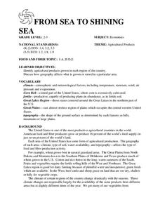
FROM SEA TO SHINING SEA
Identify agricultural products grown in each region of the country.
Discuss how geography affects what is grown or raised in a particular area.1. Hand out a copy of the two activity sheets "Food From Sea to Shining Sea" to each student....
Curated OER
Settlement Patterns of the United States
Students examine the conditions that affected the way people settled in the United States. Using maps, they examine the topography and climate of different locations and determine the factors that do and do not allow settlement to occur....
Curated OER
Global Change- Time and Cycles
Young scholars study trees and their growth. In this investigative instructional activity students work in groups to reconstruct a 50 year climatic history using a simulated tree ring.
Curated OER
Beyond Chopsticks and Rice
Students explore the stereotypical American images of China. In this English and World History lesson, students read a novel to become familiar with China and its people. Students research various events in China's history and report...
Curated OER
Where's the Barbecue?
Students identify the major landforms, regions and rivers on a map of South Carolina. They compare the locations of the major Native American groups in the state as well. They chart where barbecue restaurants are located and write...
California Polytechnic State University
Australian Geography Unit
At the heart of this resource is a beautifully detailed PowerPoint presentation (provided in PDF form) on the overall physical geography of Australia, basic facts about the country, Aboriginal history, and Australia culture and lifestyle.
Curated OER
Afghanistan Today: Civil War and Human Rights
High schoolers examine the relationship between the United States and the Soviet Union during the Cold War. They analyze the role of religion and cultural identity in shaping governments. They also examine the United States foreign...
Curated OER
Rapid Mycological Assessment
Middle schoolers examine types of mycology methods. They practice using new vocabulary and answer key questions. They complete a field survey and analyze their results.
Curated OER
Time and Cycles - Dendrochronology
Students investigate the lives of trees by examining ring cycles. In this plant life lesson, students identify the field of study known as dendrochronology and discover its history. Students investigate a simulated tree ring...
Curated OER
Go Fish!
Students are introduced to the culture of the Kumeyaay. Using their text, they discover how they used their native flora and fauna in San Diego. They participate in a matching game and examine the types of organisms who make their home...
Curated OER
Nomadic Living
Students describe what it means to be nomadic and the advantages and disadvantages of living this type of lifestyle. After watching a video, they pretend they are nomads and must develop a list of items to take along with them. They...
Curated OER
Great North
Students use maps to locate the Arctic Circle, the North Pole and Northern Europe. They draw and label countries within the Arctic Cirlce and identify the groups of people who live there. They also watch and answer questions about the...
Curated OER
Whose Business?
Fourth graders compare and contrast the businesses in Fort Griffin with those in their own community. Using the internet, they discover the factors that have influenced the development of businesses in a town. They also create a map of...


