Curated OER
Oceans Away
Young scholars explore oceans. In this science lesson plan, students locate oceans, seas and continents of the world, identify ocean-related occupations, and complete activities pertaining to food chains as well as pollution.
Curated OER
Tear the Continents
Learners tear paper into representative continent shapes and configure them with world oceans through relative location, direction and latitude and longitude starting points. They recognize the shape of the continents. Students recognize...
Curated OER
Learning About the Equator, The Seven Continents and the Four Oceans
Young scholars use a globe or map to locate the equator, oceans and continents. Using the internet, they spend time surfing through predetermined websites on continents and oceans. They write facts on different parts of the globe on...
Curated OER
The Interconnectedness of Ancient Peoples Map Study
Seventh graders begin this lesson by viewing various maps of the Ancient World. As a class, they take notes on the changes of different areas in Europe and Asia as their teacher lectures to them. They answer questions about the...
Curated OER
Continents and Oceans on the Move
Students create an awareness of the vast percentage of water covering the earth. They relate similarities/differences between topographical maps and other maps of various time periods. Students examine how to use a topographical map.
Curated OER
The Global Grapefruit - Representing a 3-Dimensional Globe on a 2-Dimensional Map
Students compare and contrast world maps and globes. They convert a 3-dimensional globe to a 2-dimensional map. They are introduced to the Mercator map projection. They observe map distortions of shape, area, distance, directions and angle.
Howard Hughes Medical Institute
EarthViewer
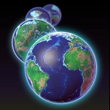
Can you imagine Washington DC and London as close neighbors occupying the same continent? Learners will be fascinated as they step back in time and discover the evolution of the earth's continents and oceans from 4.5 billion years ago to...
Curated OER
The Earth is an Orange
Students examine and identify the various types of maps. Using two types of maps, they compare the data that can be gathered from each one. They also identify and locate the continents and the oceans. They review the purposes of each...
Curated OER
Pangaea Puzzle
Learners explore plate tectonics and the formations of the Earth's surface and why maps are distorted. For this Earth's surface lesson students complete a lab and answer questions.
Curated OER
A Book Is A Window To the World
Second graders listen to pieces of literature that take place in different regions of the world. Using a map, they identify and locate the continents and oceans mentioned in the story. They describe the physical and human characteristics...
Curated OER
Modelling Ocean Currents
Students construct a replica of the Atlantic ocean given certain parameters. In this earth science lesson, students draw their own map of ocean currents. They answer questions related to the activity.
Curated OER
Where in the World Am I?
Students are introduced to geography skills. They answer questions on a worksheet using the internet and maps. They examine the area of Japan as well.
Curated OER
Global Perceptions: How Your Students View the World
Students examine their own perceptions and attitudes about places around the world. Using their mental maps, they compare and contrast it with a world map from different periods in history. They review the various types of map...
Curated OER
Reading Around the World
Students use the internet to identify the seven continents. Using maps, they locate and identify major physical features of Earth. They are read different books by various authors on the Earth and answer questions related to it. They...
Curated OER
Size It Up
Students practice their math skills in determining the water/land proportions of the Earth. Using globes, they locate the seven continents and oceans and determine which covers more space. They use this information to participate in...
Curated OER
Plate Tectonics & Land Forms
Fourth graders discuss the different interactions of plates and the ways mountains are created. In this plate tectonics lesson students complete an activity in groups.
Alabama Learning Exchange
Coral Reefs
Study explore coral reefs. In this coral reef lesson, 4th graders examine the physical structure of coral reefs. Students consider why coral reefs need to be protected and ways to protect them.


