Curated OER
Where in the United States Are We?
High schoolers spend the lesson identifying the location of the fifty states and the capitals. Using a software program, they retrace te outline of each state numerous times. To end the lesson, they write a story about a state and city...
Curated OER
Food on the Map
Students work together to examine the tastiest towns in the United States. After discovering the names of the equipment, they identify the seven continents. They take a survey and locate the cities and states of the foods mentioned.
Curated OER
Rivers, Maps, and Math
Students use maps to locate and label the major rivers of North and South America. Using the internet, they identify forests, grasslands, mountain ranges and other landforms on the continents as well. They compare and contrast the...
Curated OER
Mapping the Prairie
Fifth graders study maps of the Chicago area looking at defining characteristics and place names. They investigate settlement patterns by looking at the maps.
Curated OER
Our Fifty States
Seventh graders identify and locate all fifty states in the United States and their capitals. Individually, they research one state identifying when it became a state, its motto, song, flower and nicknames. To end the lesson plan, they...
Curated OER
Northwest Ordinance
Students examine the area where the Northwest Territory was located. They discover the steps territories need to follow to become states. They create a map of the Northwest Territory and label the states that came out of that region.
Curated OER
A Place Called Fairfax
Students use maps to locate Virginia, its surrounding states and Fairfax County. Individually, they describe the absolute and relative location of the county and why it is important to know both. As a class, they brainstorm the...
NPR
Same-Sex Marriage
The battle over same-sex marriage is a prevalent issue in the United States, and a valuable topic to be discussed in your social studies classroom. Here is a basic outline of introductory questions, focus questions, vocabulary, and media...
Curated OER
Roles of the President
Students read a document which explains the roles and responsibilities of the President of the United States. In groups, they tour the George Bush Presidential Museum and participate in a Presidential scavenger hunt. Once back in the...
Curated OER
Weather Watchers
Students are introduced to an Underground Weather Stations. In groups, they use the internet to research the weather in different parts of the United States locating each city. To end the lesson, they summarize the information they...
Curated OER
Invasives and Marsh Birds
Young scholars are taught that invasive plant removal can have a variety of impacts. They are shown this by using graphs. Students view maps of vegetation change on Iona Island. They discuss implications of changes on marsh birds using...
Curated OER
A Full Load
Learners calculate the shipping costs between two destinations. In this math lesson, students determine the distance between two places using google map. They calculate the amount of gas needed to get to a specific destination.
Curated OER
Virginia in the Civil War
Learners examine the role of Virginia during the Civil War. In groups, they brainstorm ideas about why they believe so many battles took place in Virginia. Using a map, they locate the major battles on land and in the ocean. To end...
Curated OER
Law of Superposition
Students identify the law of superposition and it states that beds of rock in a series are laid down with the oldest at the bottom and younger layers on the top. They construct a legen for a block diagram and construct a block diagram...
Curated OER
Boundaries
Students are introduced to the term of mental mapping. Individually, they develop their own mental map of Washington state and discuss as a class what makes a boundary. They draw their mental map on paper and compare it with their...
California Polytechnic State University
Australian Geography Unit
At the heart of this resource is a beautifully detailed PowerPoint presentation (provided in PDF form) on the overall physical geography of Australia, basic facts about the country, Aboriginal history, and Australia culture and lifestyle.
Curated OER
Geography
Second graders explore the major rivers of Arkansas. They locate the major rivers in Arkansas on a state map. Students discuss how water is used in the region and the state of Arkansas.
Curated OER
From the Farm to Your Table: Where Does Our Food Come From?
Students discover where the food they eat comes from. Using maps, they identify the agricultural areas of the United States and the products that are grown in each area. Using the internet, they research how food gets to America from...
Curated OER
The Shape of Arkansas
Students are shown a United States map and learn the location and shape of Arkansas. They take a map home for their family to help them locate close family members across the United States.
Curated OER
Tailoring Two Cultures to Adapt to Wisconsin's Biotic Zones
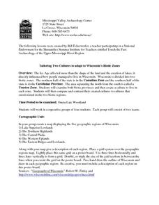
Middle schoolers examine the effect of the various ice ages on Wisconsin. In groups, they create a map representing the five geographic regions of Wisconsin. They must write out a description of each region to be placed on a poster...
Curated OER
Australian Travel Adventure
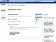
Seventh graders are introduced to the states and territories within Australia. Using the internet, they bookmark sites and take notes on what they want to share with their classmates. They also complete a map study on the country to...
Curated OER
People Take Action
Students locate landforms of California on a map. They discuss the problems and solutions that were used to save the lizard from extinction. They discuss how working together to solve problems is useful.
Curated OER
Chuuk Introduction (Middle School)
Students pretend they are visiting a relative in the Chuuk nation of Micronesia. Using their knowledge of the 4th of July, they compare and contrast the holiday to the Chuuk's independence day. They create travelogues that outline...
Curated OER
Ways We Use Water
Fourth graders write a persuasive paper after a demonstration about the properties of water and how they work. The instructional activity also uses a mind map to outline the paper.


