Curated OER
Road Map to Success
Using three different graphic organizers, learners create a road map describing how they'll meet their future career goals. They research the career they are interested in, then use their findings to construct a time line, road map, and...
National Endowment for the Humanities
Lesson 3: On the Road with Marco Polo: From Hormuz to Kashgar
Young explorers examine the route that Marco Polo and his father traveled to reach China. They examine online maps of the Silk Road and harsh terrain of Afghanistan to determine challenges that may have been encountered during travel.
Curated OER
Mapping the Aegean Seafloor
Earth science learners create a two-dimensional topographic map of the floor of the Aegean Sea. They use it to then create a three-dimensional model of the ocean floor features. This comprehensive resource delivers strong background...
Statistics Education Web
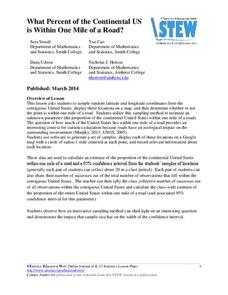
What Percent of the Continental US is Within One Mile of a Road?
There are places in the US where a road cannot be found for miles! The lesson plan asks learners to use random longitude and latitude coordinates within the US to collect data. They then determine the sample proportion and confidence...
Curated OER
Genetic Testing: Road Map or Crystal Ball?
After looking at the many aspects of the issues behind genetic testing, students are exposed to the pros and cons and must take a stand by writing a position paper. They will view the "Who Gets to Know?" video and/or reading case studies...
Curated OER
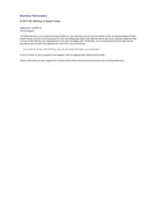
Mt. Whitney to Death Valley
This is an intriguing problem that brings together real-world data, technology, and mathematical problem solving. If visibility wasn't an issue, could you see from the highest point in the lower 48 states, Mt. Whitney, to the lowest...
Curated OER
Map Studies
Learners study maps and use web based activities to develop their mapping skills. In this mapping skills lesson, students use the internet to define cartography they make a list of information regarding a typical road map and explain the...
Curated OER
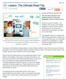
The Ultimate Road Trip
Sixth graders experience and practice real-world geography, science and math as they imagine planning out the ultimate road trip. They set goals and maintain a daily budget as they are given a set of rules as they plan their road trip...
Curated OER
Denali Park Topographic Maps
Middle schoolers construct a topographic map of the Denali National Park. They identify different elevations and record historic landmarks in student science journals.
Curated OER
Introducing Topographic Maps: Guiding Students from Concrete Models to Graphic Representations
Students interpret topographic maps and infer human activity as it is influenced by the landscape.
Curated OER
Introduction to Maps
Learners develop their map skills. In this geography lesson, students participate in an activity that requires them to survey their social studies book in order to find different types of maps and purposes for their uses.
Curated OER
Traveling the Silk Road
Students take a virtual trip down the Silk Road. Using a map, they trace the location of the trade route and others that were developed later. They use different spices and goods to trace how they came to the Americas. They answer...
Curated OER
LAND USE DEBATE / TOWN MEETING
Ninth graders research, analyze, and orally defend an issue related to the use of geologic resources. They defend their position in written form by composing a letter to an appropriate source.
Curated OER
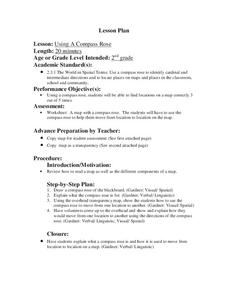
Using a Compass Rose
Second graders explore geography by completing a mapping activity in class. In this directional lesson, 2nd graders examine a map in class and utilize a compass rose to identify their location and destination. Students write directions...
Curated OER
Reading Maps Critically
Young scholars discover that maps represent different values of the cultures who make them. Using the internet, they research the role of a cartographer and how their culture affects them. In groups, they are given examples of maps in...
Curated OER
Playground Mapping
Learners review their physical models of the objects on their playground at school. Using the model, they convert it into a map with a scale and key. To end the lesson plan, they use the map to locate different objects and measure the...
Curated OER
A Tour of Jaffa
Use the age-old Traveling Salesman Problem to introduce Hamilton circuits to your young travelers. Individuals then plan an efficient route to visit all the places they want to go.
National Endowment for the Humanities
Factory vs. Plantation in the North and South
North is to factory as South is to plantation—the perfect analogy for the economy that set up the Civil War! The first lesson in a series of five helps teach beginners why the economy creates a driving force for conflict. Analysis of...
Curated OER
Orienteering - The Fundamentals
Students investigate the concept of a compass and it has been used in the past and in modern times. They practice using it in the wilderness in order to test its importance in various exploring activities. Each activity is accompanied by...
Curated OER
Silk Roads Big Map: A Silk Roads Encounters Project
Students are introduced to the Silk Road and its purpose. Using a map outline, they create an oversized replica of the Silk Road from Europe to Asia. They add political and physical features to the map along with the routes of travelers.
Curated OER
Mapping The Ocean Floor
Young scholars explore and analyze the bottom structure of underwater habitats. They describe and explain what can't see through the collection and correlation of accurate data. Learners assess that technology is utilized as a tool for...
Curated OER
Geography: examining the Glacial Features of Cape Cod
Students examine satellite images of the glacial features of Cape Cod. They analyze where human activity is located in terms of those features. Students make models of the features, including kettle holes. They also use contour maps...
Curated OER
Finding Their New World
First graders place stickers on maps indicating their understanding of the cardinal directions. They locate Jamestown, England, the Atlantic, and Virginia.
Curated OER
Grid it, Map it
Students participate in designing a city layout using grids and coordinates. They work on a city space and create a grid on a life size layout on the gym floor.


